Another tropical cyclone in the South Atlantic Ocean!
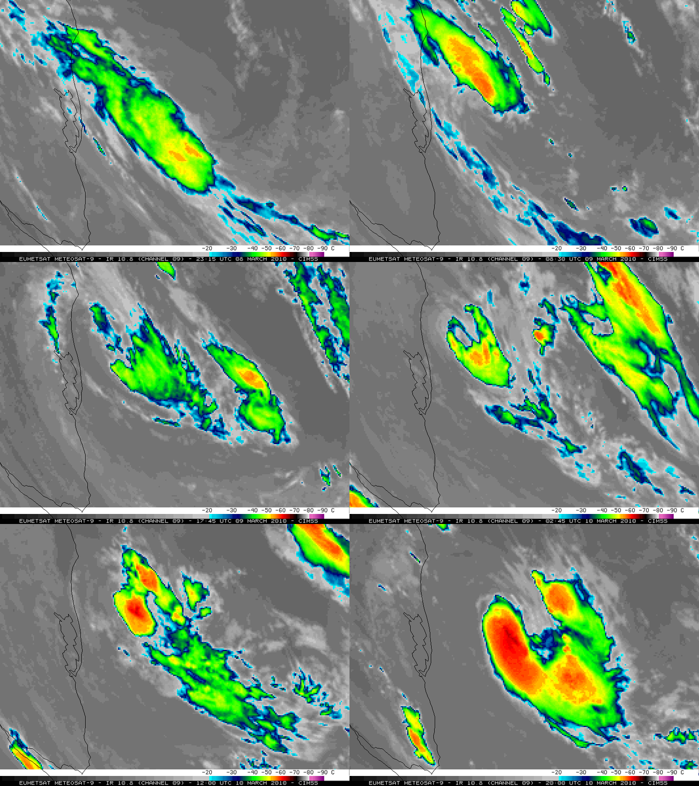
EUMETSAT Metetosat-9 10.8 µm IR images (above; also available as a QuickTime movie) showed the evolution of a disturbance that had all the appearances of being another example of a rather rare event: a subtropical cyclone in the South Atlantic Ocean (off the southeast coast of Brazil) during the 09 March 2010 – 10 March 2010 time period.
This system was eventually declared to be tropical cyclone on 10 March, according to this HPC discussion:
SOUTH AMERICA SYNOPTIC DISCUSSION
INTERNATIONAL DESKS
NWS HYDROMETEOROLOGICAL PREDICTION CENTER
CAMP SPRINGS MD
847 AM EST WED MAR 10 2010GFS DATA AT FTPPRD.NCEP.NOAA.GOV/PUB/DATA/NCCF/COM/GFS/PROD/
SYNOPSIS (VALID FROM 00Z MAR 10). THE UPPER LEVEL ANALYSIS SHOWS A CLOSED LOW NEAR 33S 45W EXTENDING A SHORT WAVE TROUGH TO THE NORTHWEST INTO BRASIL ALONG 20S 50W. THIS FEATURE IS DECOUPLING FROM A WARM CORE SURFACE LOW OFF THE COAST OF BRASIL…WITH CLOSED CIRCULATION ESTIMATED NEAR 29.6S 48.2W. ALTHOUGH A TIGHT/COMPACT STORM…IT IS NOW CLASSIFIED AS A TROPICAL CYCLONE RATHER THAN SUBTROPICAL.
On 13 March this storm was given the name “Anita” by the Brazilian MetSul weather center . Note that Brazil has only had one documented case of a land-falling tropical cyclone that had reached hurricane intensity — “Catarina” in March 2004.
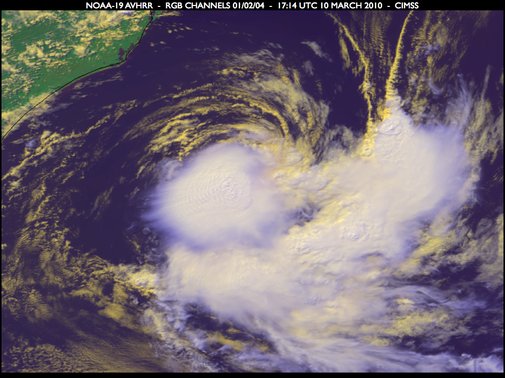
A false-color NOAA-19 Red/Green/Blue (RGB) image using channels 01/02/04 (below) displayed a nice view of the tropical cyclone on 10 March. The low-level circulation (clouds with a slightly yellow hue) was becoming partially exposed, with a large burst of convection occurring in the southwest quadrant of the cyclone.
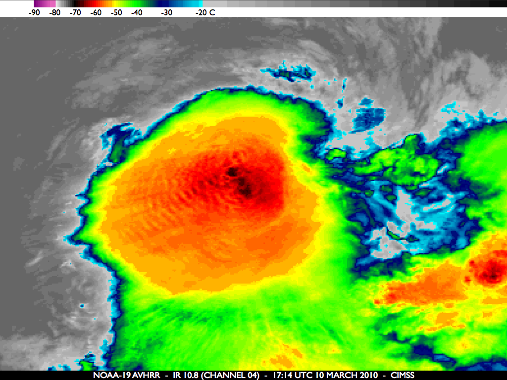
On a closer view using the corresponding NOAA-19 10.8 µm IR image (below), note the presence of a packet of gravity waves which was propagating southwestward away from the region of coldest overshooting tops (which were around -70º C, darker black color enhancement).
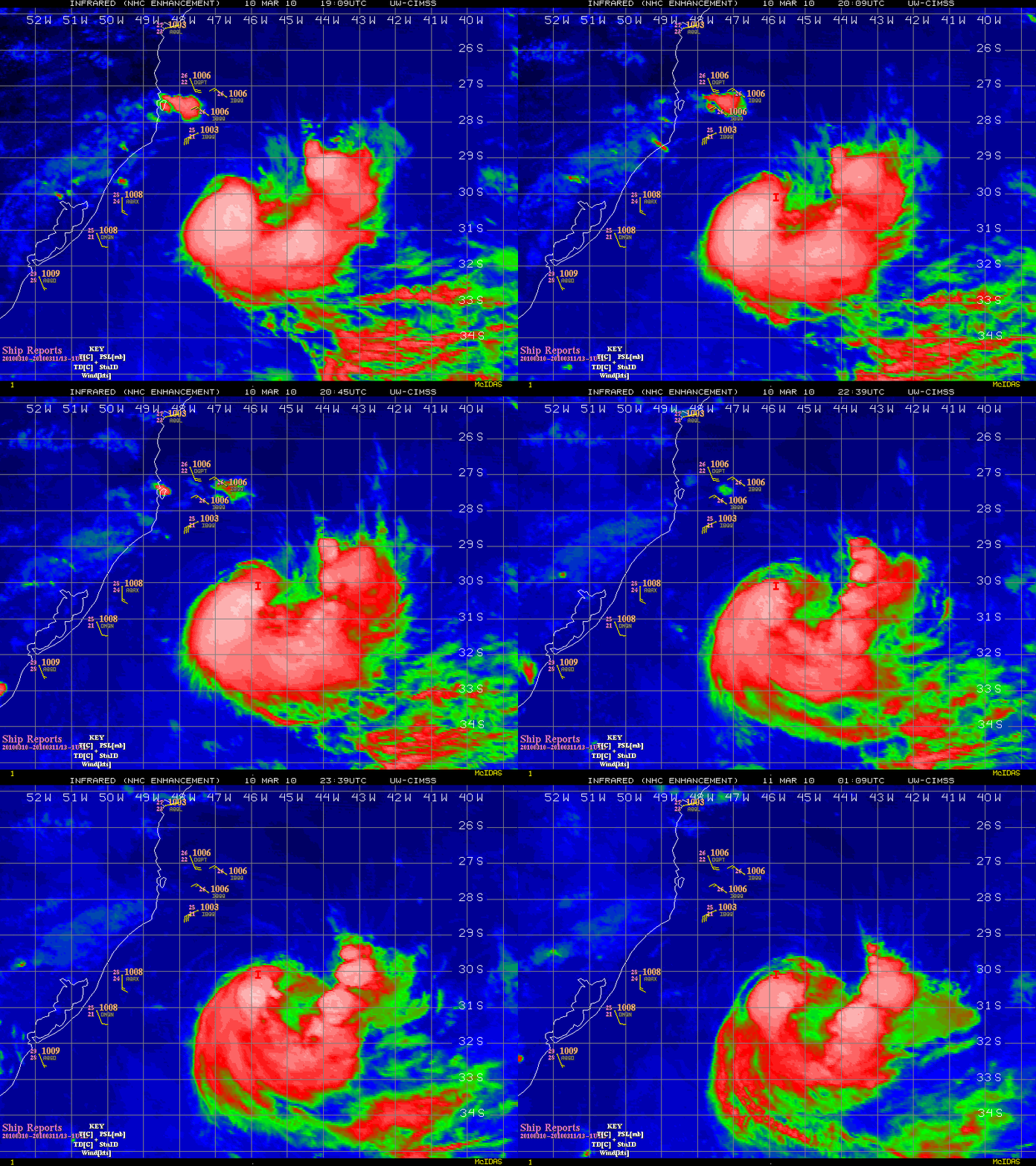
A later animation of IR imagery from the CIMSS Tropical Cyclones site (below) showed the development of additional convective bursts within the southern portion of the cyclone. Even well to the northwest of the center of the circulation, there was a ship report showing wind speeds of 35 knots.
.
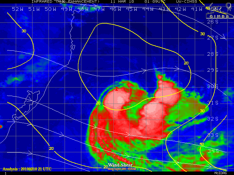
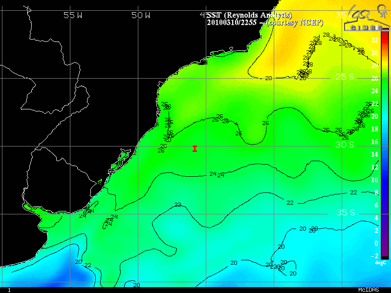
The tropical cyclone formed in an environment characterized by a moderate amount of deep layer wind shear (above), over a region of sea surface temperatures that were near 25º C (below).
Additional details and images of this South Atlantic tropical cyclone can be found at the Weather Underground, AccuWeather, and NASA.


