Starting Date [Julian Day]
(Day of Week)
|
Test Schedule Name |
Duration |
Center Point (coverage) |
Comments |
Links (large files) |
May 8 [128]
(Th) |
SRSOR (no FD) |
128/ 11:14:30 UTC - 129/ 11:14:00 UTC |
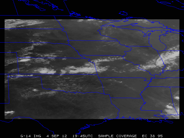
38N 95W |
Moderate Risk, southern MN, northern IA |
CIMSS Blog post (Midwest) Visible animation (mp4) 3-panel animation (mp4) HWT blog Vis+IR+Over-shooting Tops |
May 9 [129]
(F) |
SRSOR (no FD) |
129/ 11:14:30 UTC - 130/ 11:14:00 UTC |
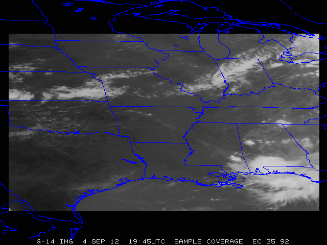
35N 92W |
Slight Risk mid Mississippi valley |
CIMSS Blog post (TX) |
May 10 [130]
(Sa) |
SRSOR (no FD) |
130/ 11:14:30 UTC - 131/ 11:14:00 UTC |
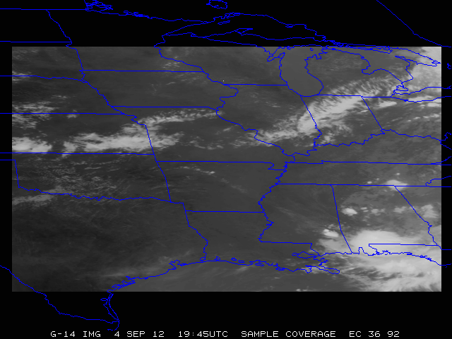
36N 92W |
Slight Risk over lower MO valley to central OK |
Vis loop (KS, MO) 2-day Vis loop (Midwest) from RAMMB in YouTube -- best if full screen and high res |
May 11 [131]
(Su) |
SRSOR (no FD) |
131/ 11:14:30 UTC - 132/ 11:14:00 UTC |
37N 96W |
Moderate Risk over KS, NE, IA |
CIMSS Blog post (Central Plains) RAMMB Blog post (Central Plains) Vis loop (NE) |
May 12 [132]
(M) |
SRSOR (no FD) |
132/ 11:14:30 UTC - 133/ 11:14:00 UTC |
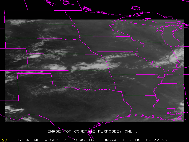
36N 92W |
Slight risk from central Great Lakes to southern Plains |
Vis loop (Midwest) SRSOR + Roof Top Camera imagery over Madison, WIi (YouTube) |
May 13 [133]
(T) |
SRSOR (no FD) |
133/ 11:14:30 UTC - 134/ 11:14:00 UTC |
36N 85W |
Continued strong cold front across central U.S. |
Vis loop (GA: Cu, etc.) Vis loop WV: from Fog to Convection CIMSS Blog |
|
May 14 [134]
(W) |
SRSOR (no FD) |
134/ 11:14:30 UTC - 135/ 11:14:00 UTC |
35N 85W |
Slight risk from Lower Mississippi Valley to Central OH Valley |
1 vs 5 min vis loop (OH) 1 vs 15 min vis loop (OH) ftp: Vis loop over GA |
May 15 [135]
(Th) |
SRSOR (no FD) |
135/ 11:14:30 UTC - 136/ 11:14:00 UTC |
36N 81W |
Slight risk over the Carolinas and mid-Atlantic states |
Convection (GA and northern FL) |
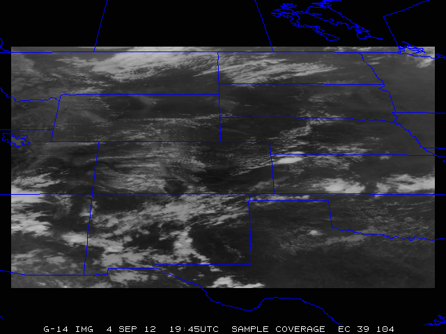
May 16 [136]
(F) |
SRSOR (no FD) |
136/ 11:14:30 UTC - 137/ 11:14:00 UTC |
39N 104W |
. |
Mountain wave clouds and snow (UT) |
May 17 [137]
(Sa) |
SRSOR (no FD) |
137/ 11:14:30 UTC - 138/ 11:14:00 UTC |
39N 111W |
Critical Fire Wx Outlook (AZ) |
Skunk Fire (AZ) visible loop with SRSOR, RSO and Standard |
May 18 [138]
(Su) |
Routine East |
138/ 11:14:30 UTC - 139/ 11:14:00 UTC |
N/A |
No SRSOR this day. |
May 19 [139]
(M) |
SRSOR (no FD) |
139/ 11:14:30 UTC - 140/ 11:14:00 UTC |
39N 101W |
Slight risk over central high Plains |
IR window: 1 vs 15 min (MN) IR window: 1 vs 5 vs 15 min (MN) Blog from HWT (WY/NE) Vis loop (WY/NE) |
May 20 [140]
(T) |
SRSOR (no FD) |
140/ 11:14:30 UTC - 141/ 11:14:00 UTC |
39N 107W |
. |
Convection (CO) visible loop from RAMMB Storm-centered Visible loop (CO) |
May 21 [141]
(W) |
SRSOR (no FD) |
141/ 11:14:30 UTC - 142/ 11:14:00 UTC |
38N 101W |
Slight risk over Central high plains and OH/mid-Mississippi Valley |
SPC MD (TX) Supercell (CO) -- loop from RAMMB VISIT blog |
May 22 [142]
(Th) |
SRSOR (no FD) |
142/ 11:14:30 UTC - 143/ 11:14:00 UTC |
38N 84W |
Slight Risk, TN and DC area |
SPC MD (PA) Convection over VA Convection over NY CIMSS Blog: over KY |
May 23 [143]
(F) |
SRSOR (no FD) |
143/ 11:14:30 UTC - 144/ 11:14:00 UTC |
38N 83W |
Slight risk NC/SC |
Vis loop (NC) associated with hail report |
May 24 [144]
(Sa) |
SRSOR (no FD) |
144/ 11:14:30 UTC - 145/ 11:14:00 UTC |
36N 105W |
Slight risk West Texas |
Vis loop (TX) IR loop (TX) SPC storm reports |
|
May 25 [145]
(Su) |
Routine East |
145/ 11:14:30 UTC - 147/ 11:14:00 UTC |
N/A |
. |
CIMSS blog with 3 GOES views of hurricane Amanda . |
|
.
|
|
|
|
|
|
August 14 [226]
(Th) |
SRSOR (no FD) |
226/ 11:14:30 UTC - 227/ 11:14:00 UTC |
TBD |
. |
August 15 [227]
(F) |
SRSOR (no FD) |
227/ 11:14:30 UTC - 228/ 11:14:00 UTC |
TBD |
. |
August 16 [228]
(Sa) |
SRSOR (no FD) |
228/ 11:14:30 UTC - 229/ 11:14:00 UTC |
TBD |
. |
August 17 [229]
(Su) |
SRSOR (no FD) |
229/ 11:14:30 UTC - 230/ 11:14:00 UTC |
TBD |
. |
August 18 [230]
(M) |
SRSOR (no FD) |
230/ 11:14:30 UTC - 231/ 11:14:00 UTC |
TBD |
. |
August 19 [231]
(T) |
SRSOR (no FD) |
231/ 11:14:30 UTC - 232/ 11:14:00 UTC |
TBD |
. |
August 20 [232]
(W) |
SRSOR (no FD) |
232/ 11:14:30 UTC - 233/ 11:14:00 UTC |
TBD |
. |
August 21 [233]
(Th) |
SRSOR (no FD) |
233/ 11:14:30 UTC - 234/ 11:14:00 UTC |
TBD |
. |
August 22 [234]
(F) |
SRSOR (no FD) |
234/ 11:14:30 UTC - 235/ 11:14:00 UTC |
TBD |
. |
August 23 [235]
(Sa) |
SRSOR (no FD) |
235/ 11:14:30 UTC - 236/ 11:14:00 UTC |
TBD |
. |
August 24 [236]
(Su) |
SRSOR (no FD) |
236/ 11:14:30 UTC - 237/ 11:14:00 UTC |
TBD |
. |
August 25 [237]
(M) |
SRSOR (no FD) |
237/ 11:14:30 UTC - 238/ 11:14:00 UTC |
TBD |
. |
August 26 [238]
(T) |
SRSOR (no FD) |
238/ 11:14:30 UTC - 239/ 11:14:00 UTC |
TBD |
. |
August 27 [239]
(W) |
SRSOR (no FD) |
239/ 11:14:30 UTC - 240/ 11:14:00 UTC |
TBD |
. |
August 28 [240]
(Th) |
SRSOR (no FD) |
240/ 11:14:30 UTC - 241/ 11:14:00 UTC |
TBD |
. |
