GOES-14 Super Rapid Scan Operations for GOES-R (SRSOR) 1-minute interval imagery
Another period of activating GOES-14 for Super Rapid Scan Operations for GOES-R (SRSOR) began on 08 May 2014. One area of severe thunderstorms began to develop over the South Dakota/Nebraska/Minnesota/Iowa region, as see on McIDAS images of 1-minute interval GOES-14 0.63 µm visible channel data (above; click image to play animation; also available as an MP4 file).
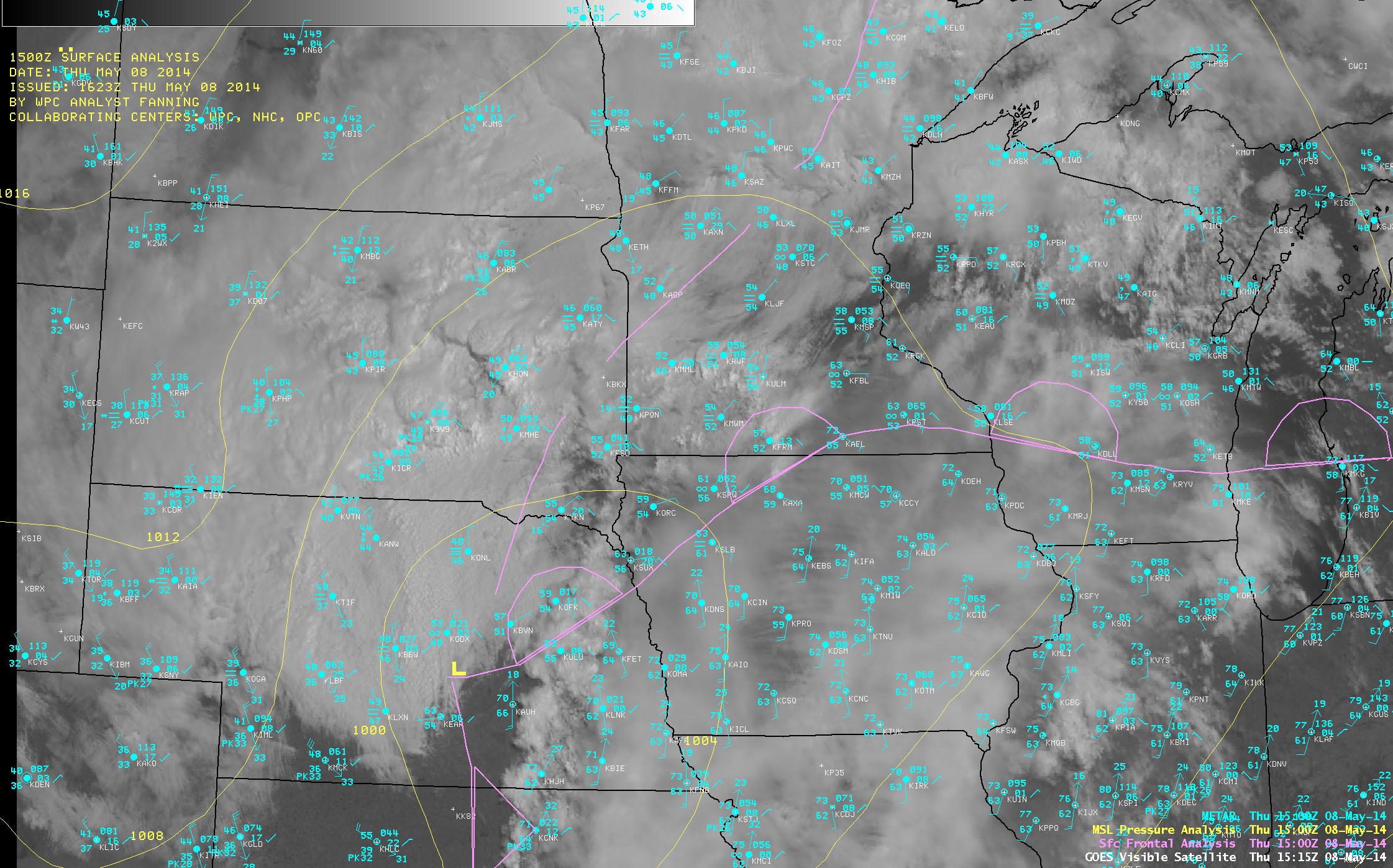
An AWIPS image of GOES-13 0.63 µm visible channel data at 15:15 UTC with overlays of METAR surface observations and fronts/pressure analysis (below) showed that a well-defined warm frontal boundary was in place across the region at 15 UTC, which helped to act as a focus for convective development as it moved northward during the morning and afternoon hours. The Storm Prediction Center had outlined a Moderate Risk for severe thunderstorms over this area, and later issued a Tornado Watch at 17:50 UTC. The first report of hail from these storms was at 17:03 UTC over far western Minnesota (SPC storm reports).

GOES-13 0.63 µm visible channel image with METAR surface reports and surface front and pressure analyses
SRSOR mode provides the opportunity to compare satellite scanning strategies. The animation below (also available as an MP4 movie file) shows
GOES-13 0.63 um visible channel images: Standard 15-minute interval (left), RSO (center), and SRSOR (right) [click image to play animation]
Another comparison of SRSOR vs RSO vs Standard image scan modes is shown below, focusing on convection farther south over the Kansas / Oklahoma / Texas region (click image to play very large animated GIF file; click here for the same animation on YouTube; an MP4 version is also available here).


