This website works best with a newer web browser such as Chrome, Firefox, Safari or Microsoft Edge. Internet Explorer is not supported by this website.

Category: VIIRS

VIIRS imagery of a low pressure system near the North Pole

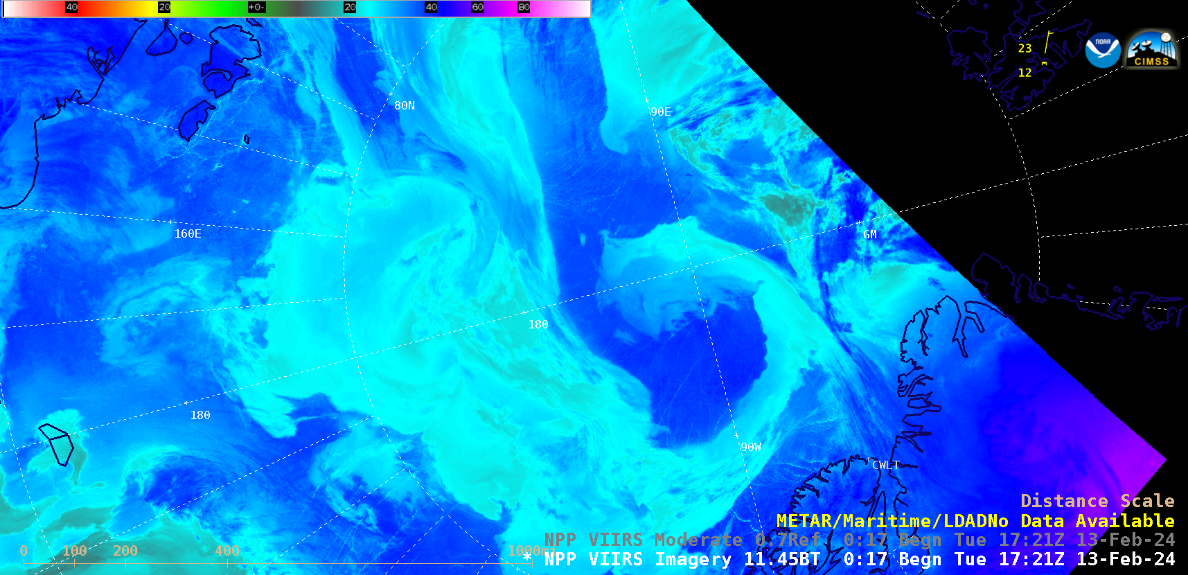
A sequence of Suomi-NPP VIIRS Infrared Window (11.45 µm) images (above) displayed the development of a coma-shaped cloud structure associated with a low pressure system near the North Pole (northwest of Greenland) on 13 February 2024. The single METAR surface report plotted is Svalbard, Norway (the reports for CWLT —... Read More

Tropical Cyclone Kirrily in the Coral Sea

Target Sector (2.5-minute interval) JMA Himawari-9 AHI Red Visible (0.64 µm) and Clean Infrared Window (10.4 µm) images (above) showed Invest 90P as it intensified to become Tropical Cyclone Kirrily over the Coral Sea on 23-24 January 2024. Visible images showed multiple exposed low-level circulation centers, while Infrared images showed that deep convection was mainly developing west... Read More