VIIRS imagery of a low pressure system near the North Pole
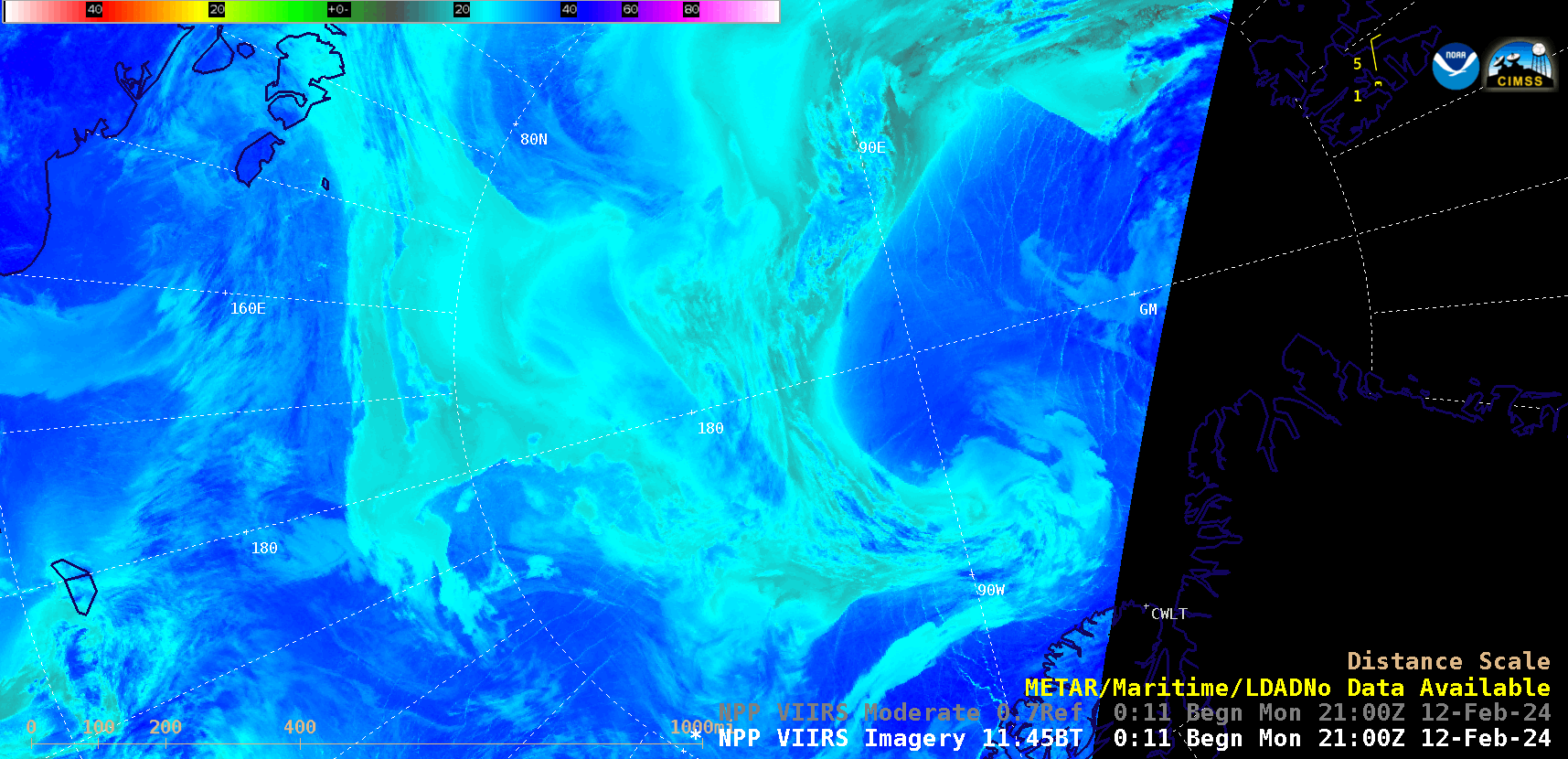
Suomi-NPP VIIRS Infrared Window (11.45 µm) images, from 2100 UTC on 12 February to 2213 UTC on 13 February [click to play animated GIF | MP4]
Analyses from the Canadian Meteorological Centre (below) showed the evolution of the surface low.
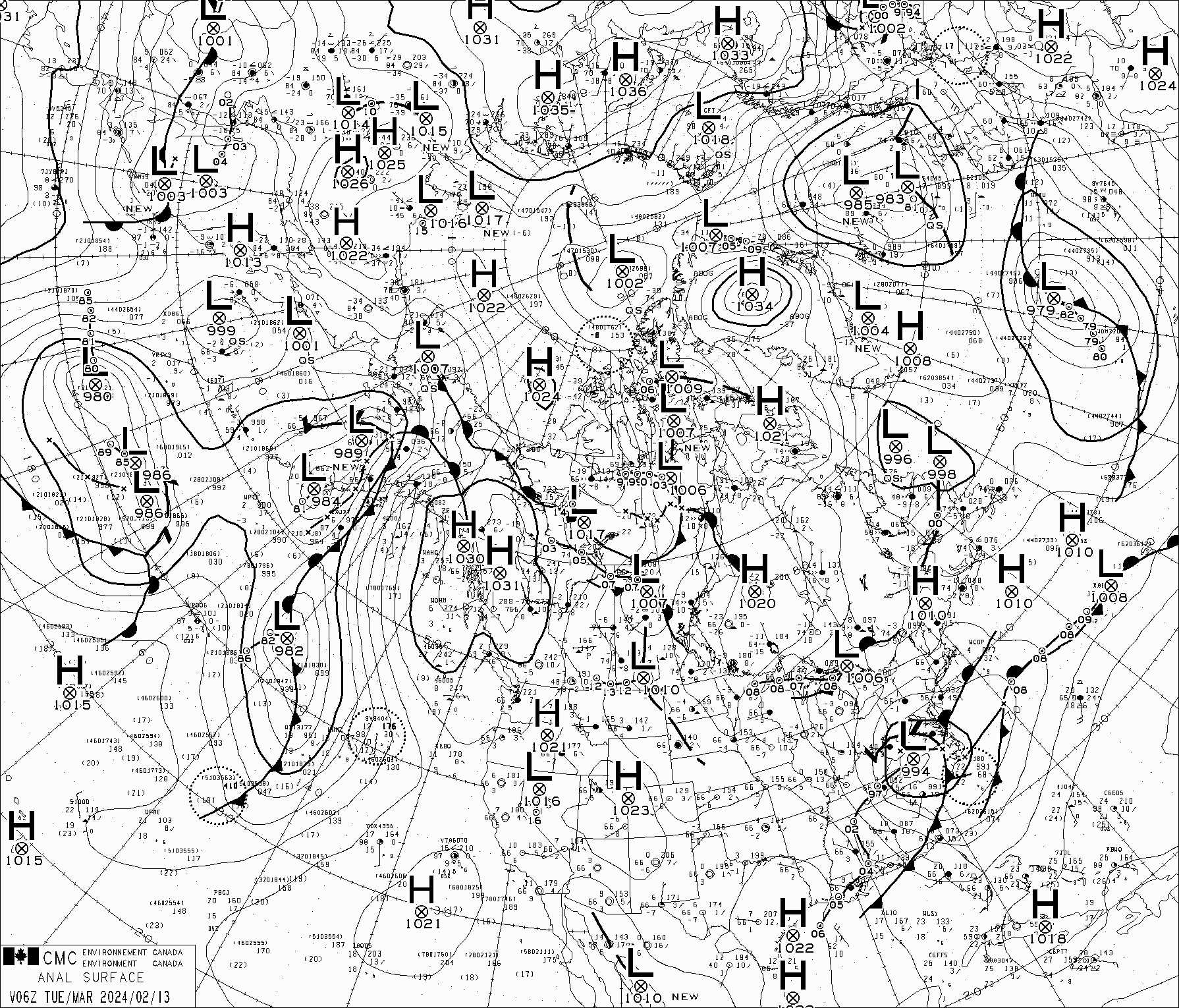
Surface analyses from 0600 UTC on 13 February to 0000 UTC on 14 February [click to play animated GIF]
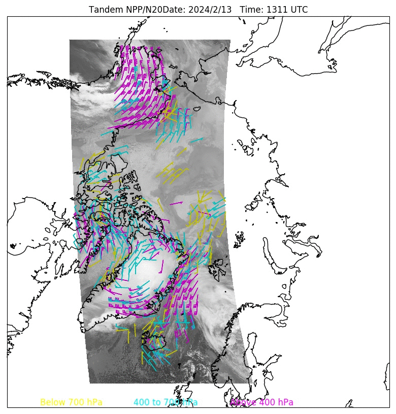
Infrared images from Suomi-NPP and NOAA-20, with overlays of Atmospheric Wind Vectors, from 1311-2138 UTC on 13 February