This website works best with a newer web browser such as Chrome, Firefox, Safari or Microsoft Edge. Internet Explorer is not supported by this website.

Category: DMSP

Tropical Depression 2 becomes Tropical Storm Barry in the far southwestern Gulf of Mexico

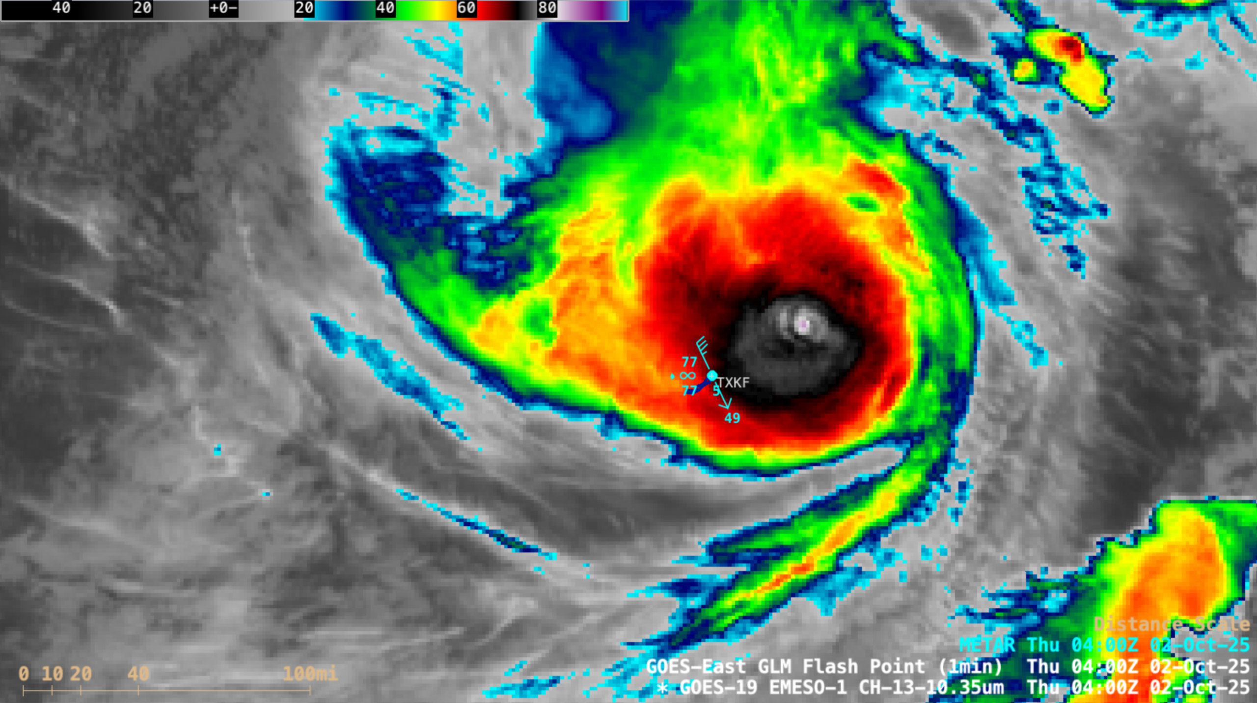
1-minute Mesoscale Domain Sector GOES-19 (GOES-East) Infrared and Visible images (above) showed persistent deep convection (with sporadic lightning activity) near the center of circulation of Tropical Depression 2 (TD2), which developed in the Bay of Campeche (just off the coast of Mexico) around 2100 UTC on 28 June 2025. Periodic convective bursts contained... Read More

Cyclone Jasper in the Coral Sea

Target Sector (2.5-minute interval) JMA Himawari-9 AHI Clean Infrared Window (10.4 µm) images (above) showed the gradual development of a ragged eye with Cyclone Jasper as the storm moved southward across the Coral Sea on 07 December 2023. Intermittent convective bursts within the eyewall contained a few overshooting tops that exhibited infrared brightness temperatures around -90ºC (yellow... Read More