Heavy rainfall in Hawaii
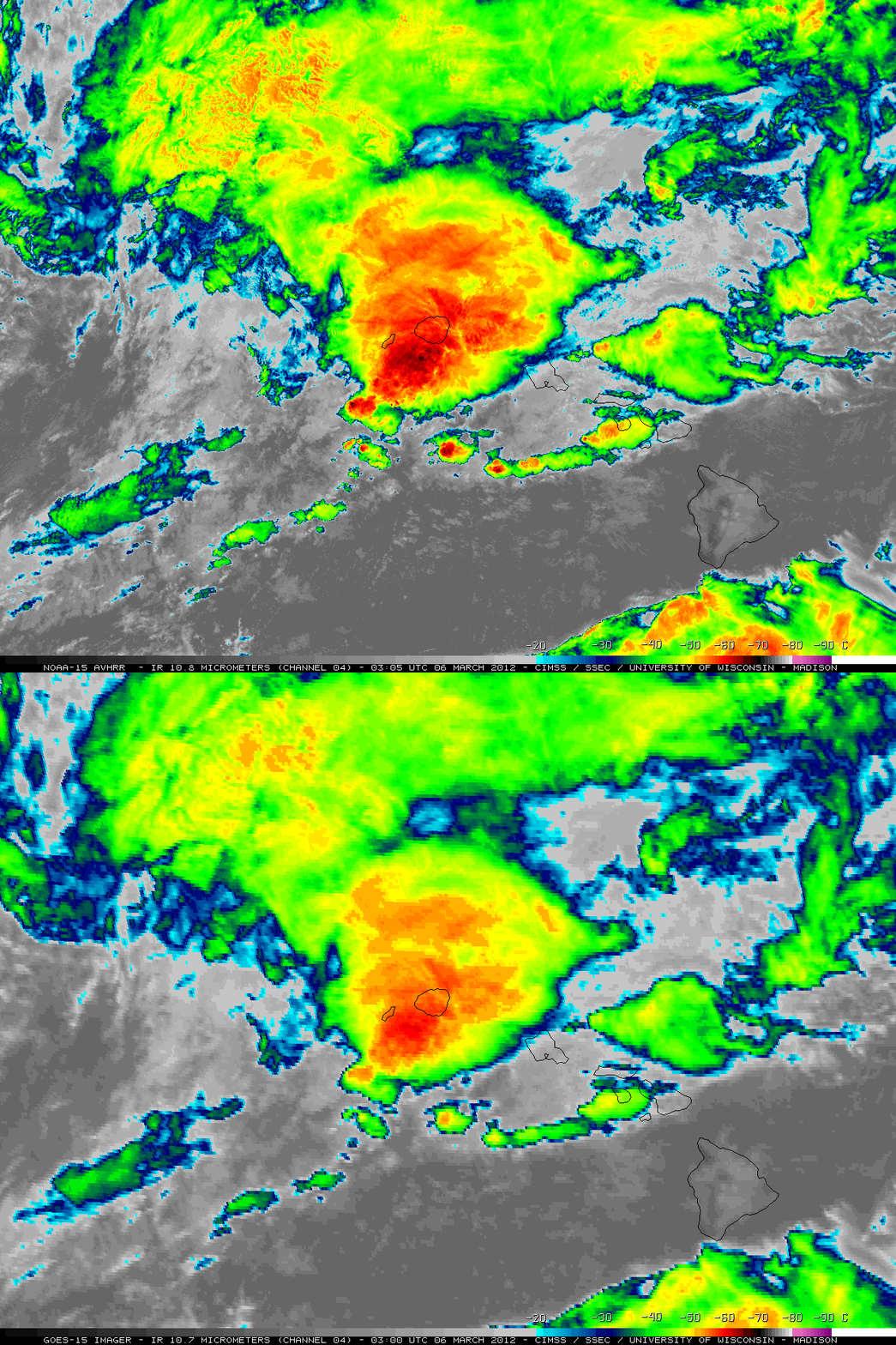
McIDAS images of GOES-15 10.7 µm IR channel data (above; click image to play animation) showed the cold cloud tops (some -60º C and colder, red color enhancement) associated with numerous large thunderstorms that moved across the northern Hawaiian Islands of Kauai and Oahu during the 04 March – 06 March 2012 period. Storm total rainfall amounts were as high as 35.97 inches at Hanalei on Kauai, and 15.64 inches at Punaluu Stream on Oahu. Lihue on Kauai set a new daily record rainfall amount with 8.64 inches falling on 05 March.
As one of the largest thunderstorm complexes was approaching the island of Kauai from the southwest around 03 UTC on 06 March (5 pm local time on 05 March), a comparison of a 1-km resolution NOAA-15 AVHRR 10.8 µm IR channel image to the corresponding 4-km resolution GOES-15 10.7 µm IR channel image (below) demonstrated the advantage of higher spatial resolution for identifying the location of colder cloud top IR brightness temperatures associated with convective overshooting tops. Southwest of Kauai the coldest IR temperature on the AVHRR image was -70º C, compared to -62º C on the GOES-15 image.
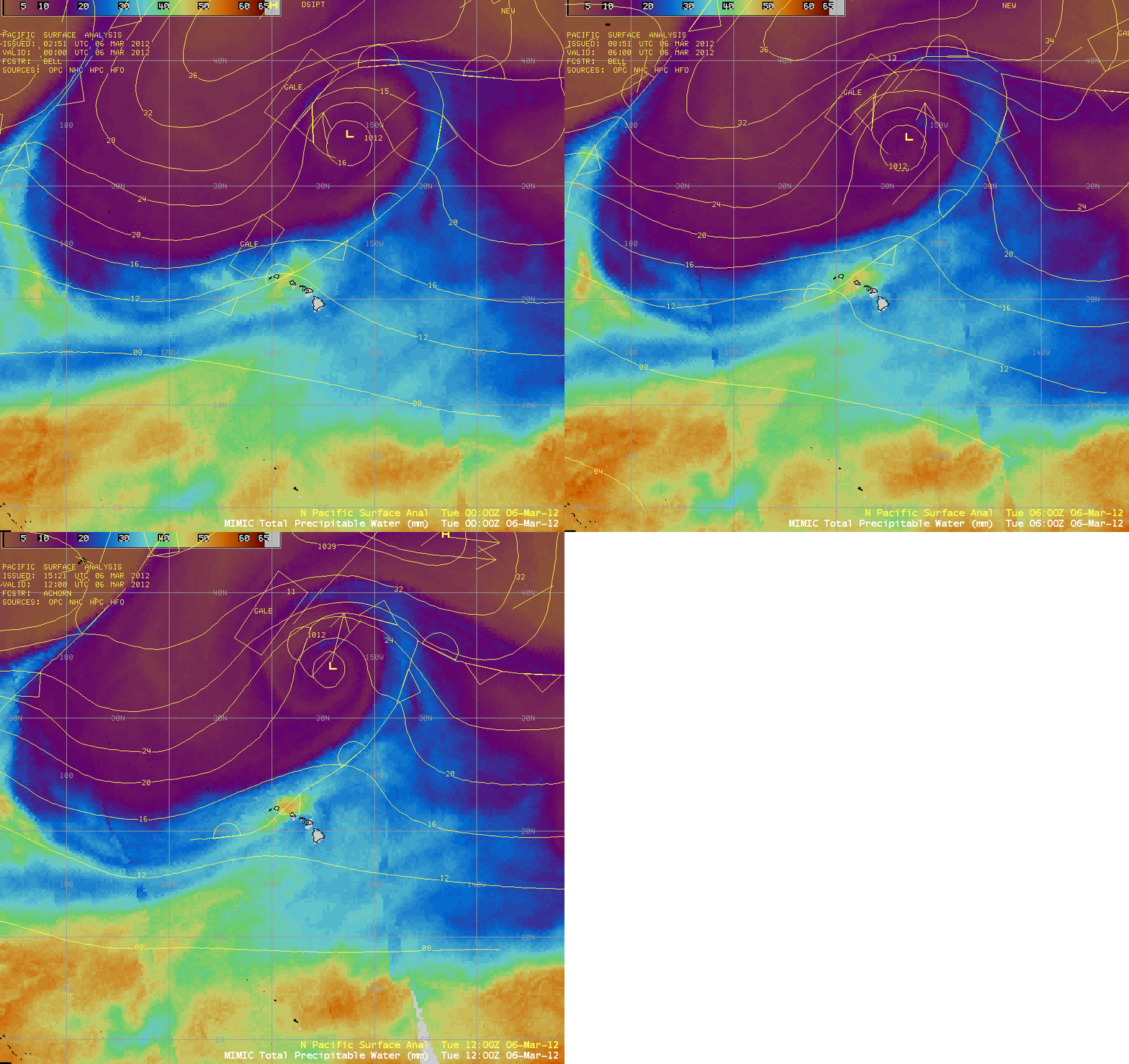
AWIPS images of the MIMIC Total Precipitable Water product with overlays of surface analyses (below; longer animation) showed that deep moisture was pooling along a stationary frontal boundary / wind shear axis that was situated between the islands of Kauai and Oahu. (Note to NWS forecast offices: MIMIC TPW is available in AWIPS, via LDM subscription)
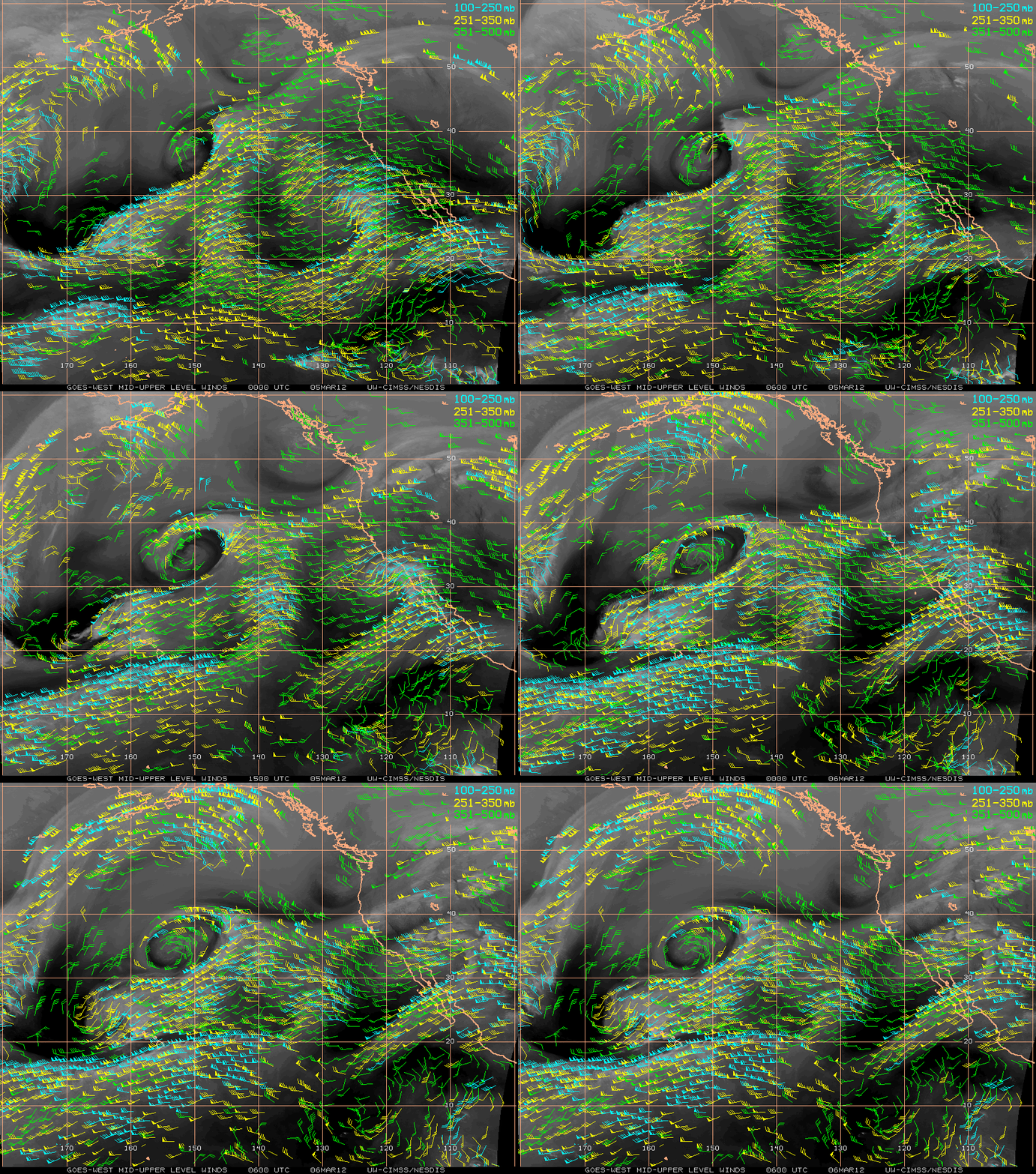
GOES-15 6.5 µm water vapor channel images with water vapor Atmospheric Motion Vector (AMV) winds from the CIMSS Tropical Cyclones site (above) showed that a well-defined trough of low pressure was located to the northwest of the Hawaiian Islands during the 05 March – 06 March period.
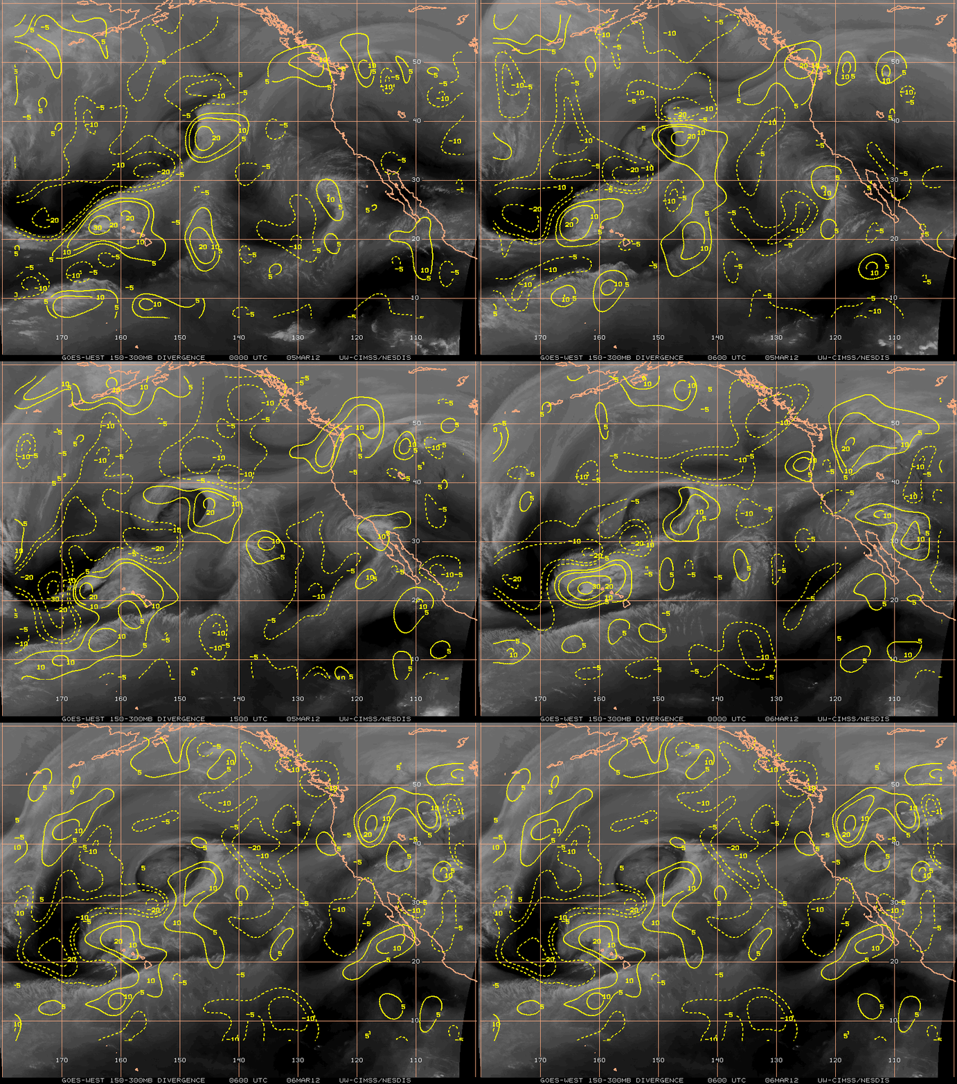
Upper-tropospheric divergence derived from these satellite AMVs (below) revealed a trend of increasing divergence aloft over the northern Hawaiian Islands as the trough approached.
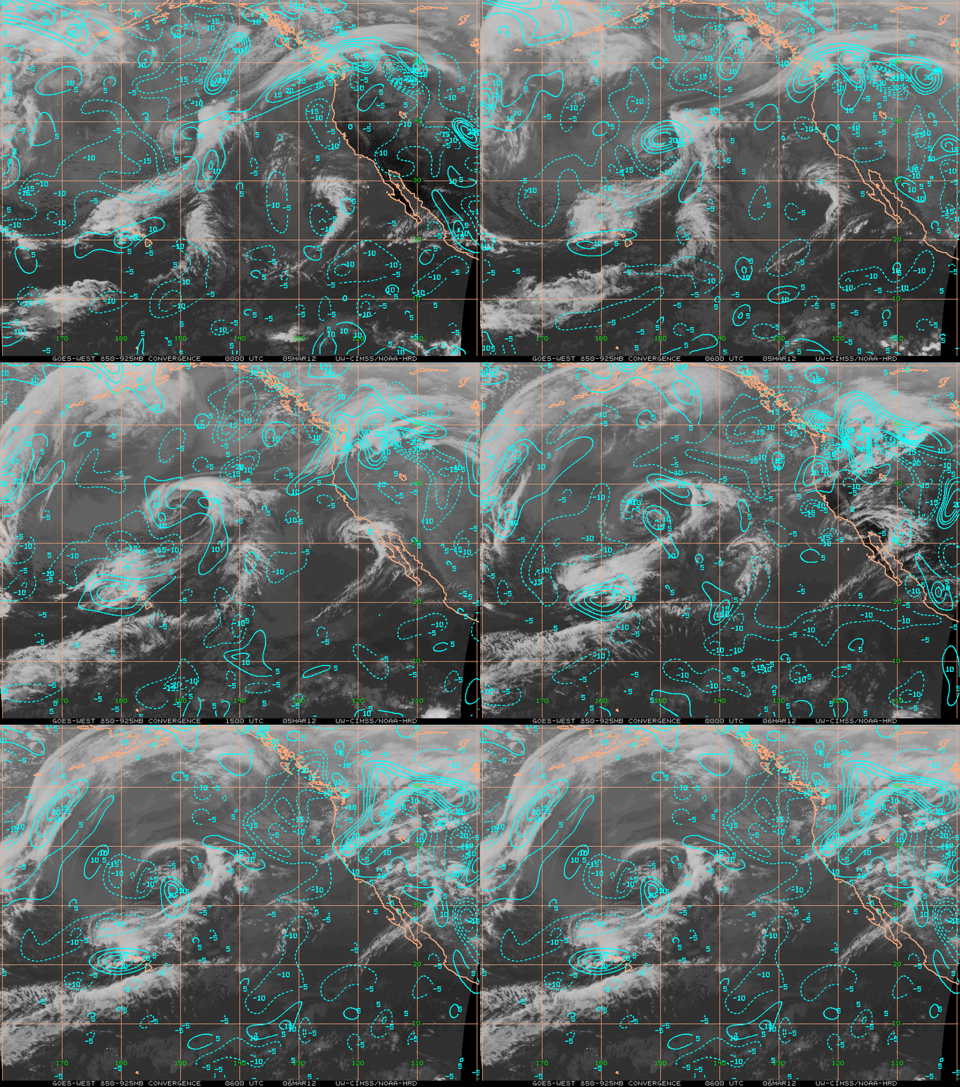
Juxtaposed beneath the strong upper-tropospheric divergence was strong lower-tropospheric convergence in the vicinity of the stationary front / wind shear axis, as seen in GOES-15 10.7 µm IR images with contours of IR satellite wind derived 850-925 hPa convergence (below). This created a favorable environment for upward vertical motion, with plenty of deep moisture to fuel the development of the strong thunderstorms.


