Heat burst in Wichita, Kansas
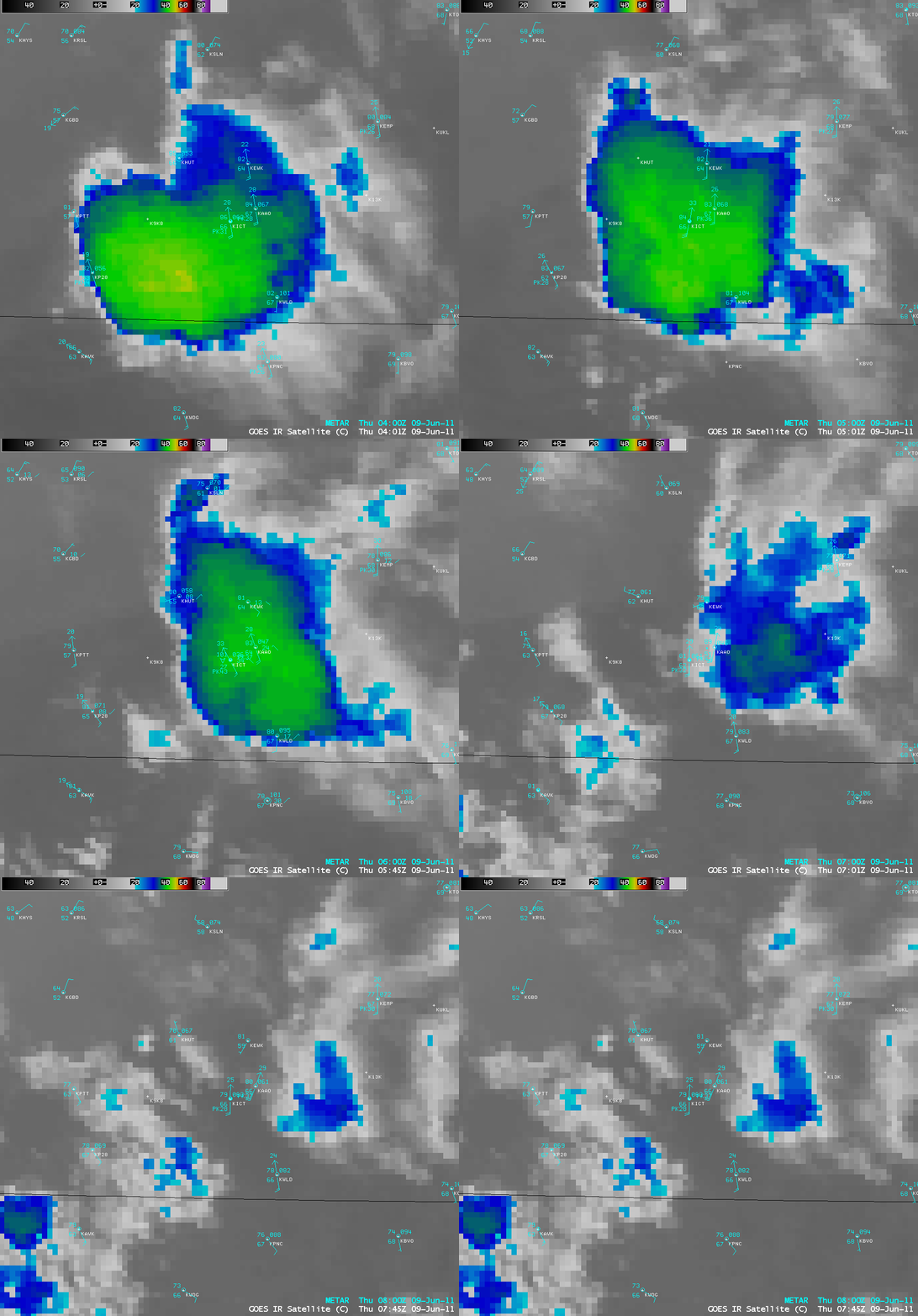
AWIPS images of 4-km resolution GOES-13 10.7 µm IR data (above) showed an area of collapsing convection (exhibiting rapidly warming cloud top IR brightness temperatures) moving northeastward across far southern Kansas on 09 June 2010. Downdrafts within this collapsing convection led to a nocturnal heat burst at Wichita (station identifier KICT) .
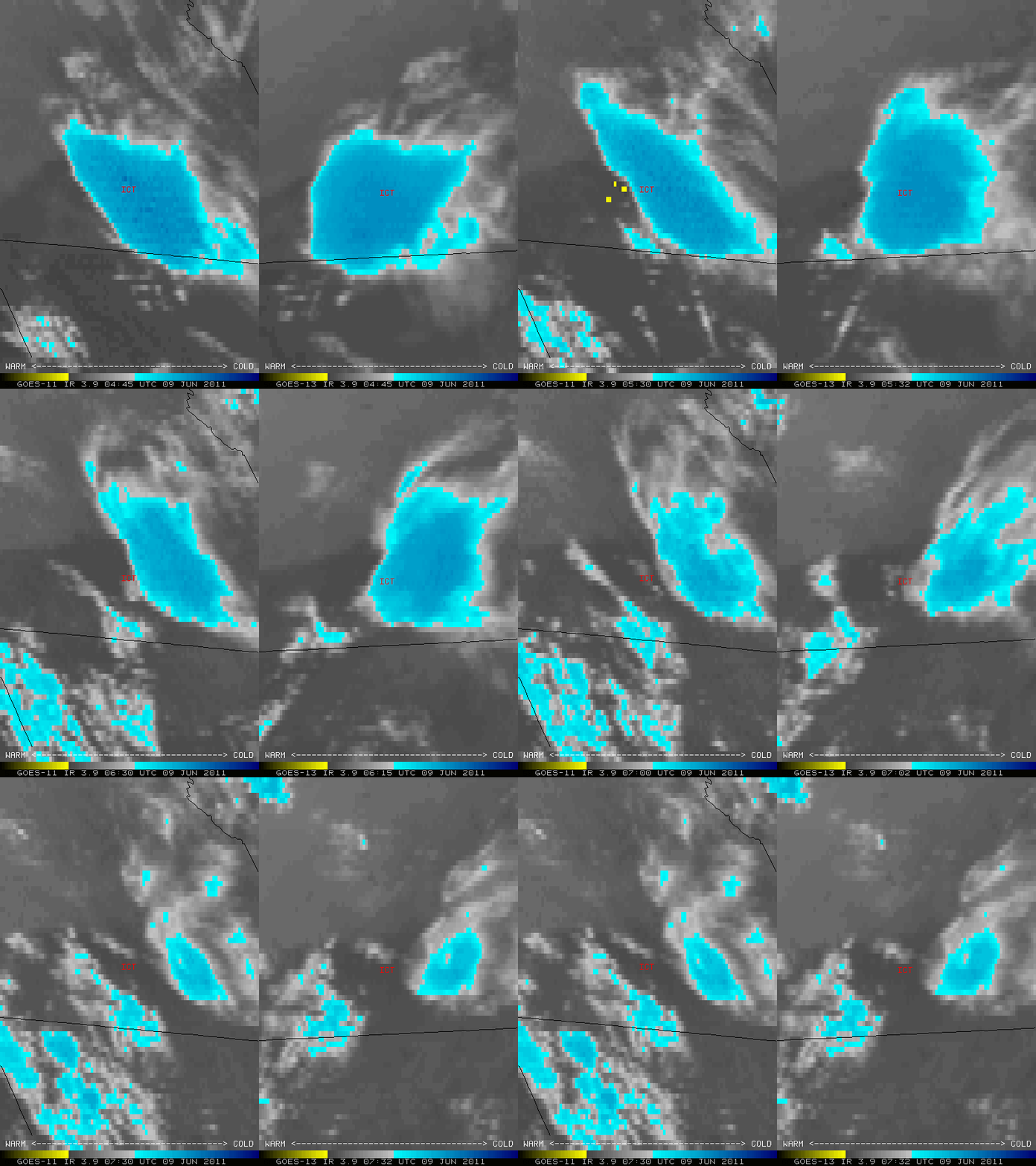
McIDAS images of GOES-11 (GOES-West) and GOES-13 (GOES-East) 3.9 µm shortwave IR channel data (below) revealed that a warm “heat burst signature” (yellow color enhancement) could be more easily detected (and seen for a longer period of time) on the GOES-11 images, utilizing the more oblique satellite viewing angle from the western satellite.
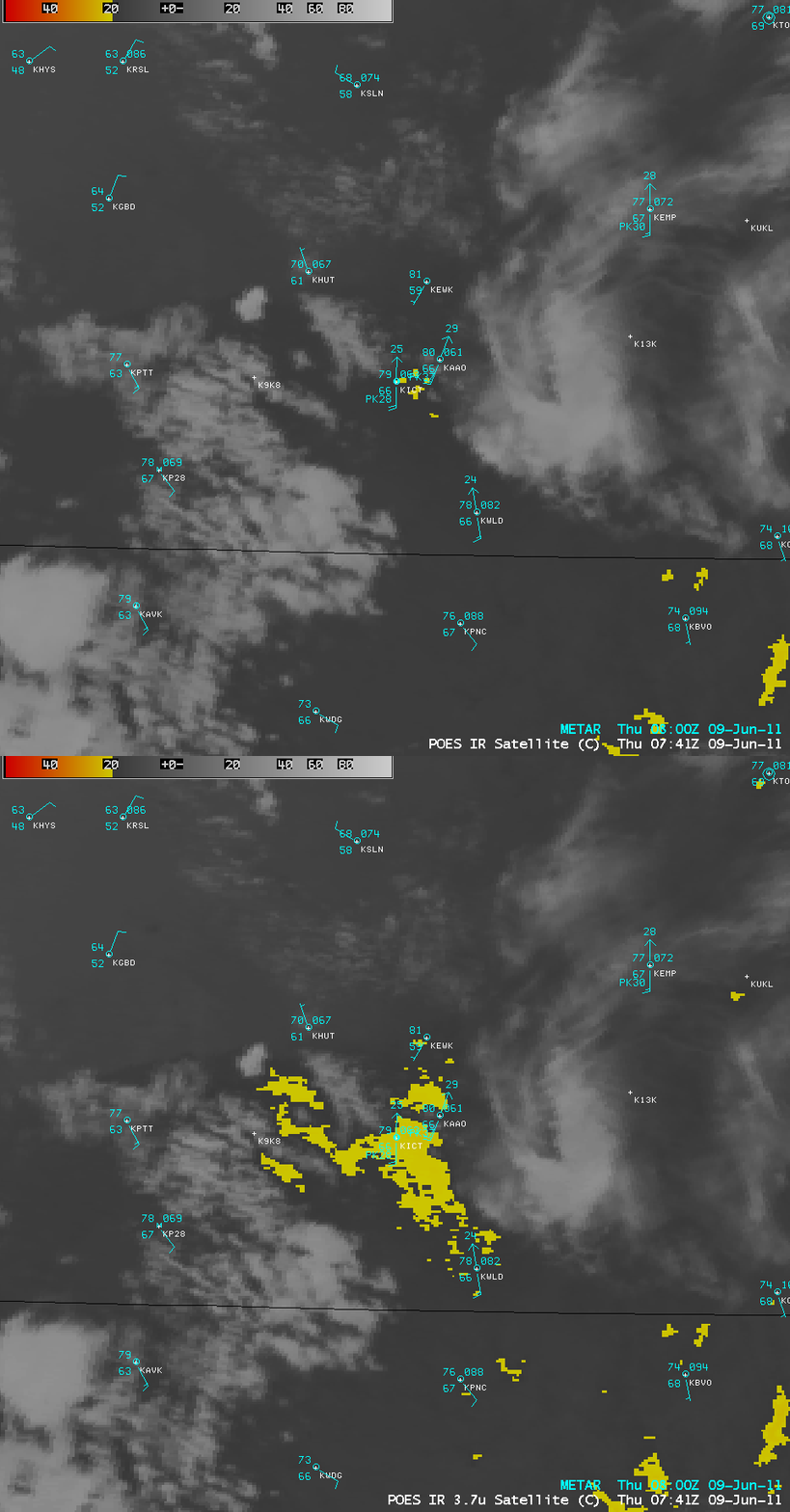
About 2 hours after the heat burst event, a comparison of AWIPS images of 1-km resolution POES AVHRR 10.8 µm IR and 3.7 µm shortwave IR data (below) continued to show an area of slightly warmer surface IR brightness temperatures (20.0º C and warmer, yellow color enhancement) along the rear flank of the collapsing convection. Again, the areal coverage of the warm signature was greater on the 3.7 µm shortwave IR image, since that channel is more sensitive to warmer temperatures.
An alternative view using a McIDAS image of the NOAA-19 AVHRR 3.7 µm shortwave IR channel data with plots of surface temperature (below) showed that the instrument shelter air temperatures had cooled to 79-80º F by 08:00 UTC — however, there is some question as to whether the warmest surface IR brightness temperatures seen on the image (red color enhancement) represent the core of the remnants of the heat burst signature, or simply a warm signature of the city of Wichita itself (Sedgewick county is outlined in black on the image).


