Northeast US winter storm
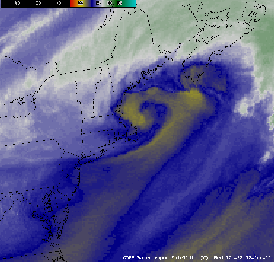
A strong “Nor’easter” winter storm impacted much of the northeastern US on 12 January – 13 January 2011. The storm exhibited a nice presentation on AWIPS images of the GOES-13 6.5 µm “water vapor channel” data (above; click image to play animation). Storm total snowfall amounts included 36.0 inches at Wilmington, Vermont, 34.5 inches at Savoy, Massachusetts, and 29.5 inches at North Haven, Connecticut (HPC Storm Summary).
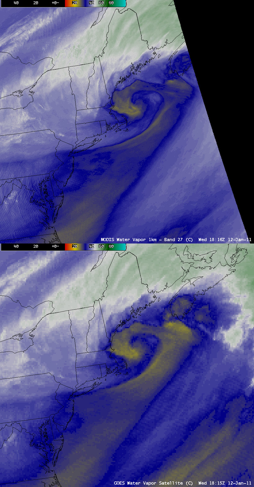
A comparison of the GOES-13 6.5 µm water vapor image at 18:15 UTC and the corresponding MODIS 6.7 µm water vapor image at 18:16 UTC (below) demonstrates the value of better spatial resolution (1 km on the MODIS image) for depicting subtle storm structures. Also note the slight northwestward “parallax shift” of the features on the GOES-13 image, due to the large viewing angle from GOES-13 (which is positioned over the Equator at 75º West longitude).
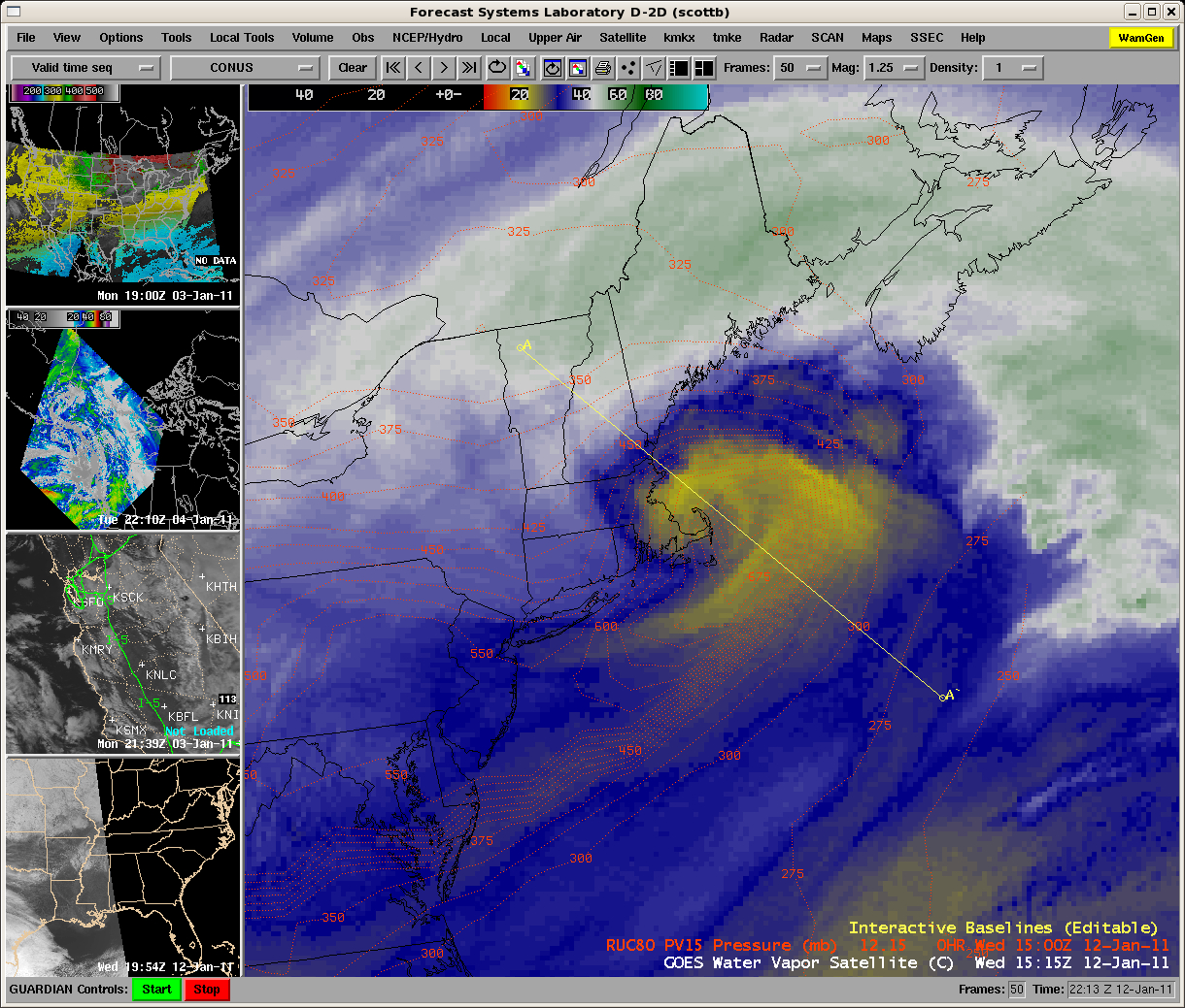
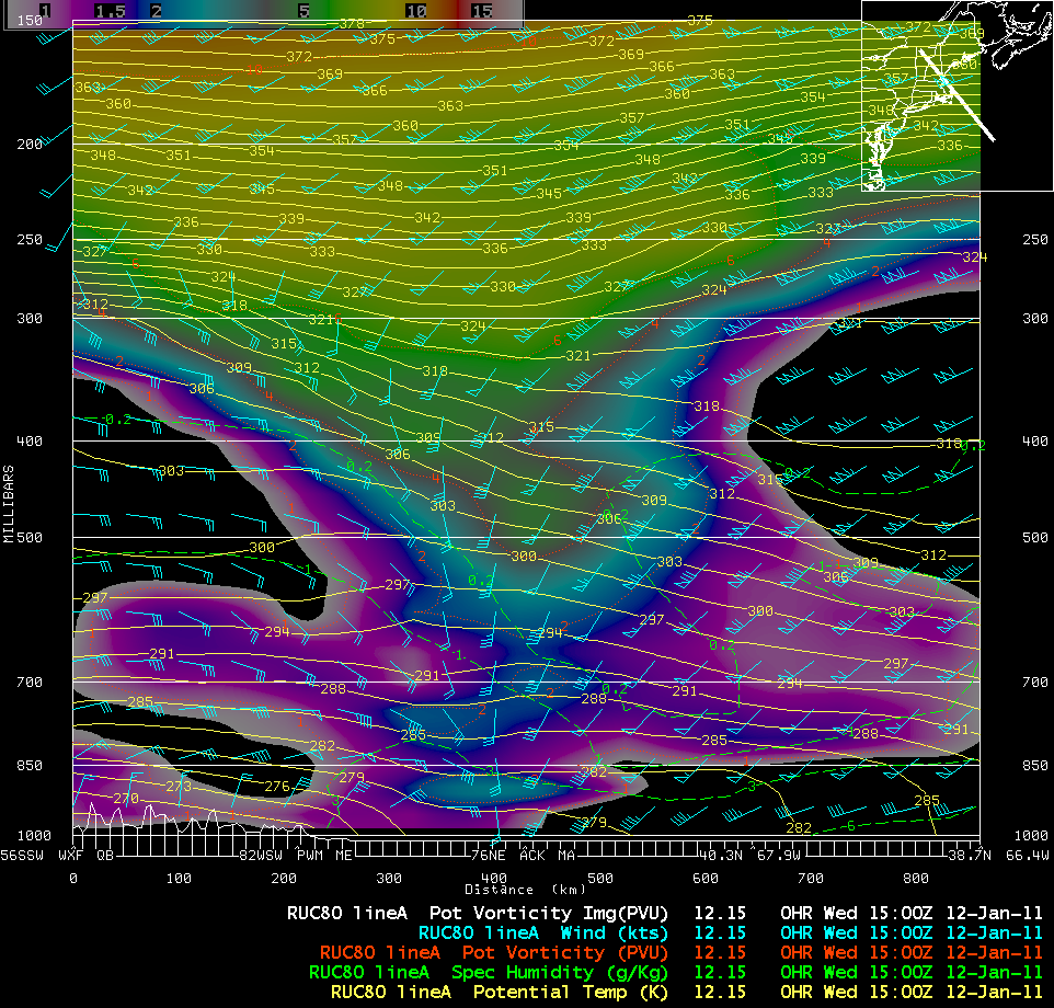
There was a strong Potential Vorticity (PV) anomaly associated with this storm — in fact, a northwest-to-southeast oriented cross section of RUC80 model fields through the developing “comma structure” seen on GOES-13 water vapor imagery at 15 UTCÂ (above) showed that the tropopause (taken to be the pressure of the PV1.5 surface) had been drawn downward to near the 800 hPa pressure level (below).
A sequence of 1-km resolution MODIS 11.0 µm IR and POES AVHRR 10.8 µm IR image (below) showed the development of banding features with IR brightness temperatures as cold as -50 to -60º C (orange to red color enhancement).
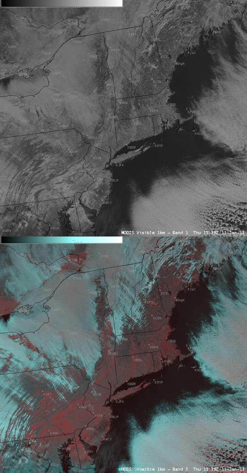
After the storm departed, a comparison of a 13 January MODIS 0.65 µm visible channel image with the corresponding MODIS Red/Green/Blue (RGB) image — created using MODIS channels 01/07/07 — showed the extent of some of the snow cover (which appears as the darkest shades of red on the RGB image), as well as the presence of supercooled water droplet clouds and glaciated ice crystal clouds (which show up as light gray and lighter shades of red on the RGB image, respectively).


