Satellite indicators of potential turbulence
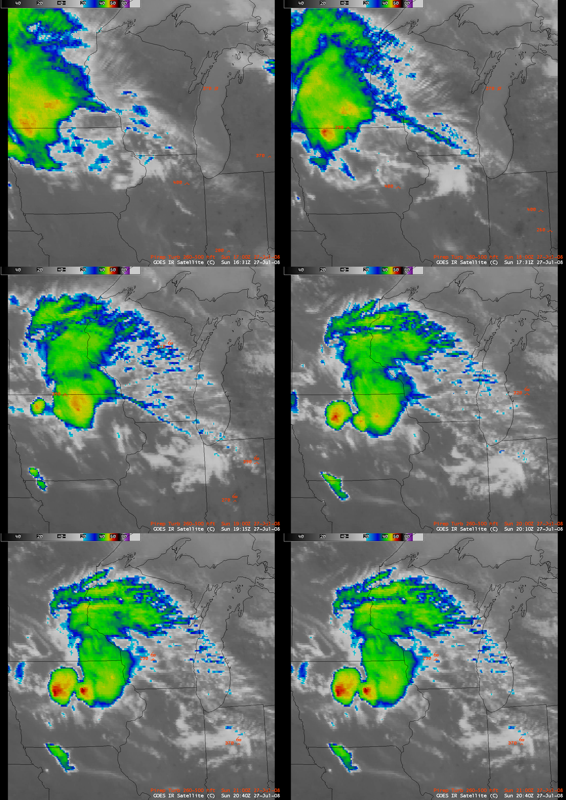
There are a number of satellite signatures that denote areas of potential turbulence, and AWIPS images of the GOES-12 10.7 µm IR channel on 27 July 2008 (above) displayed two of the more common indicators: rapidly developing convection, and transverse banding. A decaying mesoscale convective system was moving southeastward across Minnesota and Iowa, with pulses of new convection developing rapidly over northern Iowa — one pilot reported a severe updraft that caused a rapid increase in altitude of 2000 feet as the aircraft was flying over the Minnesota/Iowa border region.
Along the periphery of the northeastern quadrant of the decaying MCS, a well-defined area of “transverse banding” formed (the narrow cloud band features were generally perpendicular to the mean wind direction aloft) – there were a few reports of turbulence that appeared to be associated with this transverse banding feature: over Lake Michigan around 17:30 UTC, over northeastern Wisconsin around 19:20 UTC, and over western Lower Michigan around 20:09 UTC.
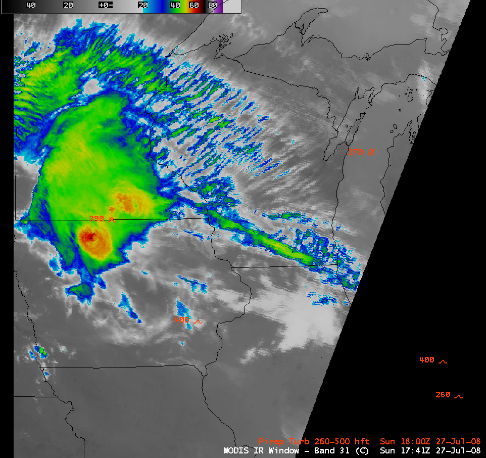
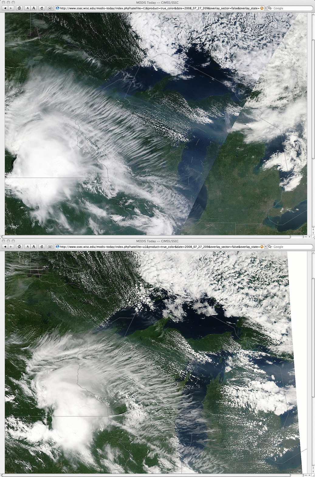
The transverse banding features that were seen on the 4-km resolution GOES IR imagery were even more obvious on an AWIPS image of the 1-km resolution MODIS 11.0 µm IR channel (above), and also on a comparison of 250-m resolution MODIS true color images from the SSEC MODIS Today site (below).
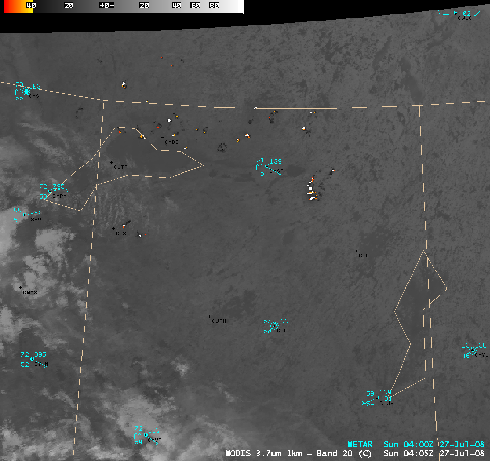
Since we’re on the topic of potential aviation hazards, also note the hazy features that were evident on the MODIS true color images (just to the east of the transverse banding) — these hazy features were due to the presence of thick smoke from wildfires that had been burning over parts of northern Saskatchewan, Canada for several days (see the US Air Quality “Smog Blog” for details). GOES-12 visible imagery indicated that this smoke began moving southeastward across Manitoba and into the north-central US on 25 July (QuickTime animation). The smoke was likely confined to layers aloft, but aircraft flying through those smoke layers would encounter significantly reduced visibilities at those altitudes. An AWIPS image of the 1-km resolution MODIS 3.7 µm IR channel (below) showed a large number of fire “hot spot” signatures across far northern Saskatchewan at 04:05 UTC (10:05 PM the previous evening, local time).


