Tropical Storm Bertha
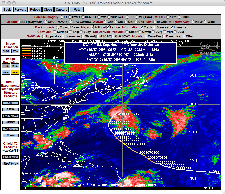
A GOES-12 IR image from the CIMSS Tropical Cyclones site (above) showed Tropical Storm Bertha continuing to linger over the western Atlantic Ocean on 16 July 2008 — this storm first became “Tropical Depression #2” over the eastern Atlantic, thirteen days earlier (on 03 July).
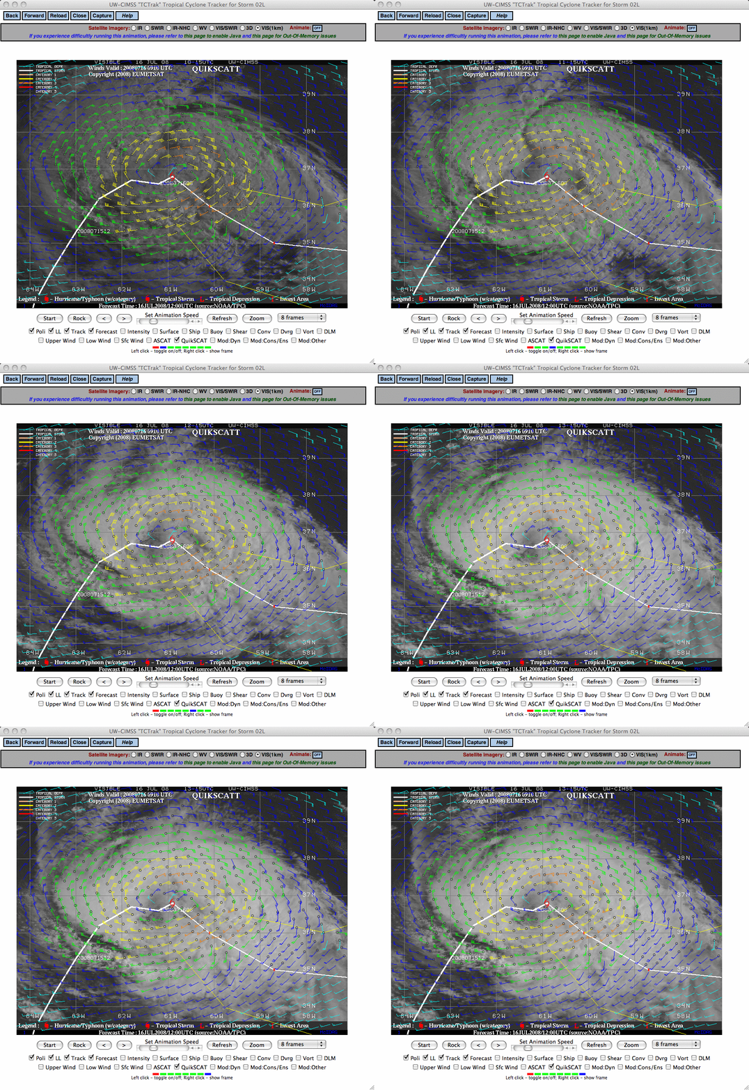
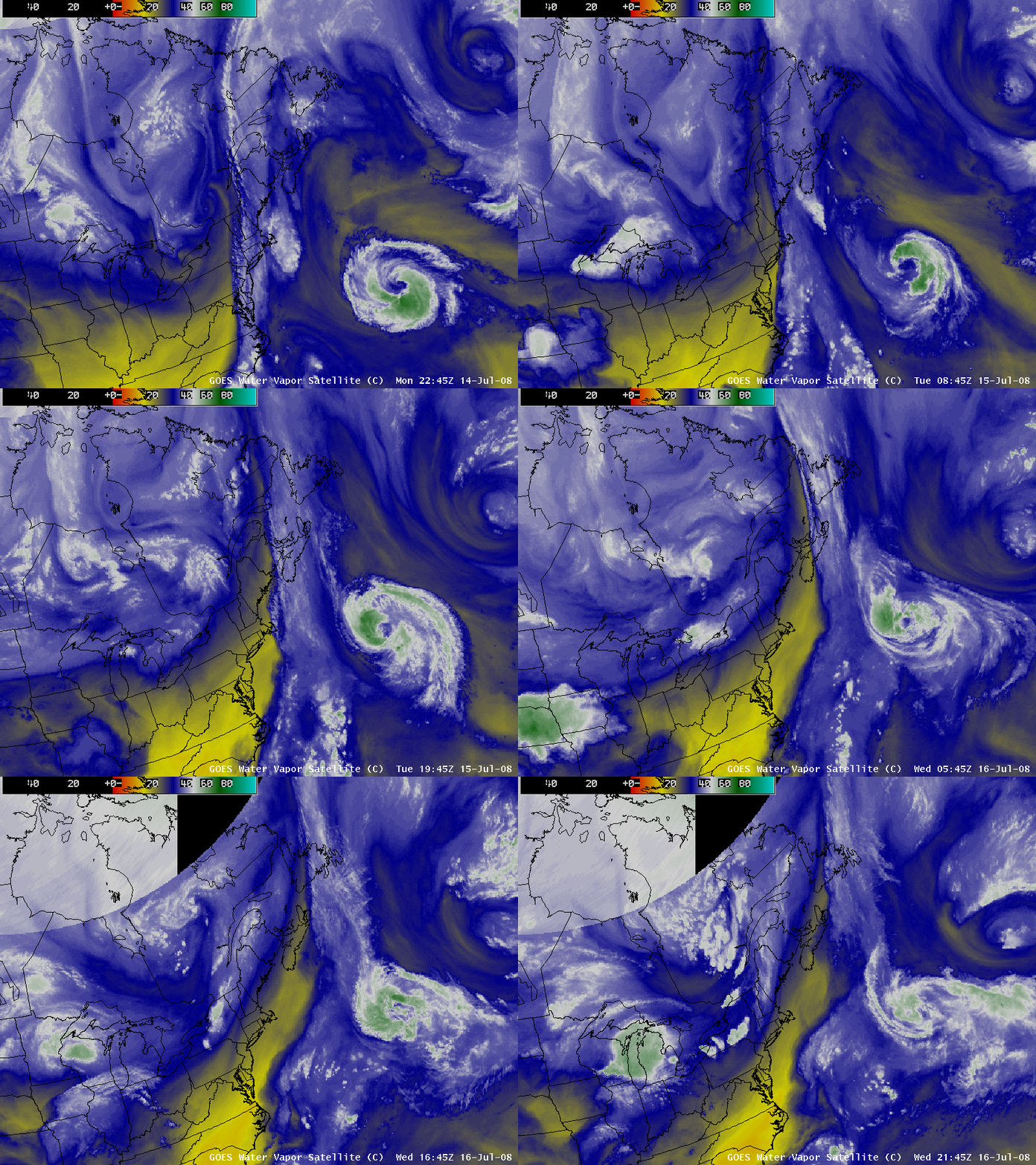
GOES-12 visible images with an overlay of SeaWinds data from the QuikSCAT satellite (above) revealed that there were still some bursts of convection near the center of the tropical cyclone, and maximum wind speeds remained near 60 knots. Tropical Storm Bertha was in the process of weakening as it began to encounter increasing environmental wind shear. AWIPS images of the GOES-12 water vapor channel (below) showed that the northeastward motion of Bertha was slowing, with a gradual turn toward the southeast as the tropical cyclone began to interact with a mid-latitude low located off to the east (this middle to upper level low was drifting southwestward across the North Atlantic Ocean).
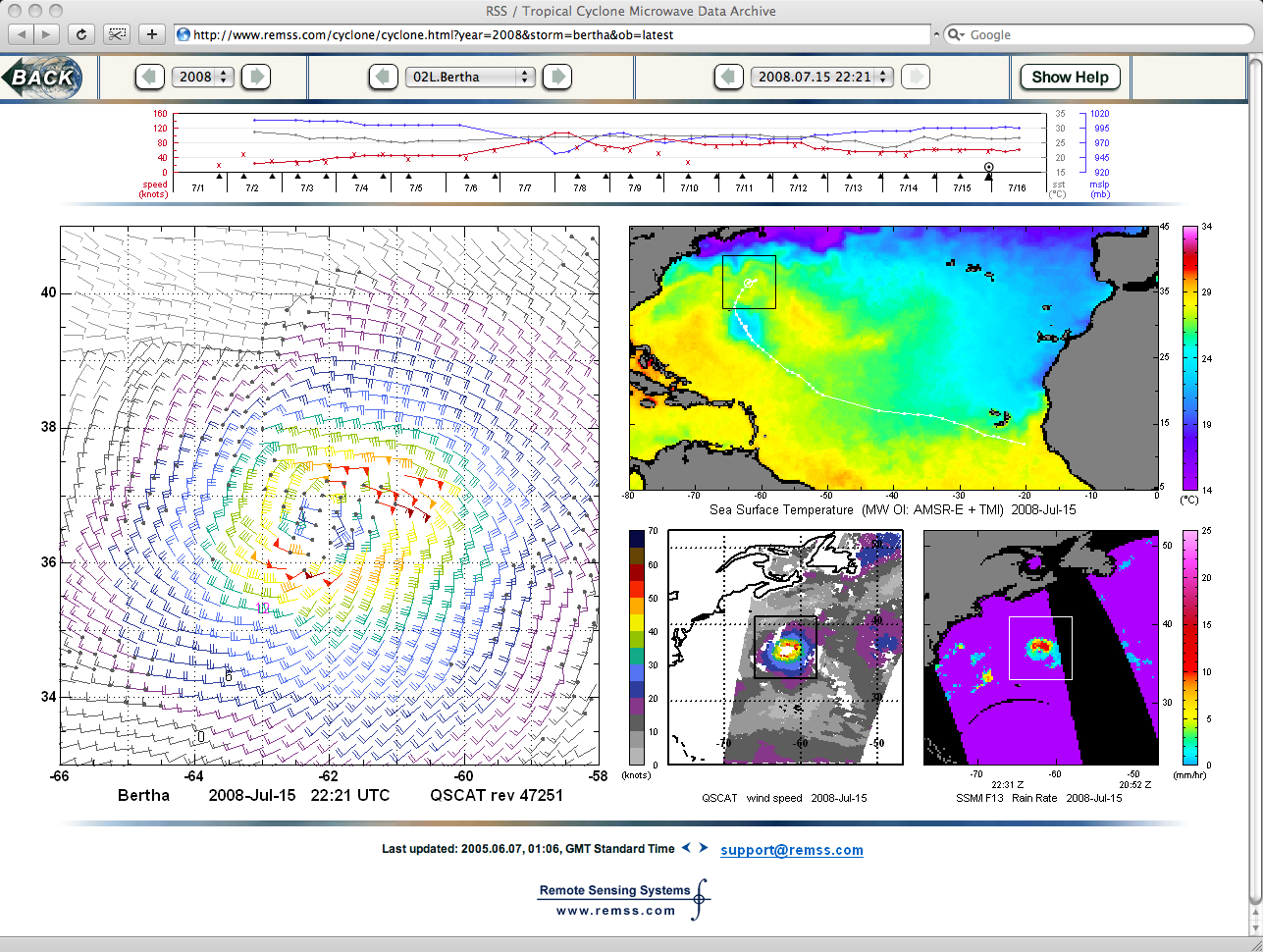
It is interesting to note the large pool of cooler Sea Surface Temperatures (cyan to blue colors) in the wake of slow-moving Bertha (below; sourced from Remote Sensing Systems).


