Blowing dust in Texas
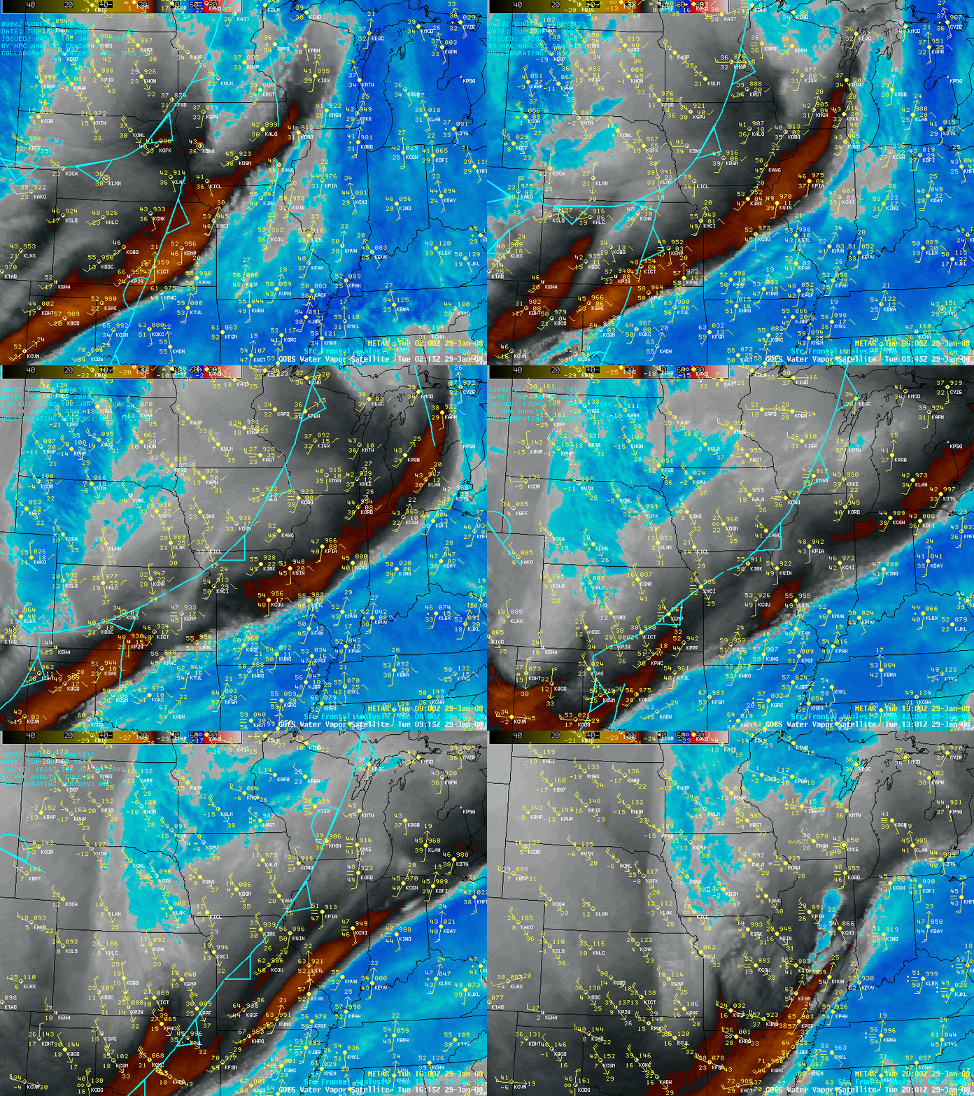
A very cold arctic air mass was in place across parts of the Canadian Prairies, with many sites in Alberta reporting surface temperatures colder than -40º F (-40º C) on the morning of 29 January 2008; the leading edge of this arctic air was surging rapidly southward across the Great Plains of the US as a strong cold frontal boundary. AWIPS images of the GOES-12 6.5µm “water vapor channel” (above) actually showed a signature of a gravity wave along the leading edge of the cold front as it moved southward across Nebraska and Kansas into Texas and Oklahoma. This lee-side cold frontal gravity wave feature could be detected on the water vapor channel imagery due to the fact that the airmass ahead of the front was quite dry, which shifted the altitude of the GOES-12 water vapor channel weighting function to much lower altitudes compared to what would be seen in a more typical airmass.
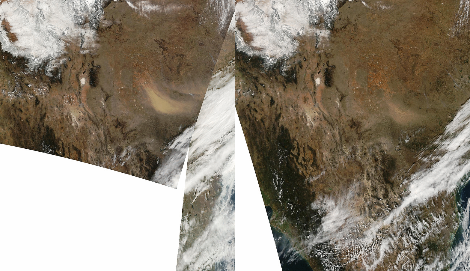
Strong pre-frontal and post-frontal winds were responsible for creating a large area of blowing dust across Texas during the afternoon hours, as seen on consecutive Terra (18:15 UTC, or 12:15 pm local time) and Aqua (19:50 UTC, or 1:50 pm local time) MODIS true color images from the SSEC MODIS Today site (below). This blowing dust reduced surface visibility to as low as 2 miles at San Angelo, Texas.
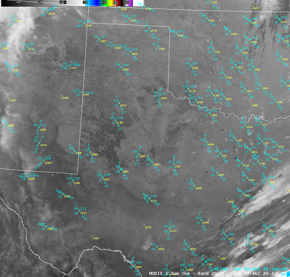
The windy conditions (several wind gusts in Texas were in excess of 60 mph) and very dry air were also creating an environment favorable for small wildfires; note that a number of fire “hot spots” (black pixels) could be seen on an AWIPS image of the MODIS 3.7µm shortwave IR channel (below).
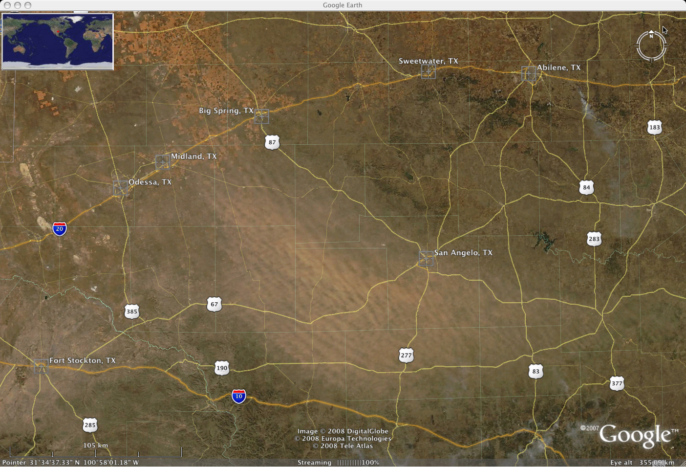
The SSEC MODIS Today true color image from the Aqua satellite displayed using Google Earth (below) showed exactly which counties and highways in Texas were being impacted by the large cloud of blowing dust. In addition, a smoke plume from small wildfire that was burning just southeast of Abilene, Texas could be seen streaming south/southeastward.


