Blowing dust in Arizona
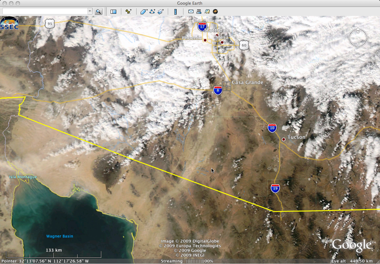
Strong winds associated with a developing storm over the southwestern US caused areas of blowing dust across southern Arizona on 22 December 2009. A MODIS true color image from the SSEC MODIS Today site (above) showed one of the larger plumes of blowing dust which was moving northeastward across the region. On a smaller scale, there were also localized areas of very thick blowing dust that reduced visibility and caused a number of multiple-vehicle accidents along Interstate 10 between Tucson and Phoenix — fatalities were reported with one of the larger vehicle pile-ups near Casa Grande.
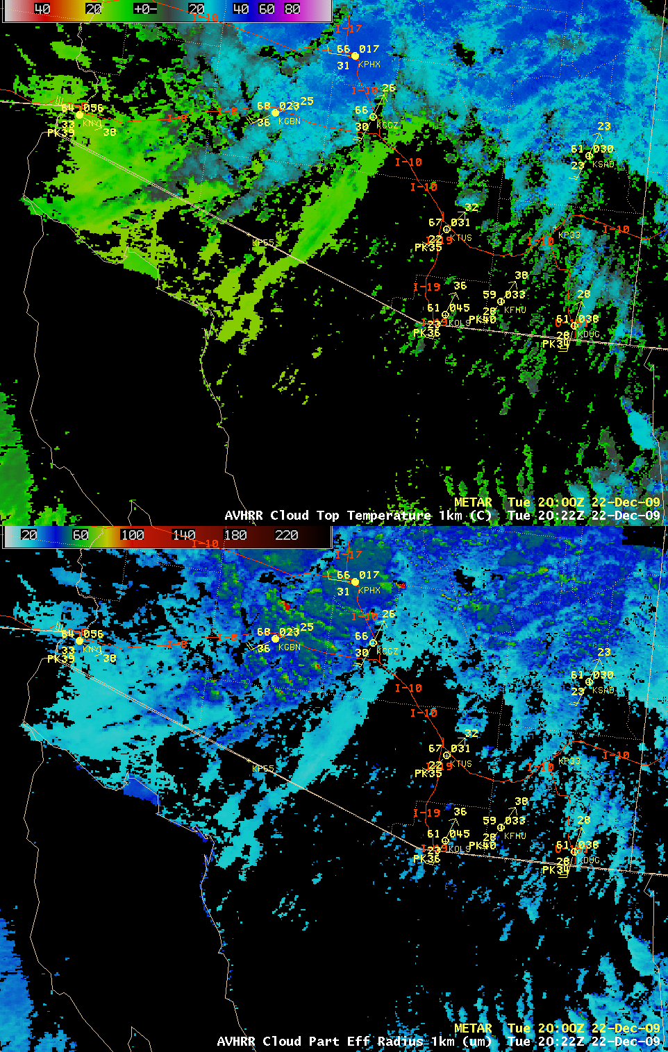
AWIPS images of the AVHRR Cloud Top Temperature (CTT) and Cloud Particle Effective Radius products (below) indicated that CTT values associated with the large-scale blowing dust plume were around +10 to +15º C, which was between the 921 and 850 hPa pressure levels on the Tucson AZ rawinsonde report. The dust particle effective radius values were in the 15-25 µm range — much smaller than the 50-100 µm values seen for the cloud features located in other parts of the image scene.
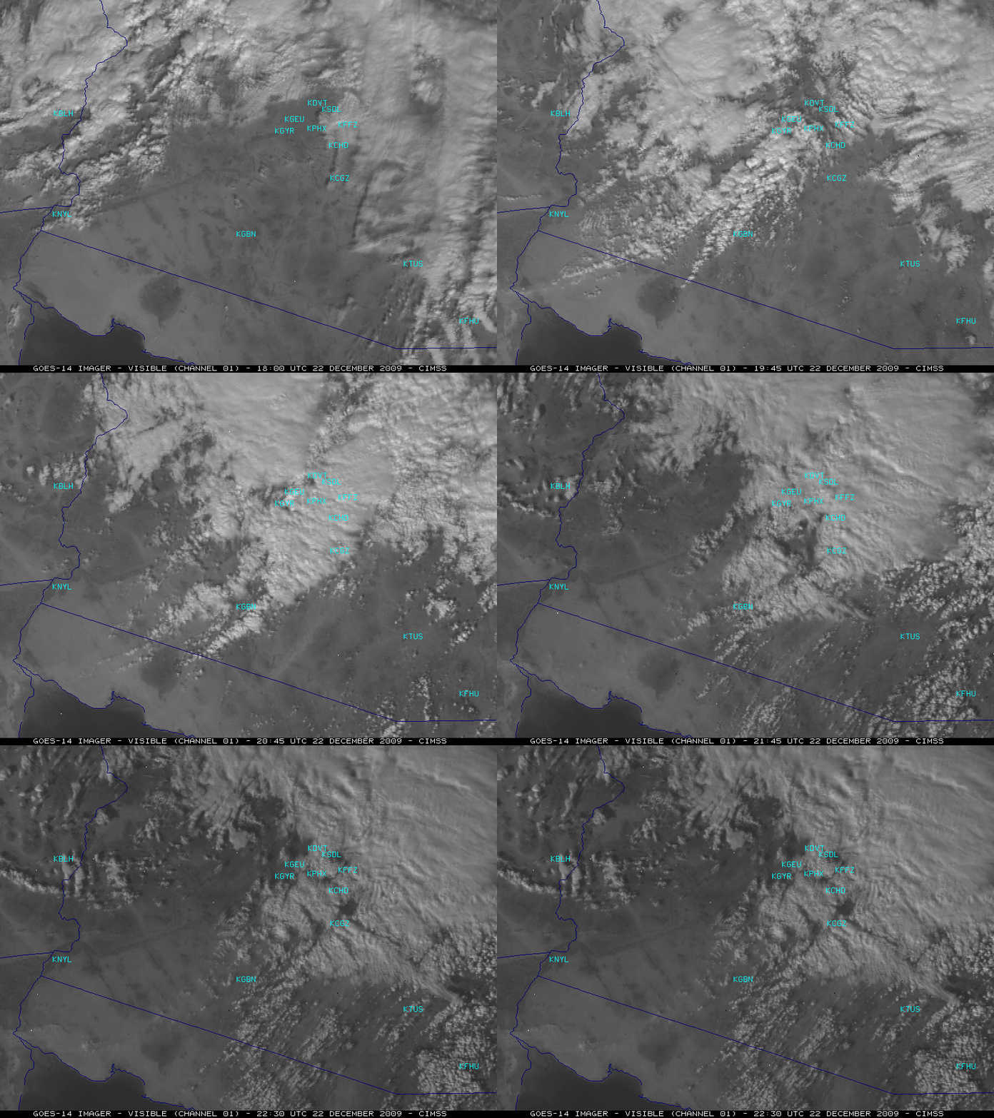
As part of its ongoing NOAA Science Test, GOES-14 was emulating GOES-West operations on that day. McIDAS images of the GOES-14 visible channel data (above) showed the evolution of the large-scale dust plume as it became more organized along the Arizona/Mexico border and moved northeastward toward the Casa Grande (station identifier KCGZ) area. Also worthy of mention is the fact that the convection that moved through the Phoenix area generated a few reports of 0.25 inch diameter hail.
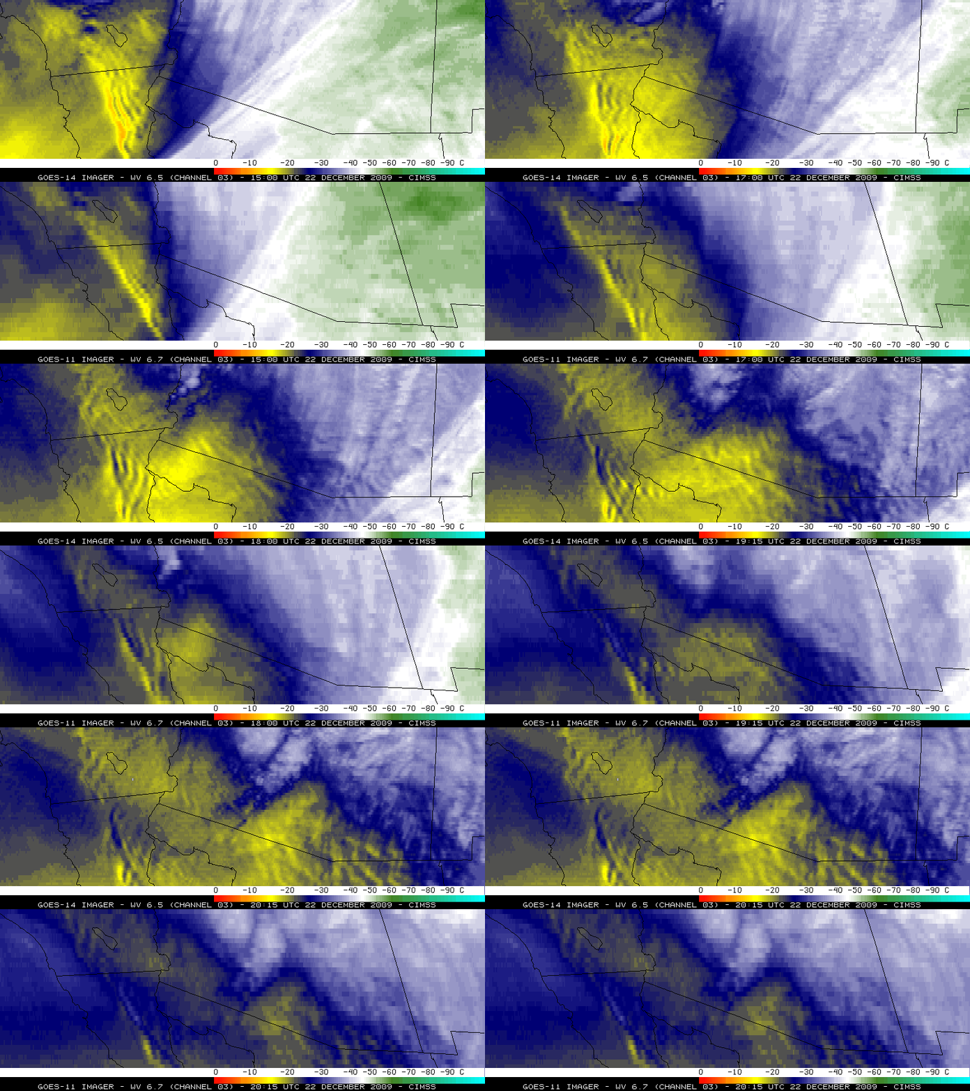
A clue to the approach of strong mid-tropospheric winds could be seen in a comparison of 4-km resolution GOES-14 6.5 µm water vapor and 8-km resolution GOES-11 6.7 µm water vapor images (below) — lee waves were apparent immediately downwind of the higher terrain, particularly over Baja California. Note how the improvement in spatial resolution from 8-km to 4-km improves the ability to detect the complexity and the areal extent of the lee waves on water vapor imagery. When GOES-11 is due for replacement as the operational GOES-West satellite, GOES-14 will likely take over that duty.
A MODIS 11.0 µm – 12.0 µm IR difference image (below) was useful for helping to highlight the large-scale blowing dust plume at 20:09 UTC. Beginning with GOES-12, the Imager instrument 12.0 µm IR channel was replaced with a 13.3 µm channel, preventing the application of this type of IR difference blowing dust identification on the more recent GOES satellites — however, the 12.0 µm IR channel will return on the ABI instrument aboard GOES-R.


