Tehuano wind event in the wake of a strong eastern US winter storm
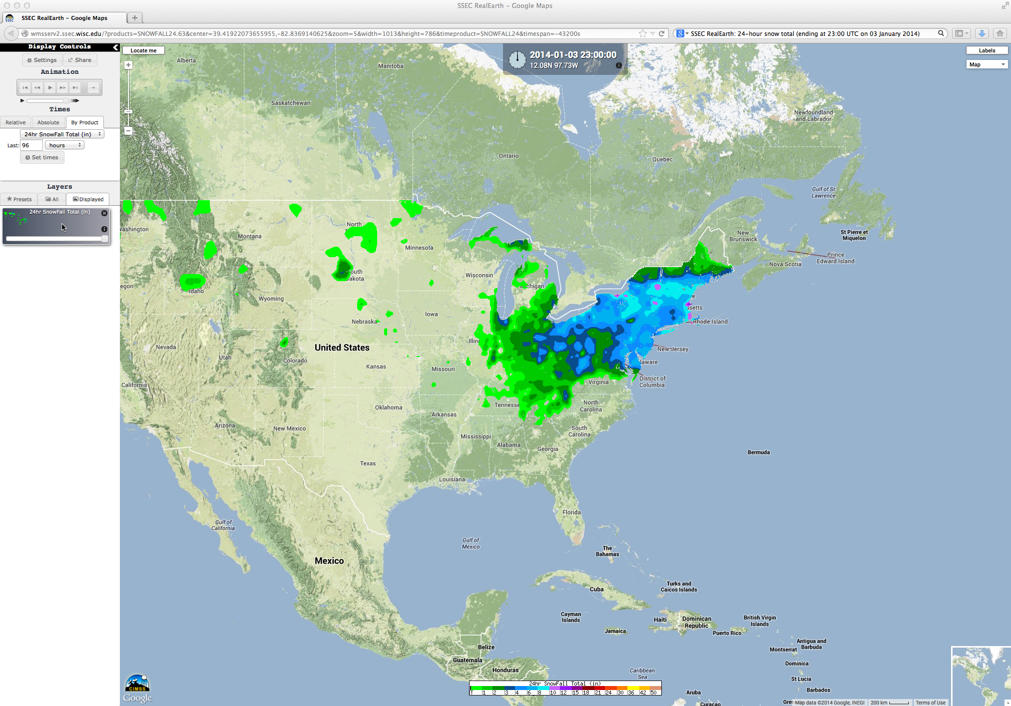
A strong winter storm affected much of the central and eastern US during the 02 January – 03 January 2014 period. A map of SSEC RealEarth 24-hour snowfall totals (above) shows how widespread the resulting snowfall was, with amounts as high as 24 inches in Massachusetts abd 22 inches in New York (WPC storm summary).
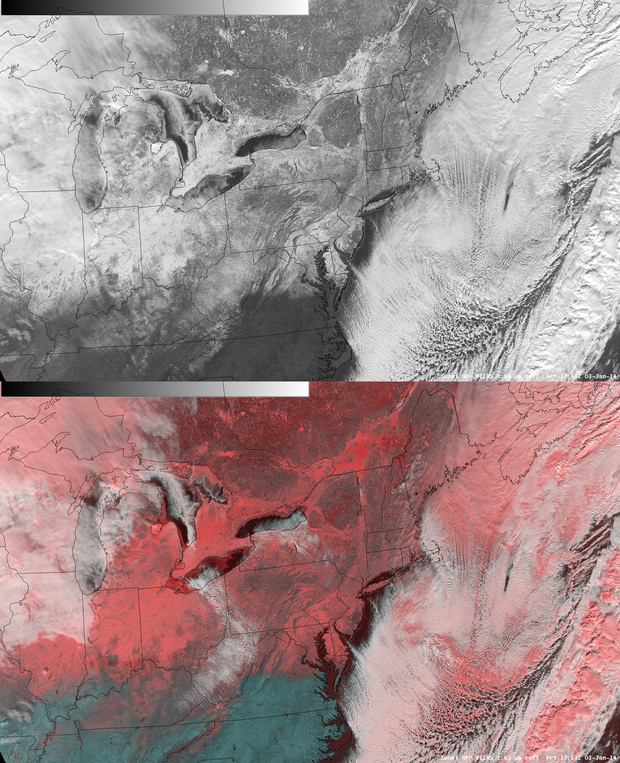
As the storm system departed over the Atlantic Ocean on 03 January, an AWIPS image comparison of the 17:53 UTC (12:53 PM Eastern time) Suomi NPP VIIRS 0.64 µm visible channel data and the corresponding false-color “snow vs cloud discrimination” Red/Green/Blue (RGB) product (below) showed the areal coverage of snow on the ground (varying shades of red on the RGB image). Some patches of supercooled water droplet clouds (varying shades of white on the RGB image) could be seen streaming off of Lake Erie and Lake Ontario; in fact, a closer look revealed mesoscale bands of “lake-effect snow” downwind of the Finger Lakes in western New York, and also downwind of Lake Champlain along the New York/Vermont border.
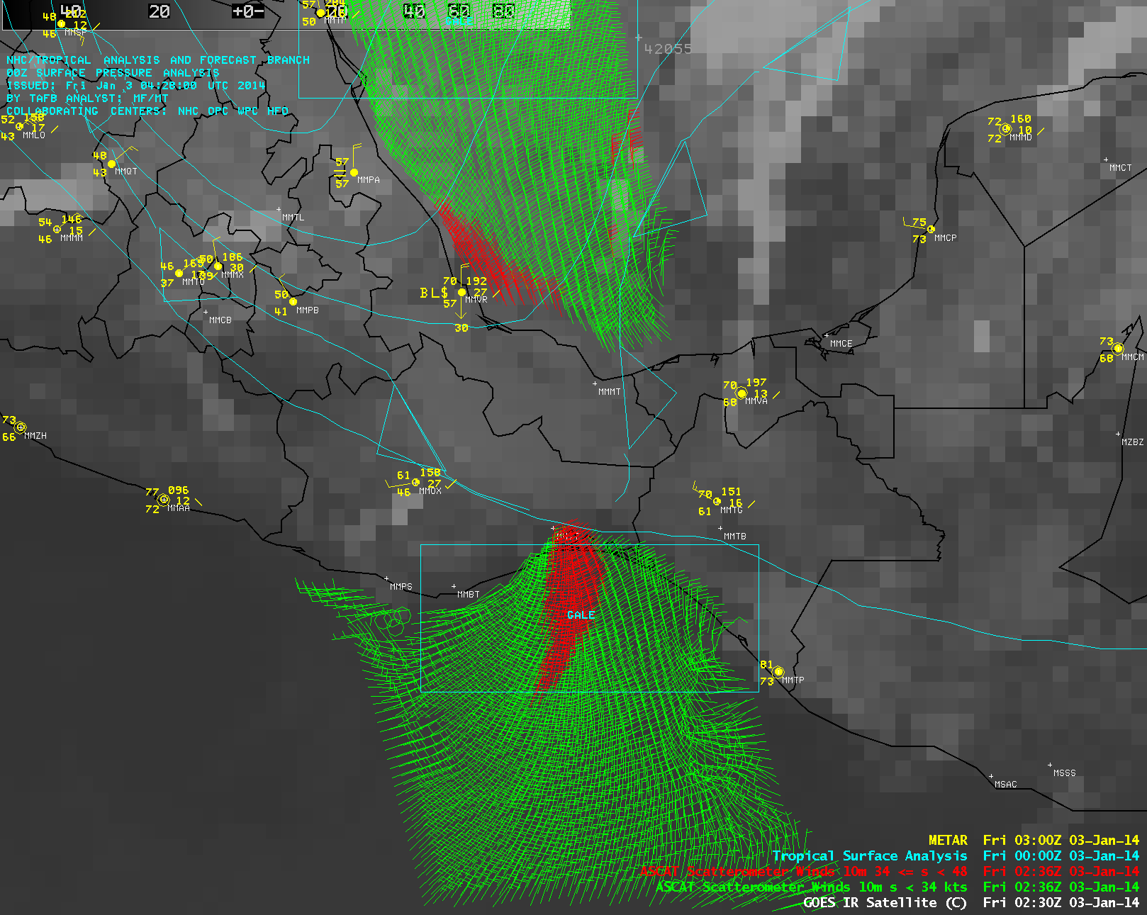
Cold air moving southward in the wake of the storm crossed the western Gulf of Mexico, moved through the Chivela mountain pass in southern Mexico, and eventually emerged over the Pacific Ocean in the Gulf of Tehuantepec — this type of mountain gap wind flow is known as a Tehuano wind event or a “Tehuantepecer”. An image of Metop ASCAT surface scatterometer winds at 02:36 UTC (below) showed that a large area of northerly gale force winds (red wind barbs) was present over the Gulf of Tehuantepec, with maximum remotely-sensed wind speeds of 41 knots. The tropical surface analysis (cyan) displayed the fractured cold frontal boundary that had advanced into southern Mexico; behind the cold front along the Gulf of Mexico coast at Veracruz (station identifier MMVR), the surface visibility at the time was reduced to 6 miles due to blowing sand (time series of MMVR surface reports). Surface reports at Ixtepec (station identifier MMIT) along the Gulf of Tehuantepec were sparse, but did show northerly winds gusting to 37 knots at 17 UTC (time series of MMIT surface reports).
Daytime images of GOES-13 0.63 µm visible channel data on 03 January (below; click image to play animation) showed the hazy plume of blowing dust and sand moving southwestward, with the boundaries of the strong Tehauno winds marked by long, narrow rope clouds.
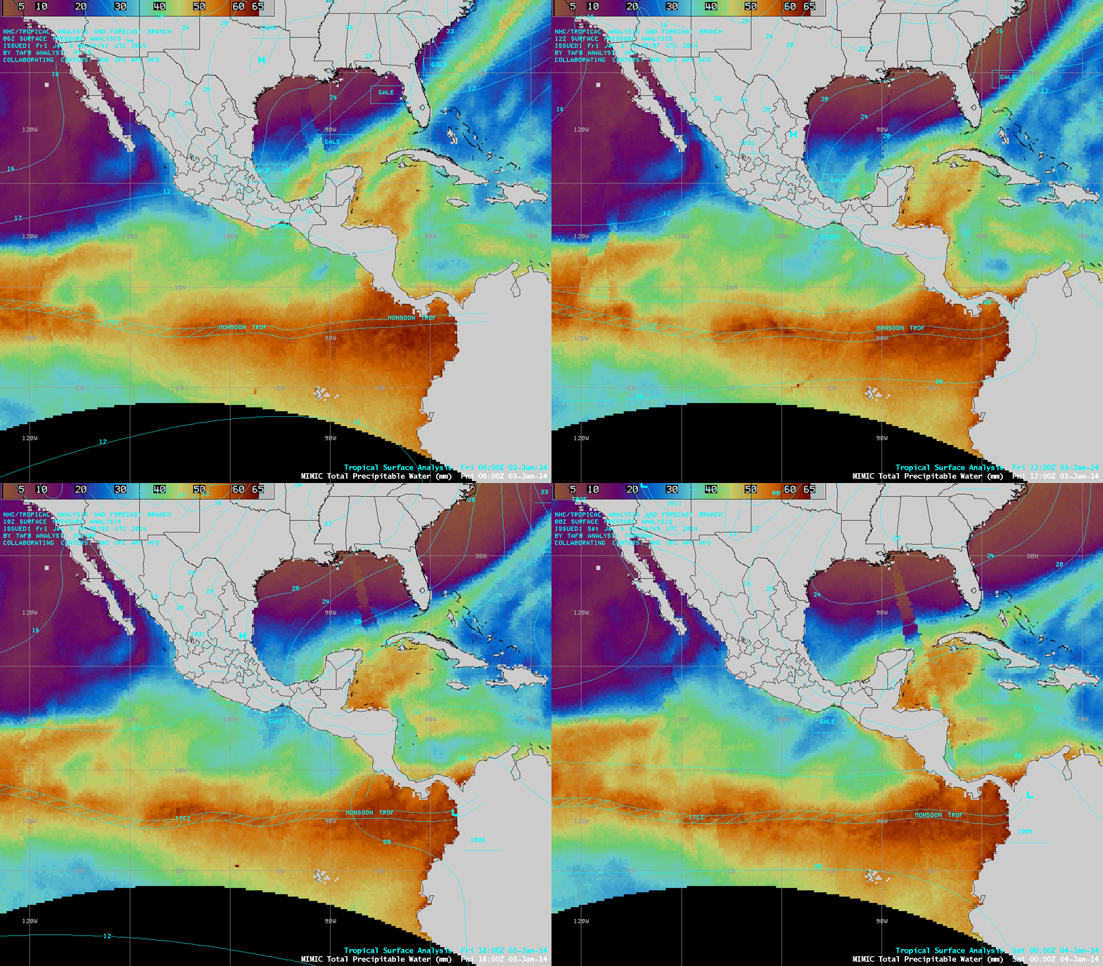
A signature of the dry air (darker blue color enhancement) associated with the Tehuano winds could be seen on the MIMIC Total Precipitable Water product (below).


