Super Typhoon Usagi
McIDAS images of MTSAT-2 10.8 µm IR channel data (above; click image to play animation) showed Super Typhoon Usagi in the West Pacific Ocean as it continued to move northwestward across the Philippine Sea. Note the slight amount of “trochoidal wobble” seen in the path of the eye. The coldest IR brightness temperature seen on the MTSAT-2 IR images was -92º C at 12:32 UTC. At the time of these images, advisories issued by the Joint Typhoon Warning Center listed the maximum sustained winds at 140 knots, with gusts to 170 knots; at its peak intensity, Usagi had an estimated lowest pressure of 882 hPa, making it the most intense tropical cyclone so far in 2013.
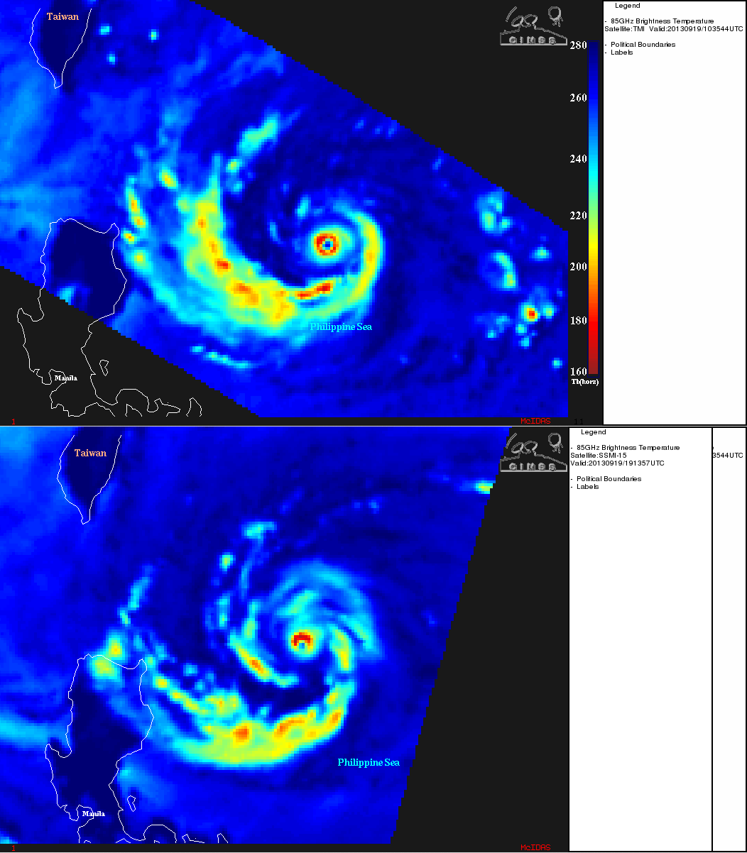
From the CIMSS Tropical Cyclones site, a comparison of 85 GHz microwave images from the TRIMM Microwave Imager (TMI) at 10:35 UTC and the DMSP SSM/I at 19:13 UTC (above) displayed a very small ring of high brightness temperatures surrounding the “pinhole eye”.
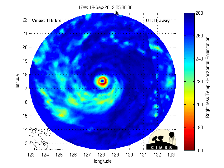
MIMIC-TC morphed microwave images (below; click image to play animation) showed a well-defined closed eyewall during much of the early part of the day on 19 September.
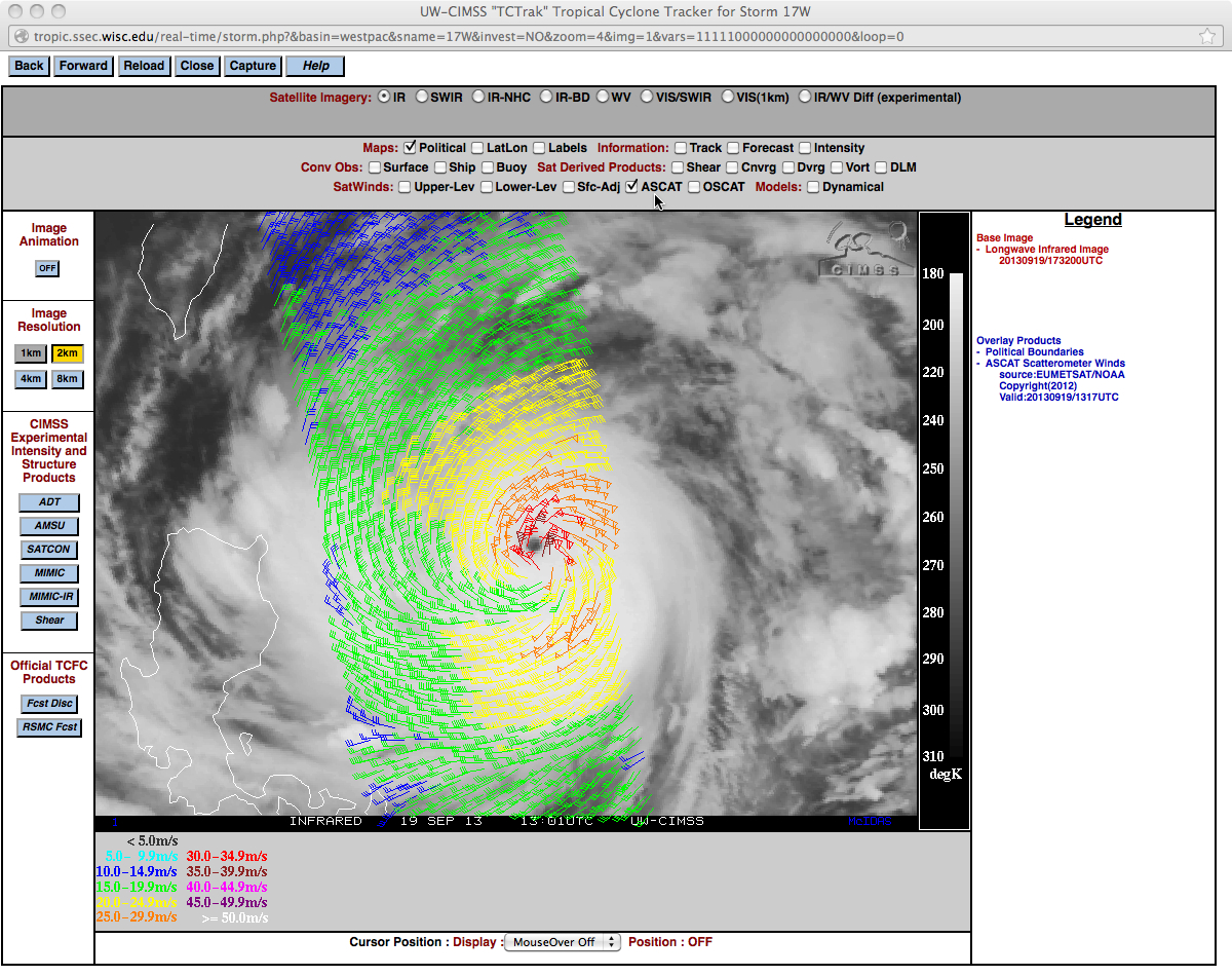
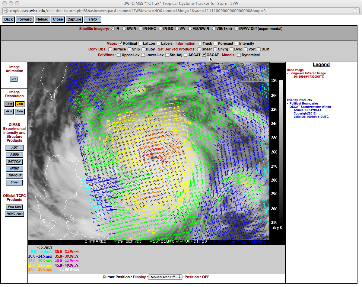
Scatterometer surface winds from the ASCAT instrument at 13:17 UTCÂ (above) and the OSCAT instrument at 15:10 UTCÂ (below) showed the large areal coverage of strong winds around the center of Usagi.
 ===== 20 September Update =====
MTSAT-2 0.67 µm visible channel images (above; click image to play animation) showed the detailed structure of the compact eye of Super Typhoon Usagi.


