GOES-15 Super Rapid Scan Operations (SRSO) imagery
GOES-15 (left) SRSO visible images and GOES-13 (right) RSO visible images (click image to play animation)
The GOES-15 (GOES-West) satellite was placed into Super Rapid Scan Operations (SRSO) on 18 May 2013 (to support the IfloodS field experiment), providing bursts of imagery at 1-minute intervals. At the same time, the GOES-13 (GOES-East) satellite had been placed into Rapid Scan Operations (RSO) due to the threat of severe weather over the central US, providing images as frequently as every 5-10 minutes. A comparison of 0.63 µm visible channel GOES-15 SRSO images with GOES-13 RSO images covering western Kansas, western Oklahoma, and the Texas Panhandle regions (above; click image to play animation; also available as a QuickTime movie) showed interesting views of the convective storm development — both from a perspective of the different satellite viewing geometries, and also the different temporal resolution from the different scanning strategies of the two GOES satellites. One of the more notable tornadoes on this day (SPC storm reports) moved through Rozel, Kansas.
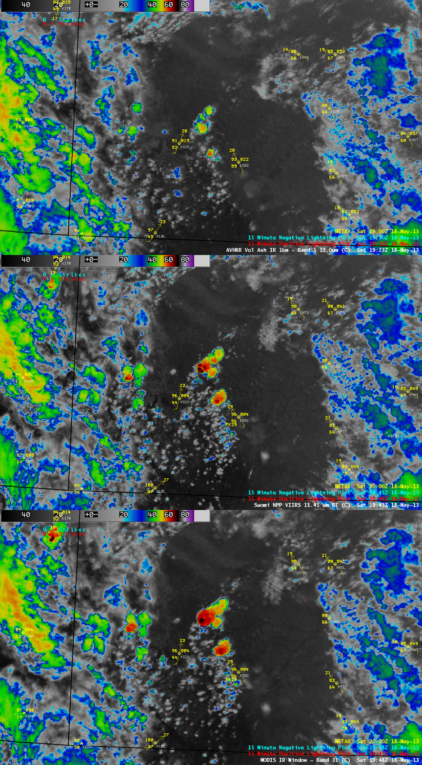
About a half hour prior to the start of the GOES-15 SRSO period, a sequence of three AWIPS images of 1-km resolution IR data from POES AVHRR (12.0 µm), Suomi NPP VIIRS (11.45 µm), and Aqua MODIS (11.0 µm) showed the rapid cooling of cloud-top IR brightness temperatures (to values of -70 F and colder, black color enhancement), even before any cloud-to-ground lightning strikes were detected (below).
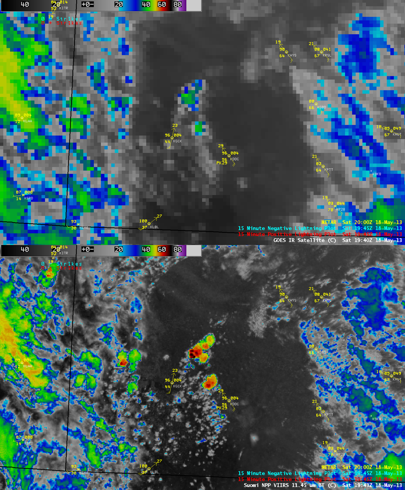
A comparison of the 19:43 UTC 1-km resolution Suomi NPP VIIRS 11.45 µm IR image with the corresponding 4.km resolution GOES-13 10.7 µm IR image (below) demonstrated the value of higher spatial resolution for the earlier and more accurate detection of the cold cloud-top IR brightness temperatures values associated with the rapidly-developing convective cells over southwestern Kansas. The actual times that the two satellite were imaging the storms were very close, yet the difference in coldest IR brightness temperature values (-58 C on GOES, compared to -77 C on VIIRS) was quite striking. The northwestward shift in the location of features on the GOES-13 image was due to parallax.
On the following day (19 May 2013), GOES-15 was again placed into SRSO mode, allowing a similar GOES-15 SRSO vs GOES-13 RSO visible image comparison of the development of severe convection over Oklahoma and Kansas (below; click image to play animation; also available as a QuickTime movie). One of the more notable tornadoes on this day (SPC storm reports) moved through Shawnee, Oklahoma, causing 2 fatalities.


