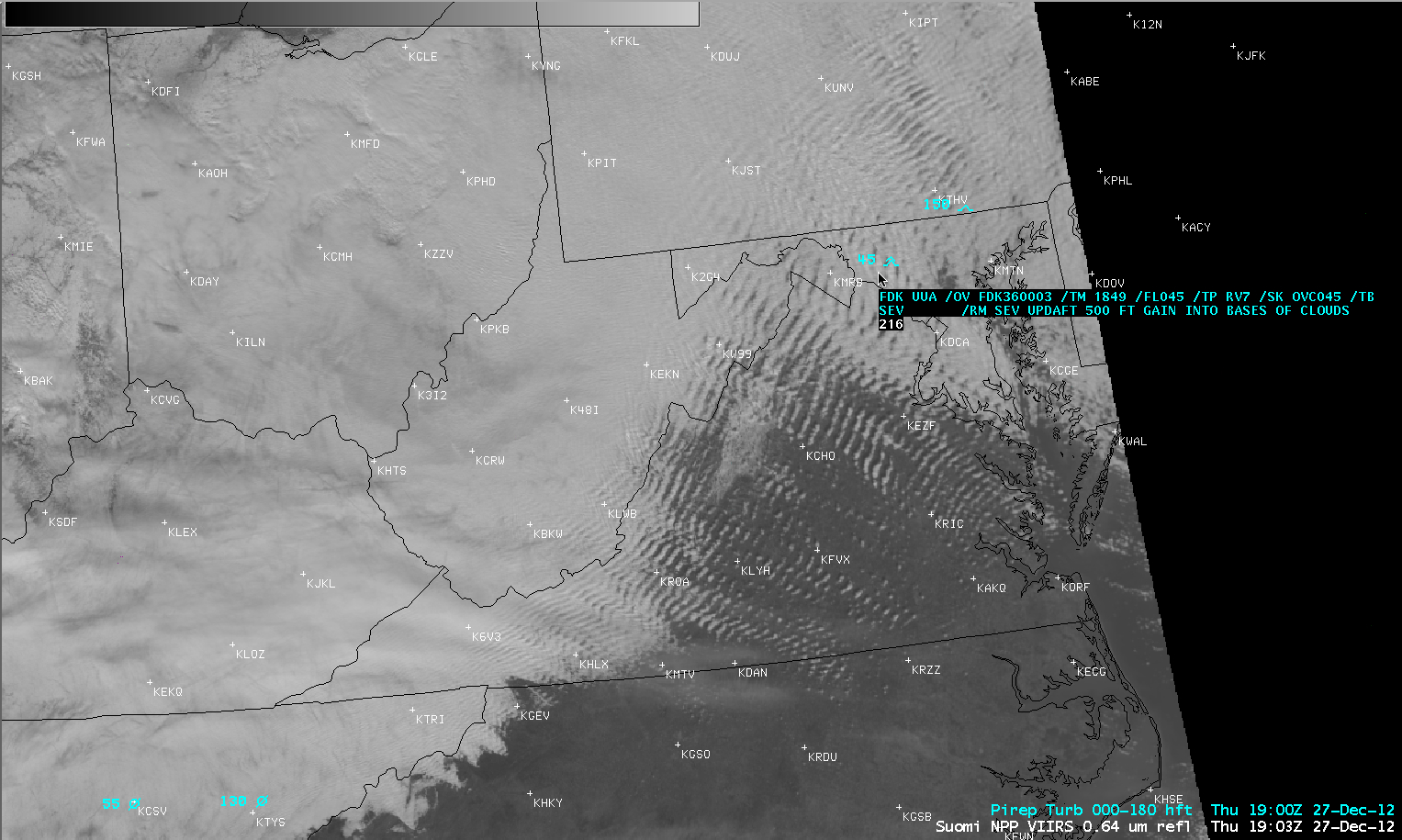
Mountain waves across the Mid-Atlantic region of the US
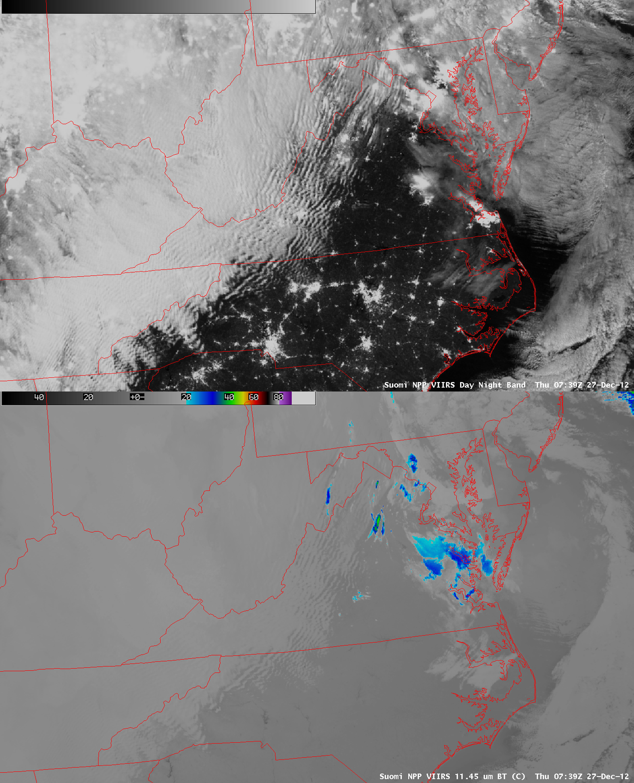
Strong westerly to northwesterly winds in the wake of a departing winter storm were aiding in the formation of widespread mountain waves along and downwind of the Appalachian Mountains on 27 December 2012. A comparison of AWIPS images of 1-km resolution Suomi NPP VIIRS 0.7 µm Day/Night Band (DNB) with the corresponding 11.45 µm IR channel data at 07:39 UTC or 2:39 AM local time (above) showed how the DNB imagery could be used as a “visible channel at night” to aid in the detection and characterization of cloud features that are illuminated by moonlight. City lights could also be seen in cloud-free areas (or in areas covered by thin cloud layers) on the DNB image..
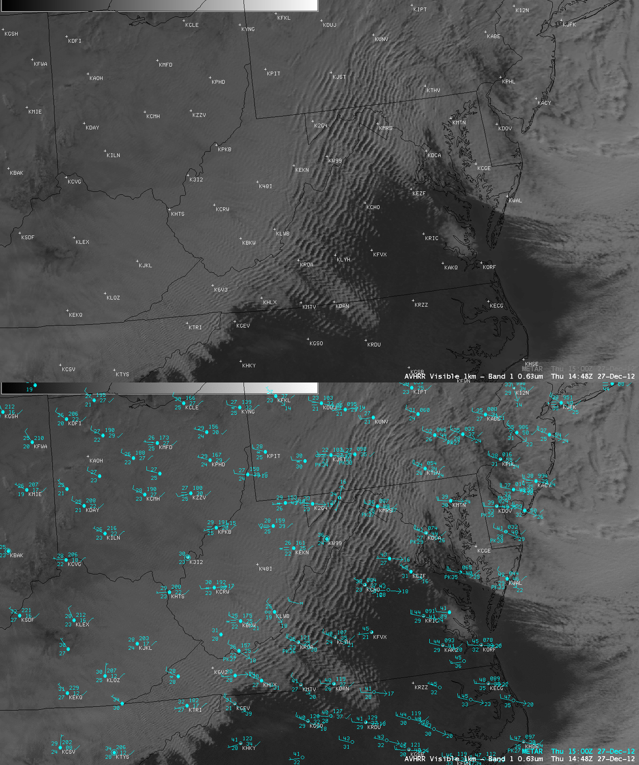
After sunrise, a 1-km resolution POES AVHRR 0.63 µm visible channel image at 14:48 UTC or 9:48 AM local time (below) showed how widespread the mountain waves had become across much of the Mid-Atlantic region of the US. At that time, surface reports showed wind gusts of 37 knots or 43 mph at Martinsburg, West Virginia (station identifier KMRB) and 39 knots or 45 mph at Jefferson, North Carolina (station identifier KGEV). The peak wind gust at Jefferson was 68 knots or 78 mph at 4:55 AM local time.
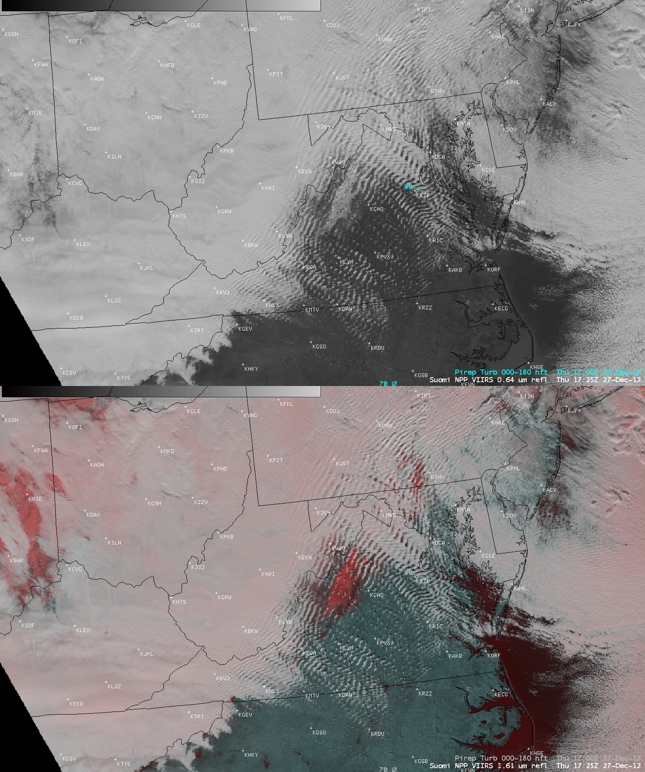
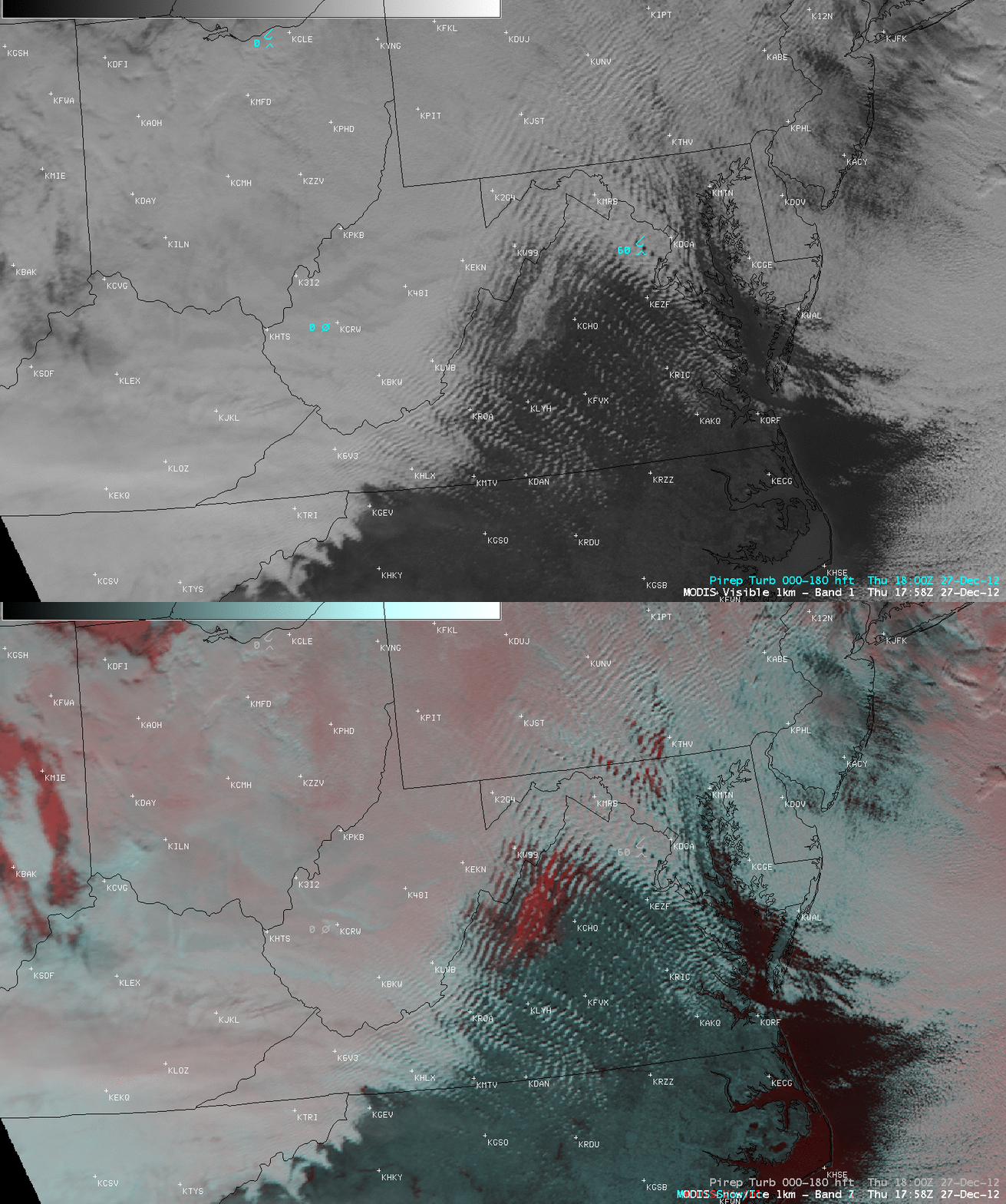
Comparisons of visible channel images with their corresponding false-color Red/Green/Blue (RGB) images from Suomi NPP VIIRS (above) and Aqua MODIS (below) demonstrated how RGB imagery can be used to aid in the discrimination of cloud vs snow cover — for example, there was a large area with snow on the ground (darker shades of red on the RGB images) seen in the Shenandoah Valley and the surrounding mountains of northwestern Virginia. Gaps in the clouds also revealed patchy areas of snow cover which extended northeastward into south-central Pennsylvania.
The appearance of mountain waves on satellite imagery — either on visible imagery, or on water vapor imagery — often suggests an enhanced potential for turbulence. While there were isolated pilot reports of light to moderate turbulence across the region throught the day (some of which were seen on the VIIRS and MODIS images above), there was one incident of severe turbulence encountered in Maryland at 18:49 UTC or 1:49 PM local time (below).


