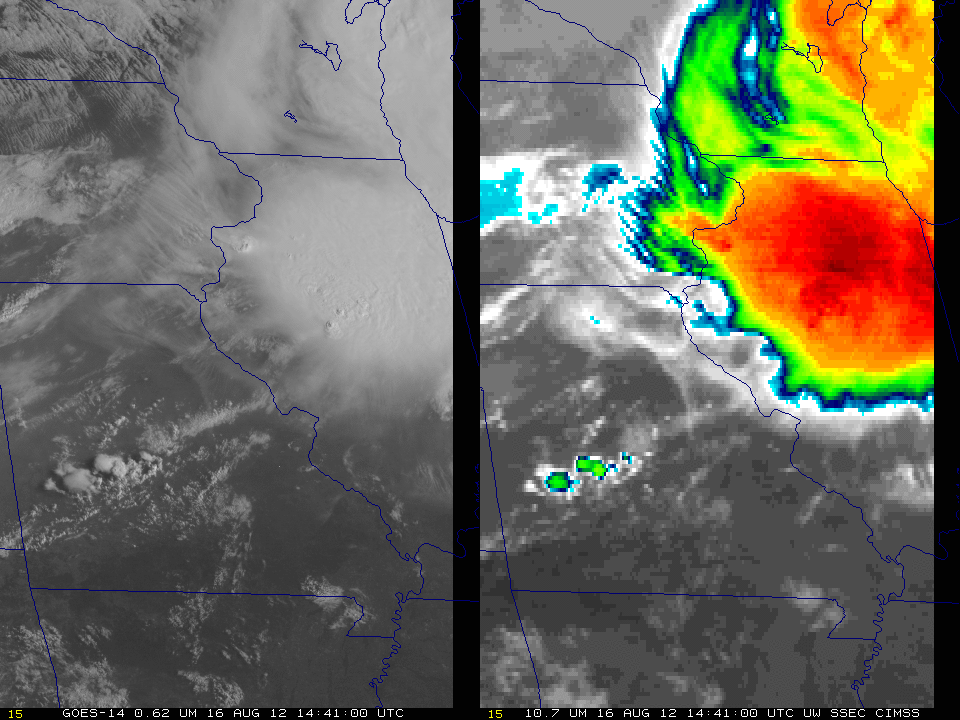
GOES-14 in SRSOR mode
GOES-14 will be in Super-Rapid Scan mode for the next several weeks, meaning 1-minute imagery will be available over various footprints. The imagery from Aug 16 2012, above, shows the central United States, with morning convection over the western Great Lakes and convection over the Red River between Texas and Oklahoma.
Friday’s view will be over AL, centered near 35 N, 85 W. See this website for details.
The one-minute imagery allows the satellite to show the ephemeral nature of overshooting tops. Consider the active convection over central Illinois. Cold cloud tops (as cool as -70 C) develop and decay over the 15-minute loop above (the overshoots are evident in the visible imagery as well). Present GOES imagery has a routine refresh rate of every 15 minutes; overshooting tops can easily be missed at that rate. GOES-R will routinely produce imagery every 5 minutes, allowing for better detection of overshooting tops. The images within the loop also show nice examples of transverse banding (over eastern Iowa) and gravity waves propagating outwards from the overshooting tops.
(Added: Click here for a big animated gif image of visible imagery. Size: 69 Mb).


