")
GOES-15 6.5 µm water vapor channel images (click image to play animation)
GOES water vapor imagery tells you how moist or how dry the middle to upper troposphere is, right? Well, in general, yes — but it’s important to remember that the water vapor imagery actually displays the temperature of a layer of moisture that is emitting radiation. This layer of moisture emitting the radiation that is sensed by the water vapor detectors is usually located within the middle to upper troposphere, but if the atmosphere is quite dry (and/or quite cold), the water vapor channel can actually “see” further down through the troposphere and sense thermal radiation that is emitted from the surface.
On 14 February 2012, GOES-15 6.5 µm water vapor channel images (above; click image to play animation) centered on the Big Island of Hawaii showed how the two highest topographical features (Mauna Kea and Mauna Loa) initially appeared cooler (darker blue color enhancement) than the rest of the island prior to sunrise, but then quickly warmed (exhibiting brighter yellow colors) during the morning hours as sunlight warmed the surface.
GOES-15 0.63 µm visible channel images (below; click image to play animation) showed that the peaks of Mauna Kea and Mauna Loa were cloud-free during this period.
")
GOES-15 0.63 µm visible channel images (click image to play animation)
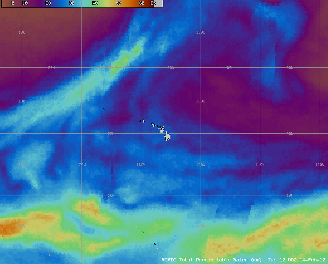
While there was a band of higher moisture associated with the ITCZ well south of Hawaii, and another band of moisture along a cold frontal boundary well northwest of Hawaii, the atmosphere over Hawaii itself was fairly dry — MIMIC Total Precipitable Water values (below) generally in the 20-25 mm range over the islands (animation).

MIMIC Total Precipitable Water product + surface analysis
In this case, the middle to upper troposphere over the Hawaii region was quite dry, which had the effect of shifting the altitude of the water vapor channel weighting function (below) to an altitude low enough to enable some thermal radiation emitted from the higher terrain on Hawaii to “bleed up” through what little water vapor was present aloft and be detected on the GOES-15 water vapor channel imagery.
")
GOES-15 water vapor channel weighting function (using Hilo HI rawinsonde data)
View only this post Read Less


")

")


