Tornadoes are relatively rare in Japan, and the majority of them occur in association with tropical cyclones — but a tornado struck the city of Tsukuba, Japan on 06 May 2012, and was responsible for one fatality, over 40 injuries, and damage (rated F2 to F3) to nearly 500 homes... Read More
")
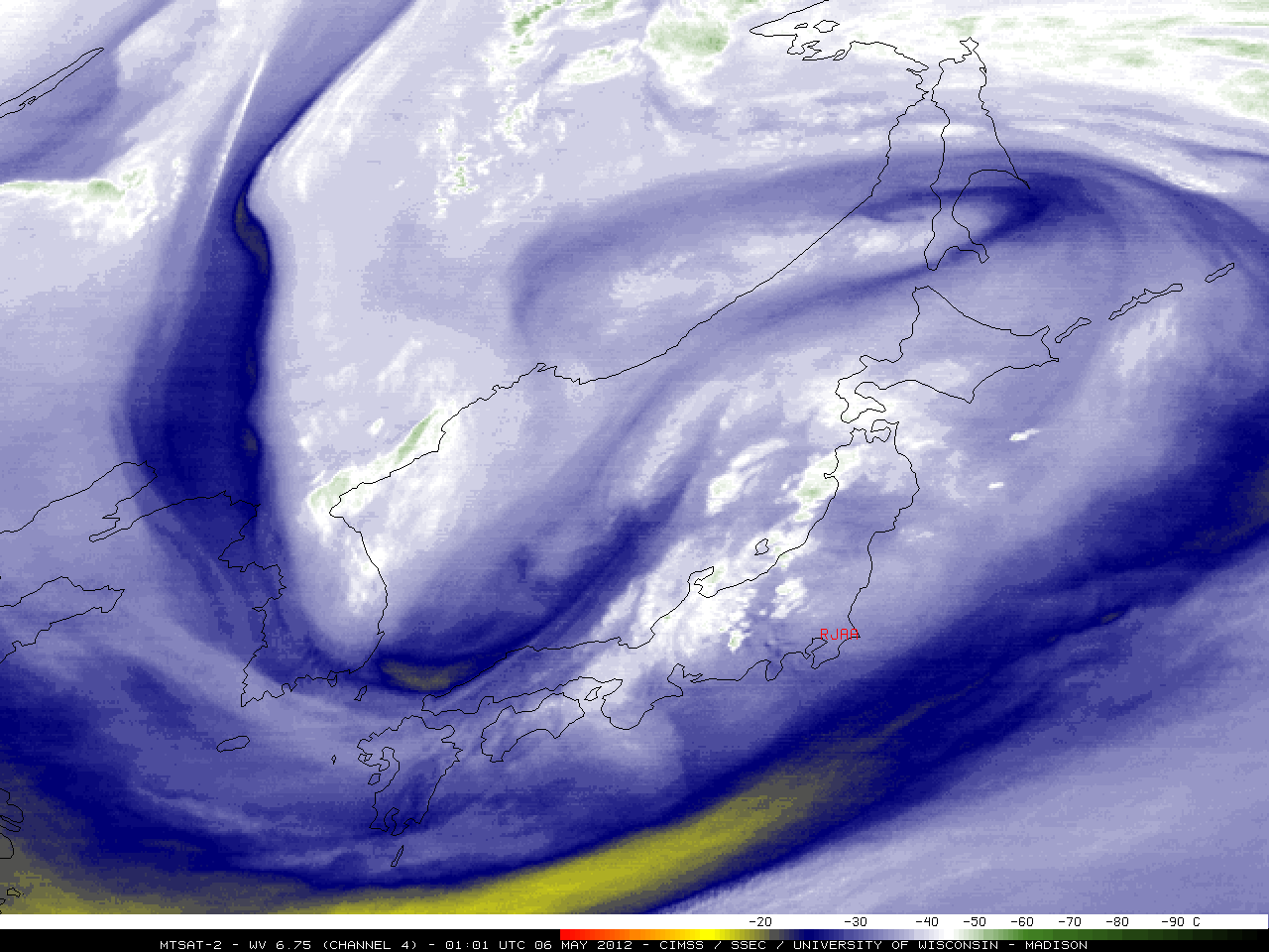
MTSAT-2 6.7 µm water vapor channel images (click image to play animation)
Tornadoes are relatively rare in Japan, and the majority of them occur in association with tropical cyclones — but a tornado struck the city of Tsukuba, Japan on 06 May 2012, and was responsible for one fatality, over 40 injuries, and damage (rated F2 to F3) to nearly 500 homes and buildings. MTSAT-2 6.7 µm water vapor channel images (above; click image to play animation) showed that strong convection developed over Japan along the eastern periphery of a large upper-level low. The location of Tokyo Narita International Airport (station identifier RJAA) is overlaid on the images — Tsukuba is about 30 miles northwest of RJAA.
Also important to note on the water vapor imagery (prior to 05 UTC) was the appearance of a small area of lee waves immediately downwind of the Mt. Fuji area (just to the west of RJAA), suggesting the presence of a strong jet streak moving northeastward over the Japanese island of Honshu. A longer animation showed the development of a number of distinct cyclonic vortices, many marked by a pronounced warm/dry signature on the water vapor imagery. These vortices corresponded to individual Potential Vorticity (PV) anomalies; one of the stronger PV anomalies moved just south of RJAA and helped to initiate a new cluster of convection offshore toward the end of the long animation.
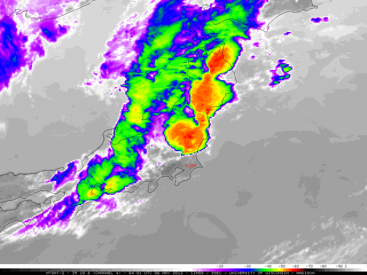
A closer view using MTSAT-2 10.8 µm IR channel images (below; click image to play animation) showed that cloud top IR brightness temperatures associated with the tornadic supercell quickly cooled to the -55 to -60º C range (darker red color enhancement), and exhibited subtle cold/warm thermal couplets and brief enhanced-V signature at 04:01 UTC.
")
MTSAT-2 10.8 µm IR channel images (click image to play animation)
MTSAT-2 0.7 µm visible channel images (below; click image to play animation) revealed subtle indications of overshooting tops, as well as a brief anvil plume (at 06:32 UTC). The hazy signature of a blowing dust plume was also evident just to the south and east of Japan.
")
MTSAT-2 0.7 µm visible channel images (click image to play animation)
The tornado was reported to have occurred at Tsukuba around 1 pm local time (05:00 UTC), with hail at Mito around 1:20 pm local time (05:20 UTC). The location of the tornado (T) and hail (H) are overlayed on a close-up view of the 05:01 UTC MTSAT-2 0.7 µm visible channel image (below), which showed a well-defined flanking line boundary of convection feeding northwestward into the parent thunderstorm.

MTSAT-2 0.7 µm visible image + Surface reports + Tornado and Hail report locations
View only this post
Read Less


")
")
")
")

")

")

")
