
Suomi NPP VIIRS visible and IR images of the eye of Tropical Cyclone Funso
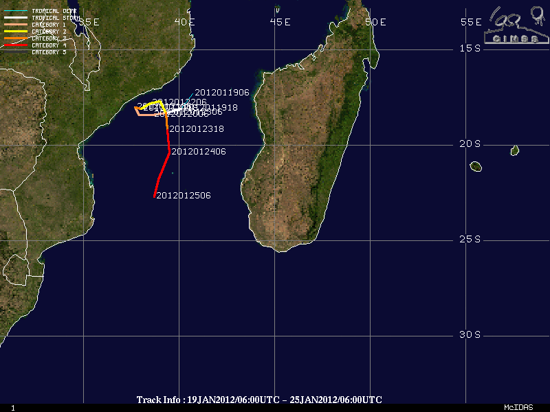
On 24 January 2012 NASA renamed the recently-launched NPP satellite (formerly known as the NPOES Preparatory Project) the Suomi National Polar-orbiting Partnership (or Suomi NPP) in honor of Dr. Verner Suomi, recognized as “the father of satellite meteorology” (see: NASA News | University of Wisconsin News). A comparison of Suomi NPP 375-meter resolution VIIRS 0.640 µm visible channel and 11.450 µm IR channel images (above) showed the eye of Category 4 Tropical Cyclone Funso, which was located in the Mozambique Channel between Africa and Madagascar at 11:02 UTC on 24 January (track of Tropical Cyclone Funso).
On 25 January 2012, another Suomi NPP 375-meter resolution VIIRS 11.450 µm IR image (below) displayed very cold cloud top IR brightness temperatures (as low as -77º C) associated with a large thunderstom complex over Texas — this storm produced hail up to 1.25 inches in diameter (SPC storm reports) and heavy rainfall of up to 9.29 inches at Uhland (NWS Austin/San Antonio Texas Public Information Statement).

Suomi NPP VIIRS 11.450 µm IR image
The corresponding 4-km resolution GOES-13 (GOES-East) 10.7 µm IR image (below) showed much less structure to the cloud top temperature field, with the coldest IR brightness temperature being -70º C.

GOES-13 10.7 µm IR image
View only this post Read Less

")


")
")
 image (displayed using Google Earth)")


