")
GOES-13 0.63 µm visible channel images (click to play animation)
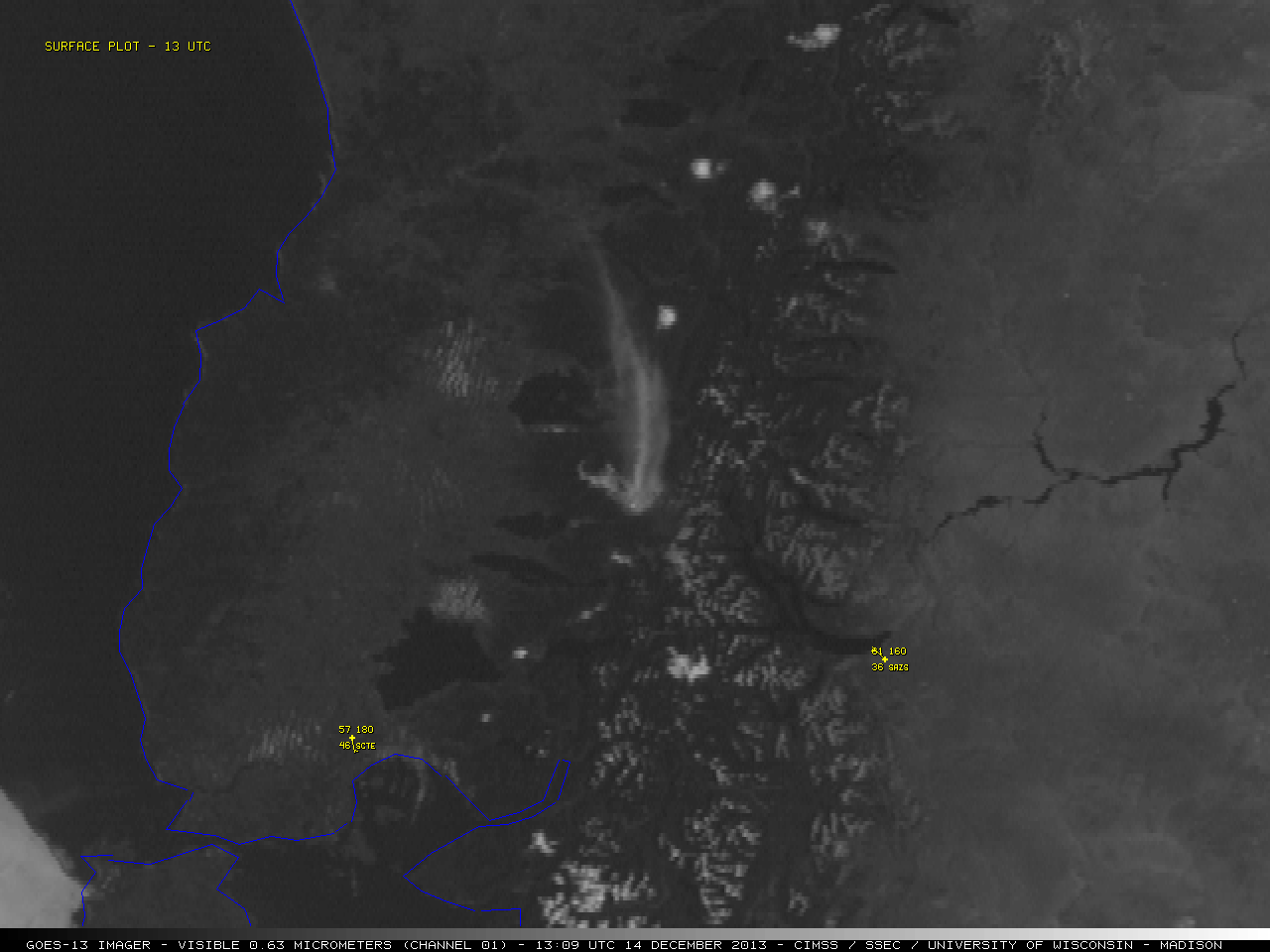
On the morning of 14 December 2013, GOES-13 0.63 µm visible channel images (above; click image to play animation) showed what appeared to be a plume of re-suspended volcanic ash moving northward from the region of the Cordón Caulle volcano in Chile. As the airborne ash plume begain to disperse later in the day, it then began to move in a more northeasterly direction. Since no volcanic ash advisories were issued by the Beunos Aires Volcanic Ash Advisory Center (VAAC), it was assumed that this was a case of re-suspended ash that covered the ground following previous eruptions.
Although there is not always a thermal anomaly or “hot spot” seen on shortwave IR satellite images accompanying a volcanic eruption, no such hot spot was seen on the corresponding GOES-13 3.9 µm shorwave IR imagery (below; click image to play animation). The higher terrain of the Cordón Caulle volcano complex — located in the center of the images — initially appeared cooler (lighter gray) prior to sunrise, but then their higher-elevation surfaces begain to warm (darker gray pixels) after sunrise. The plume of re-suspended volcanic ash also exhibited a darker appearance after sunrise, due to the reflection of solar radiation off the small particles.
")
GOES-13 3.9 µm shortwave IR images (click to play animation)
Quantitative products derived from Terra MODIS imagery (below) indicated that the plume had a maximum height of around 5-6 km, with ash/dust loading in the 4-5 g/m2 range, and a mean particle effective radius as large as 4-6 µm.

Terra MODIS Ash Height product

Terra MODIS Ash/Dust Loading product

Terra MODIS Ash Particle Effective Radius product
View only this post Read Less


")
")