GOES-14 has entered super rapid scan operations that will continue through 15 May 2016 (Link), in part to support the Hazardous Weather Testbed (HWT) at the Storm Prediction Center (GOES-R HWT Blog) and the VORTEX Southeast experiment. GOES-14 is viewing the central Plains today and tomorrow in anticipation of thunderstorm development. (SPC Day... Read More
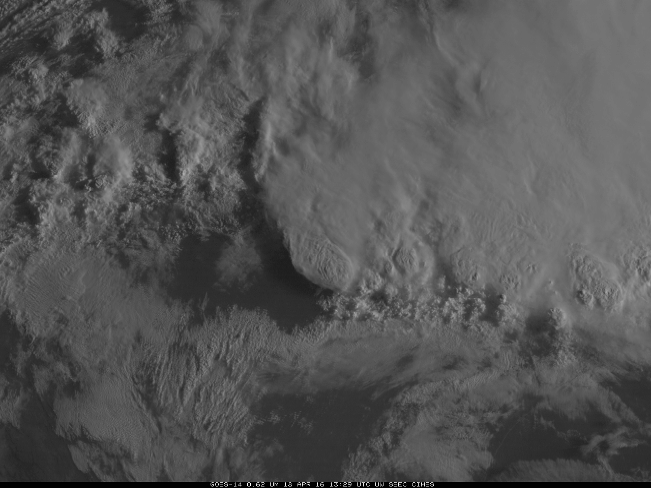
![GOES-14 0.62 µm Visible Imagery, 18 April 2016 [click to play animation]](https://cimss.ssec.wisc.edu/satellite-blog/wp-content/uploads/sites/5/2016/04/GOES14_APRIL18_2.GIF)
GOES-14 0.62 µm Visible Imagery, 18 April 2016 [click to play animation]
GOES-14 has entered super rapid scan operations that will continue through 15 May 2016 (
Link), in part to support the Hazardous Weather Testbed (HWT) at the Storm Prediction Center (
GOES-R HWT Blog) and the
VORTEX Southeast experiment. GOES-14 is viewing the central Plains today and tomorrow in anticipation of thunderstorm development. (SPC Day 1 Convective Outlook for
18 April; Day 2 Convective Outlook for
19 April). The visible animation above shows a strong thunderstorm early in the morning on 18 April 2016 near Kerrville TX.
Note that the Twitter Feed @SRSORbot is now active. The bot tweets out 1-hour animations (with 5-minute time steps) every 20 minutes using the latest GOES-14 SRSO-R visible (day) or infrared (night) imagery.
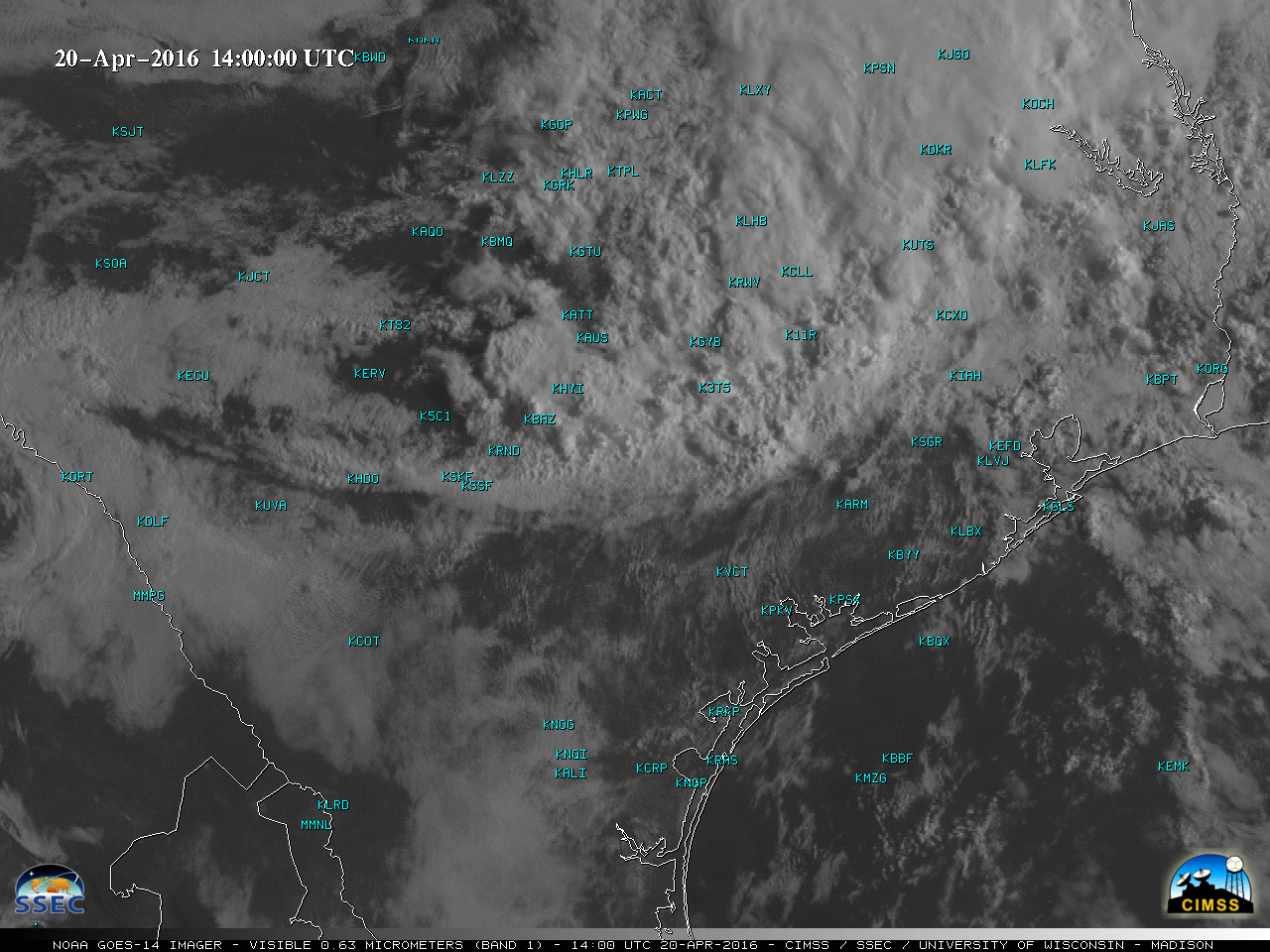
A longer version of the GOES-14 Visible image animation (with overlays of surface weather symbols) is shown below (also available as a large 203 Mbyte animated GIF).
![GOES-14 Visible (0.63 µm) images, with plots of surface weather symbols [click to play MP4 animation]](https://cimss.ssec.wisc.edu/satellite-blog/wp-content/uploads/sites/5/2016/04/960x1280_GOES14_B1_GOES14_VIS_TX_18APR_2016109_170000_0001PANEL.GIF)
GOES-14 Visible (0.63 µm) images, with plots of surface weather symbols [click to play MP4 animation]
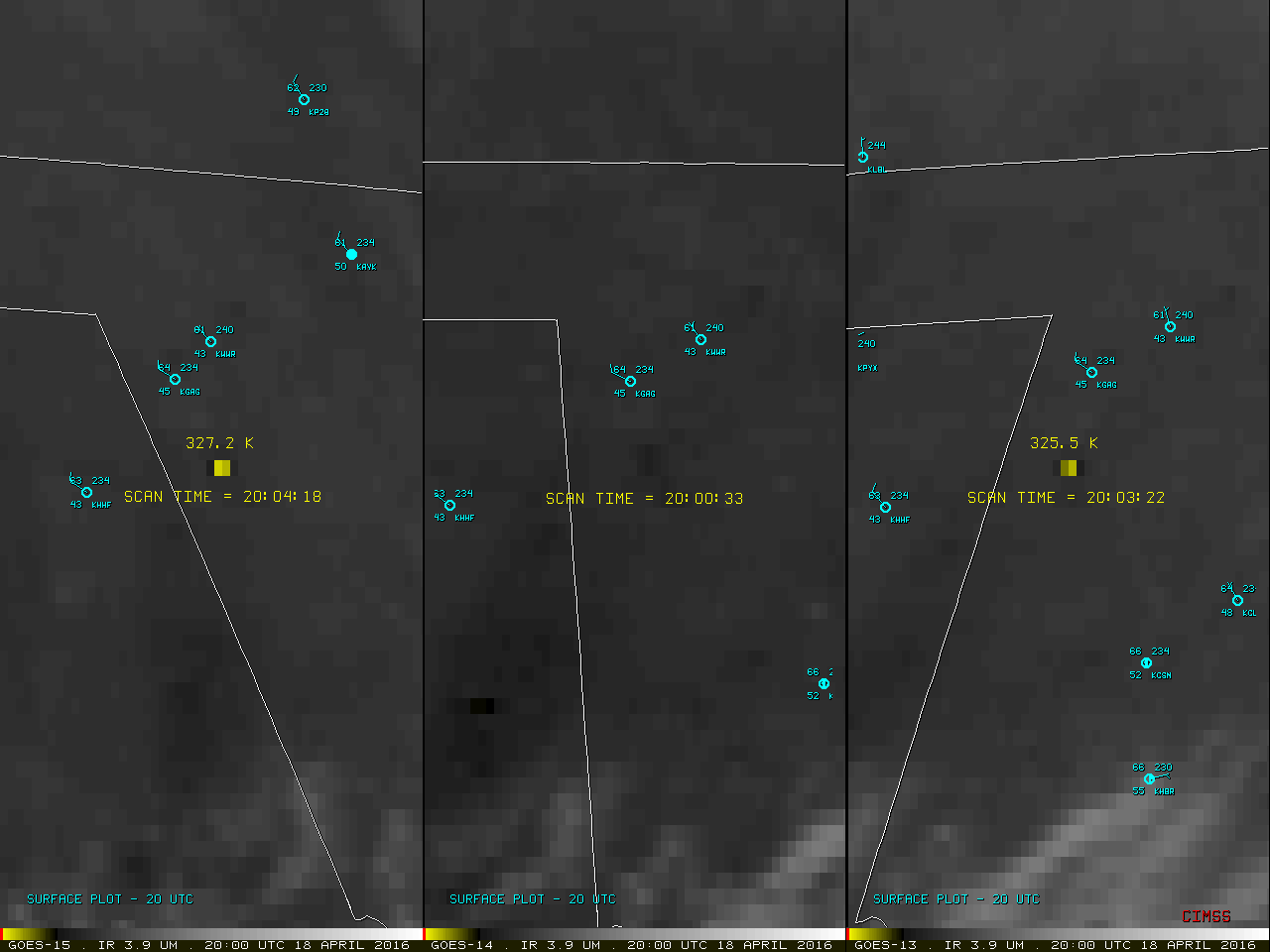
A comparison of GOES-15, GOES-14 and GOES-13 Shortwave Infrared (3.9 µm) images, below, demonstrates the advantage of 1-minute super rapid scan over the routine 15-minute routine scan interval for characterizing the intensity and trends of a short-lived grassfire in far western Oklahoma. Even though a fire hot spot (yellow color enhancement) appeared on the “
2000 UTC” GOES-15 and GOES-13 images, the actual scan time of the fire for those 2 satellites was 2004 and 2003 UTC, respectively; a fire hot spot of 317.2 K was first detected on the 2101 UTC GOES-14 image. The magnitude of the fire hot spot then quickly increased to 332.8 K (red color enhancement) on the
2005 UTC GOES-14 image; the short-term fluctuations in the intensity of the fire hot spot were only adequately captured by the 1-minute super rapid scan interval of the GOES-14 images.
![GOES-15 (left), GOES-14 (center) and GOES-13 (right Shortwave Infrared (3.9 µm) images [click to play animation]](https://cimss.ssec.wisc.edu/satellite-blog/wp-content/uploads/sites/5/2016/04/160418_G15_G14_G13_SWIR_OK_FIRE_20.GIF)
GOES-15 (left), GOES-14 (center) and GOES-13 (right Shortwave Infrared (3.9 µm) images [click to play animation]
View only this post
Read Less
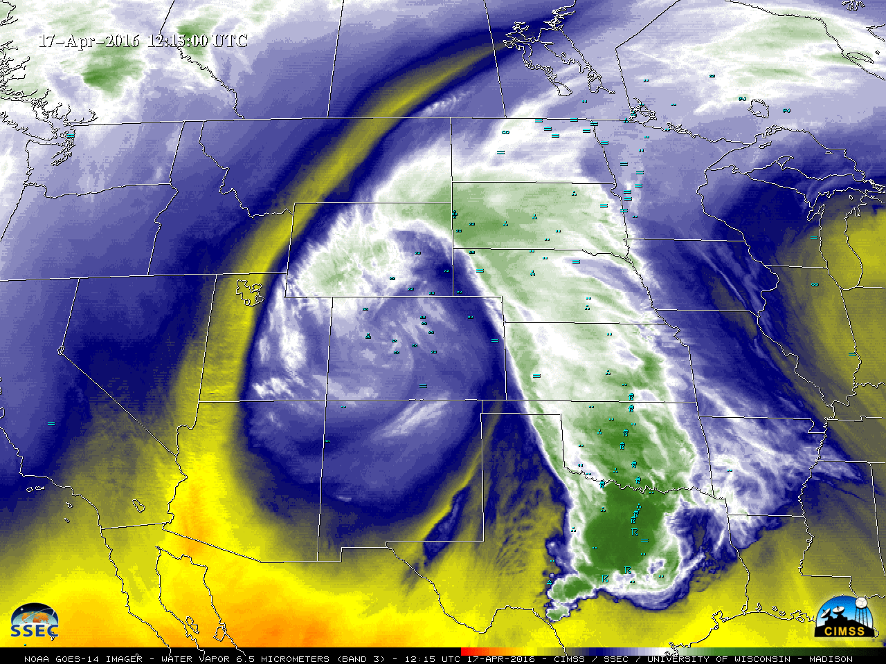
![GOES-14 Visible (0.63 µm) images [click to play MP4 animation]](https://cimss.ssec.wisc.edu/satellite-blog/wp-content/uploads/sites/5/2016/04/960x1280_GOES14_B1_GOES14_VIS_TX_20APR_2016111_140000_0001PANEL.GIF)
![GOES-14 Water Vapor (6.5 µm) images [click to play MP4 animation]](https://cimss.ssec.wisc.edu/satellite-blog/wp-content/uploads/sites/5/2016/04/960x1280_GOES14_B3_GOES14_WV_TX_20APR_2016111_140000_0001PANEL.GIF)
![GOES-14 sounder Water Vapor bands 6.5 µm (top), 7.0 µm (middle) and 7.4 µm (bottom) images [click to play animation]](https://cimss.ssec.wisc.edu/satellite-blog/wp-content/uploads/sites/5/2016/04/160420_goes14_sounder_band10_band11_band12_Texas_outflow_boundary_anim.gif)
![GOES-14 0.62 µm Visible Imagery, 18 April 2016 [click to play animation]](https://cimss.ssec.wisc.edu/satellite-blog/wp-content/uploads/sites/5/2016/04/GOES14_APRIL18_SRSOanim.gif)
![GOES-15 (left), GOES-14 (center) and GOES-13 (right Shortwave Infrared (3.9 µm) images [click to play animation]](https://cimss.ssec.wisc.edu/satellite-blog/wp-content/uploads/sites/5/2016/04/160418_goes15_goes14_goes13_shortwave_infrared_OK_grassfire_anim.gif)
![GOES-14 Water Vapor (6.5 µm) images [click to play MP4 animation]](https://cimss.ssec.wisc.edu/satellite-blog/wp-content/uploads/sites/5/2016/04/960x1280_GOES14_B3_GOES14_WV_WESTERN_US_15-17APR_2016108_121500_0001PANEL.GIF)
![Advanced Dvorak Technique intensity plot for Cyclone Fantala [click to enlarge]](https://cimss.ssec.wisc.edu/satellite-blog/wp-content/uploads/sites/5/2016/04/Cyclone_Fantala_adt.gif)
![Meteosat-7 Infrared (11.5 µm) images [click to play animation]](https://cimss.ssec.wisc.edu/satellite-blog/wp-content/uploads/sites/5/2016/04/160414-15_meteosat7_infrared_Cyclone_Fantala_anim.gif)
![Meteosat-7 Infrared (11.5 µm) and DMSP-18 SSMI Microwave (85 GHz) images [click to enlarge]](https://cimss.ssec.wisc.edu/satellite-blog/wp-content/uploads/sites/5/2016/04/160415_15utc_meteosat7_infrared_dmsp18_ssmi_mw_Cyclone_Fantala_anim.gif)
![Meteosat-7 Infrared Window (11.5 µm) images [click to play animation]](https://cimss.ssec.wisc.edu/satellite-blog/wp-content/uploads/sites/5/2016/04/160417-18_metosat7_infrared_Cyclone_Fantala_anim.gif)
![Suomi NPP VIIRS Infrared Window (11.45 µm) and Day/Night Band (0.7 µm images [click to enlarge]](https://cimss.ssec.wisc.edu/satellite-blog/wp-content/uploads/sites/5/2016/04/160417_2249utc_suomi_npp_viirs_Infrared_Day_Night_Band_Cyclone_Fantala_anim.gif)
