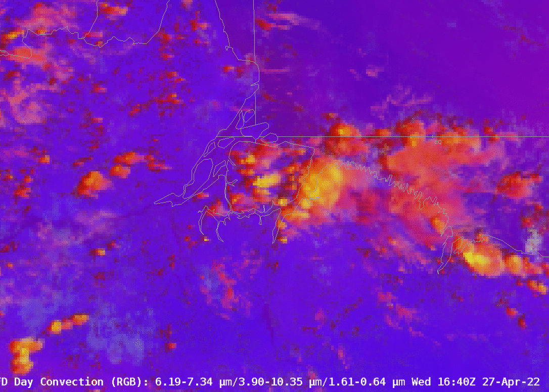
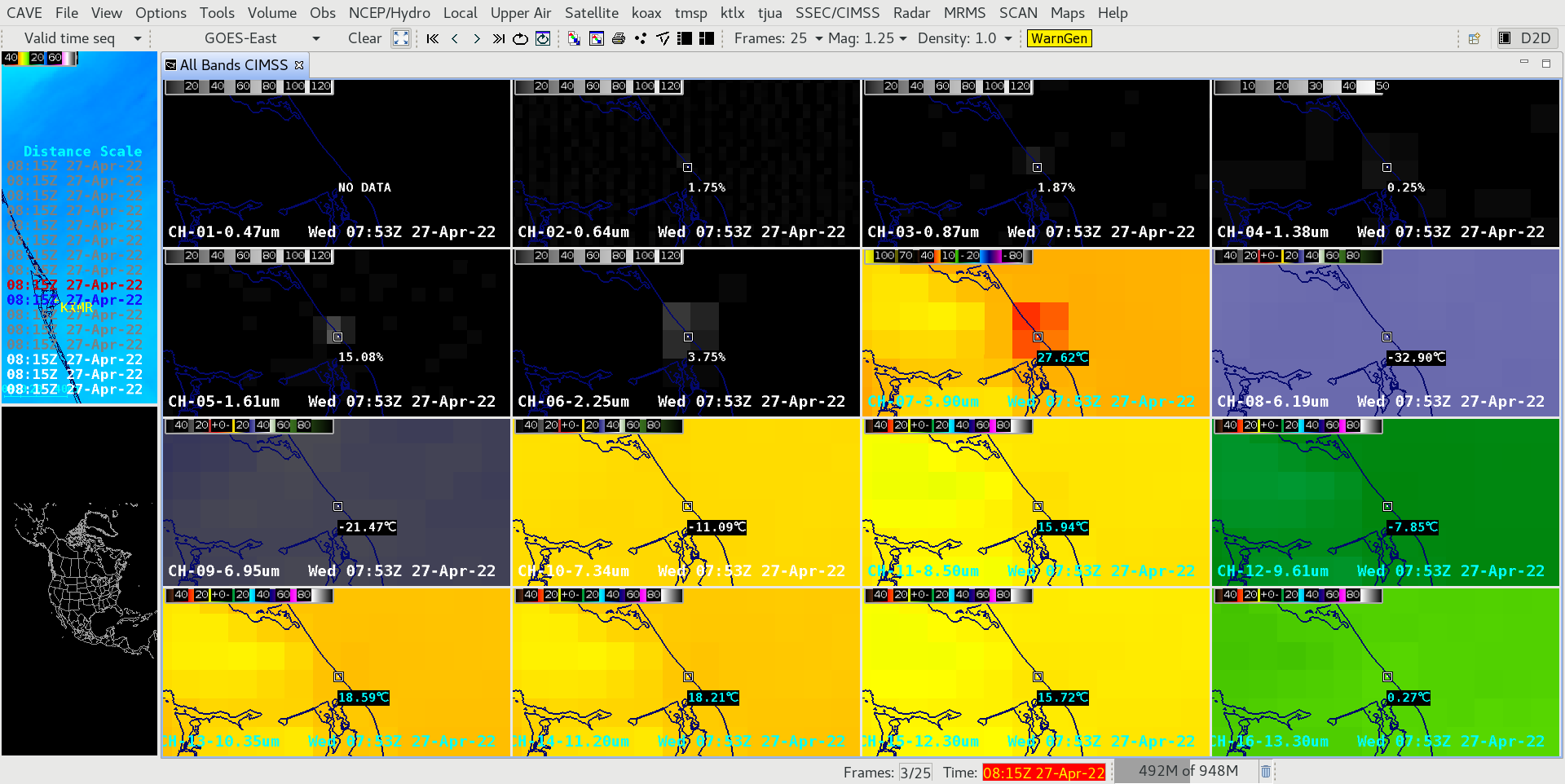
Conventional Meteorological Canon is that the Day Convection RGB, shown above in full-disk imagery from AWIPS (and because it’s Full Disk, the resolution is degraded to 6 km in both latitudinal and longitudinal directions), shows yellow in regions where cloud (ice) particle sizes are very small at the top of strong updrafts, and because they are small, there is much more reflectance of 3.9 µm solar radiation, so that the Day Fog Difference (3.9 µm – 10.3 µm), the green component of the RGB, acquires a very strong positive value. One of the Level 2 products derived from the Advanced Baseline Imager (ABI) is Cloud Particle Size Distribution (PSD). What does the PSD look like over that developing convection. This can be explored using the Satellite Information Familiarization Tool (SIFT).
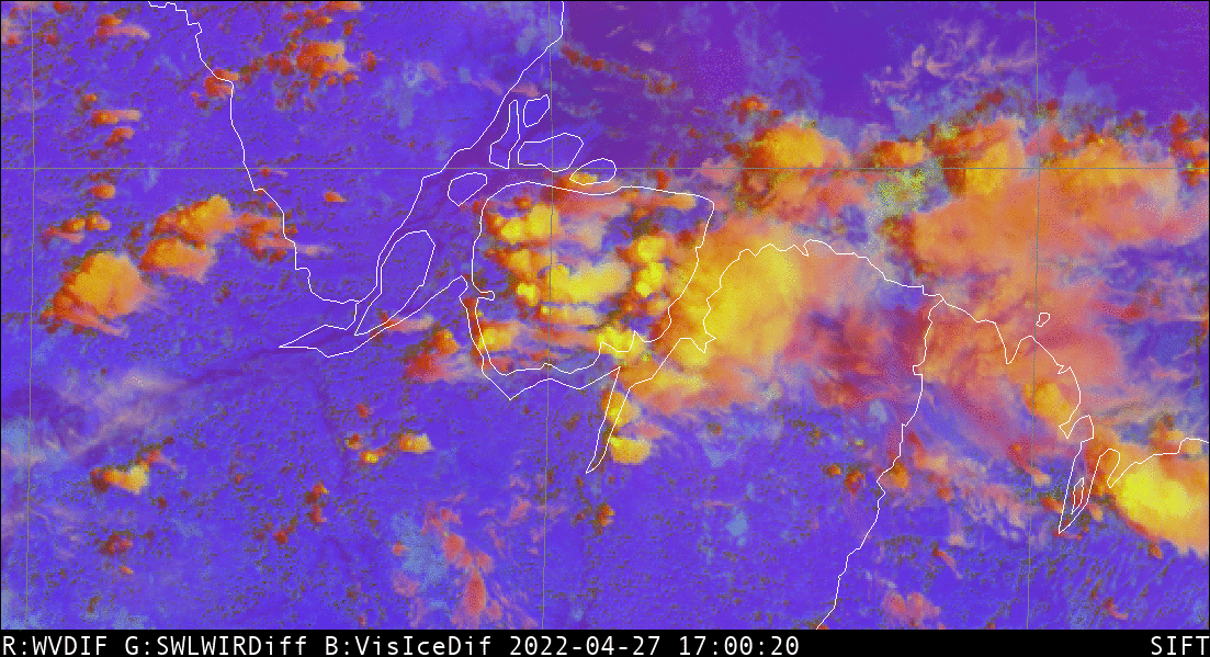
The toggle below shows the Day Convection RGB and the GOES-16 Level 2 Cloud Particle Size at 1700 UTC on 27 April 2022, with growing convection over the large island (Marajó) in the Amazon Delta. The Cloud Particle Size individually with a color bar is shown below as well.

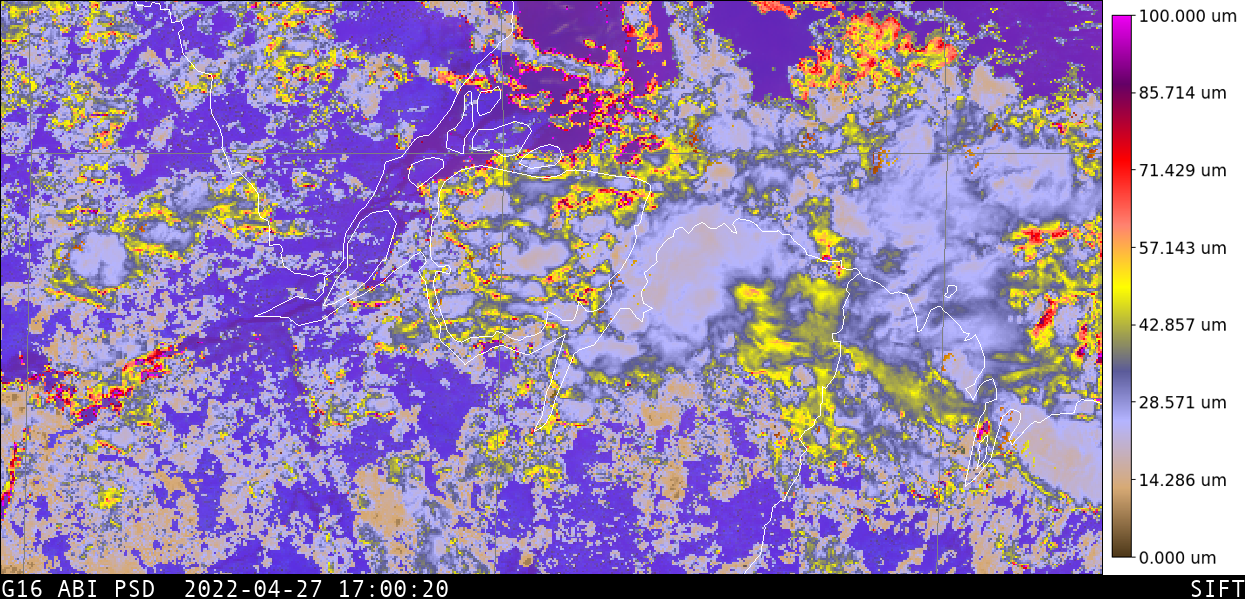
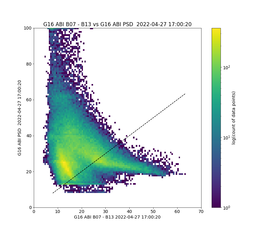
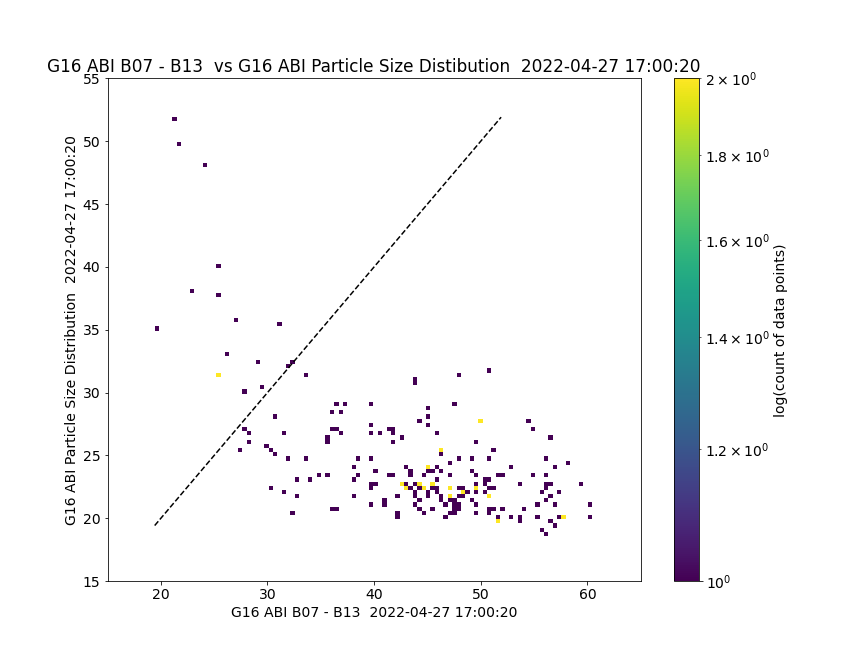
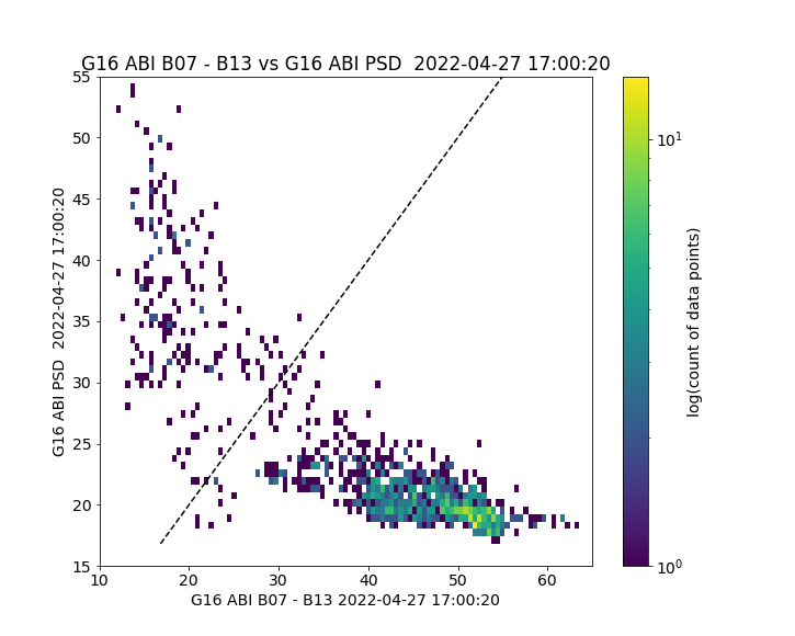
Cloud Particle size values over the growing convection do appear to be smaller than in regions surrounding the growing convection. SIFT includes functionality to compare values within regions. The toggle below shows a small polygon — shaded in magenta — over the growing convection. The scatterplot beneath compares the Day Fog Difference and Cloud Particle Size within the polygon. Note that the Cloud Particle Size Distribution product is computed in daytime with ABI Bands 2 (0.64 µm) and 6 (2.25 µm) (ATBD).

The scatterplot above does suggest that Night Fog Brightness Temperature Difference fields — when large (which means where the Convection RGB will acquire a yellowish hue) — are related to Cloud Particle Size over the developing convection: smaller cloud particles are indicated where the Day Convection RGB is most yellow. There are other regions of yellow in the scene — and other regions of small particle size. Consider the region to the east, for example, as shown in the toggle below. Similar to the scene above, where the Brightness Temperature Difference is large, the Cloud Particle Sizes are small. A region-wide comparison (i.e., for the whole scene), is here.
View only this post Read Less


