This website works best with a newer web browser such as Chrome, Firefox, Safari or Microsoft Edge. Internet Explorer is not supported by this website.

Archive: Jan 2025

Ice in Lake Erie

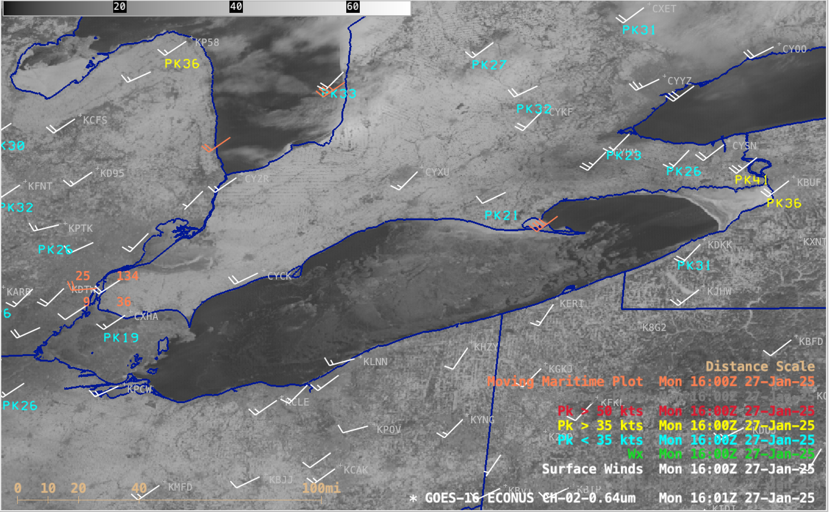
5-minute CONUS Sector GOES-16 (GOES-East) Visible images (above) showed ice across much of Lake Erie on 27th January 2025. The far western and far eastern parts of the lake were covered in fast ice — while the motion of drift ice within the central portion of the lake was being influenced by... Read More

Wet Weather in Alaska

GOES-18 Upper Level water vapor infrared imagery, above, (source) shows a stream of upper-level moisture moving over southeastern Alaska on the east side of a cyclonic system over western Alaska on 27 January 2025. This large storm moved warm and moist air northward into Alaska; several stations tied record warm... Read More

Historic snowstorm across the Deep South

GOES-16 Upper-level water vapor infrared imagery for the 2.5 days ending at 1331 UTC on 22 January 2025, above as an mp4 (click here for a 125-megabyte animated gif) shows an active subtropical jetstream initially across the Gulf States. The jet deforms as an impulse drops south through California. Note... Read More