East Pacific storm, as viewed by GOES-17 and GOES-15
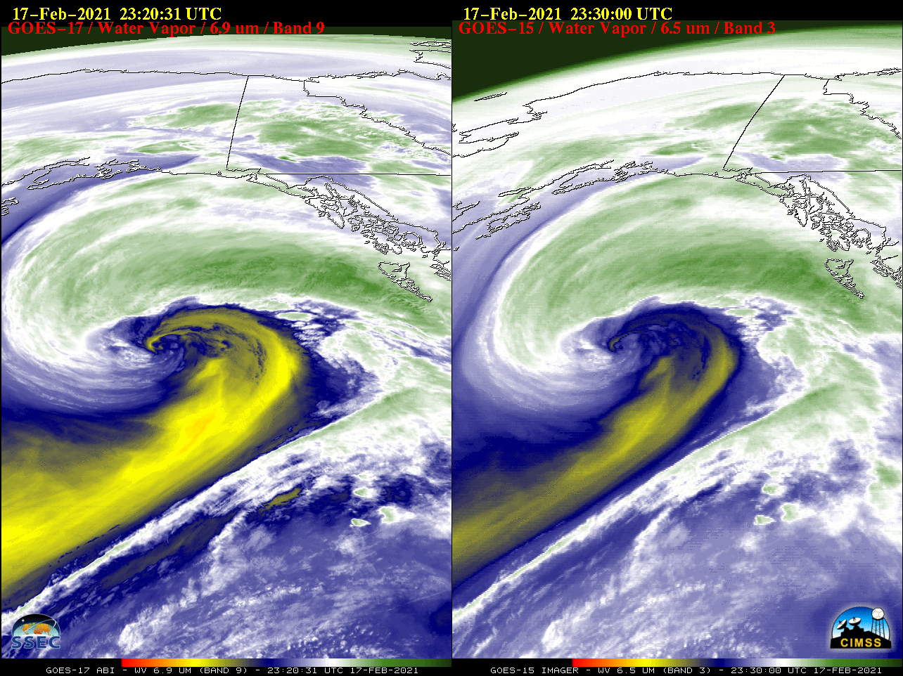
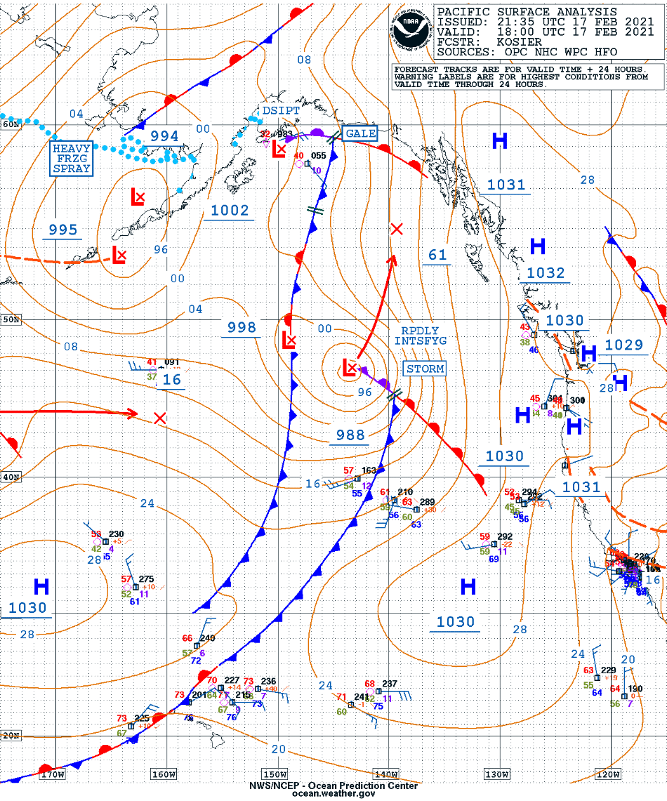
The rapid intensification of a Storm Force low over the East Pacific Ocean during the 17-18 February 2021 period (surface analyses) could be seen on Water Vapor images from GOES-17 (6.9 µm) and GOES-15 (6.5 µm) (above). This was from the final full day of GOES-15 imaging operations (while the satellite... Read More

