PyroCb in Ontario, Canada
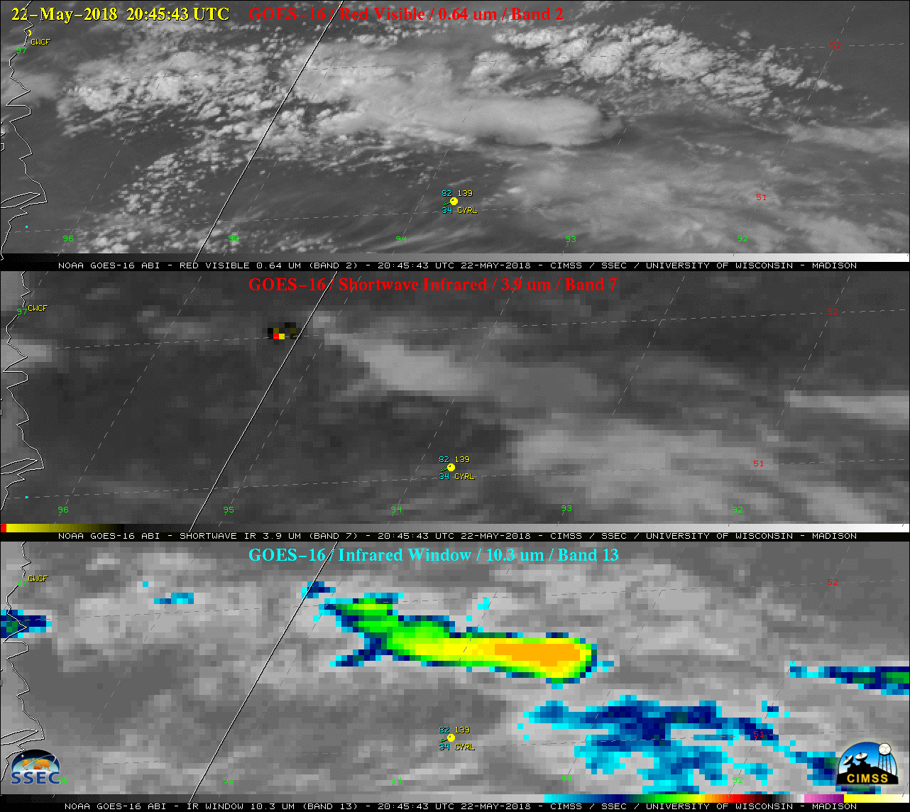
GOES-16 (GOES-East) “Red” Visible (0.64 µm), Shortwave Infrared (3.9 µm) and “Clean” Infrared Window (10.3 µm) images (above) showed that Canadian wildfires burning along the Manitoba/Ontario border produced a pyroCumulonimbus (pyroCb) around 1930 UTC on 22 May 2018.As the pyroCb moved southeastward over western Ontario, the coldest GOES-16 cloud-top infrared brightness temperatures were... Read More
