GOES-16 daytime and nighttime images of the West Mims Fire in Georgia
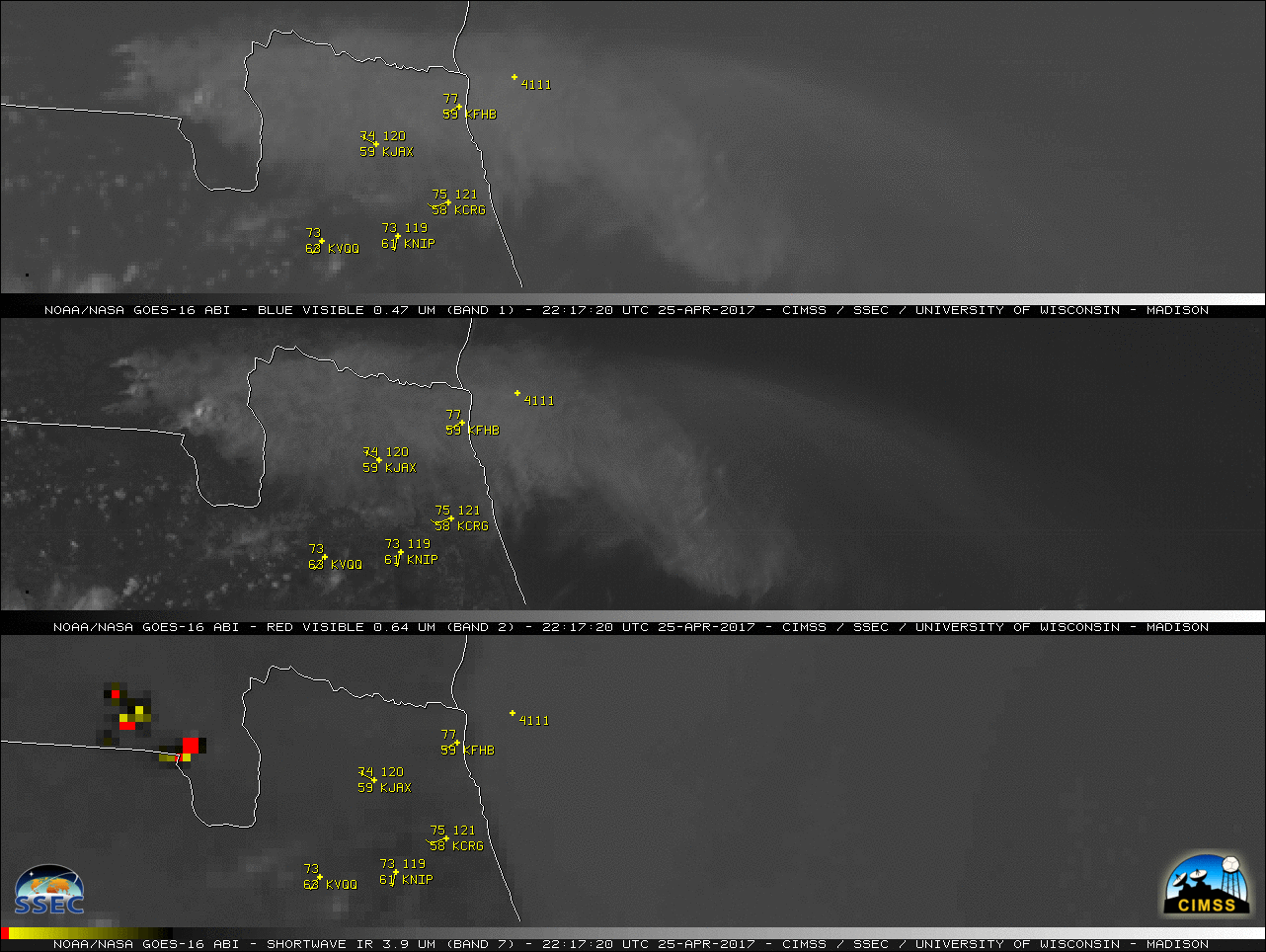
** The GOES-16 data posted on this page are preliminary, non-operational data and are undergoing testing. **A daytime comparison of GOES-16 ABI “Blue” Visible (0.47 µm), “Red” Visible (0.64 µm) and Shortwave Infrared (3.9 µm) images (above; also available as an MP4 animation) displayed the smoke plume and “hot spots” (black to yellow to... Read More
