![MIMIC Total Precipitable Water for the 72 hours ending 1400 UTC 17 September 2015 [click to enlarge]](http://cimss.ssec.wisc.edu/satellite-blog/wp-content/uploads/2015/09/MIMICTPW_Ending17Sept2015latest72hrs.gif)
MIMIC Total Precipitable Water for the 72 hours ending 1400 UTC 17 September 2015 [click to enlarge]
![]() ![]() |
|
Tropical Depression Nine in the Atlantic OceanSeptember 17th, 2015 | Scott Lindstrom
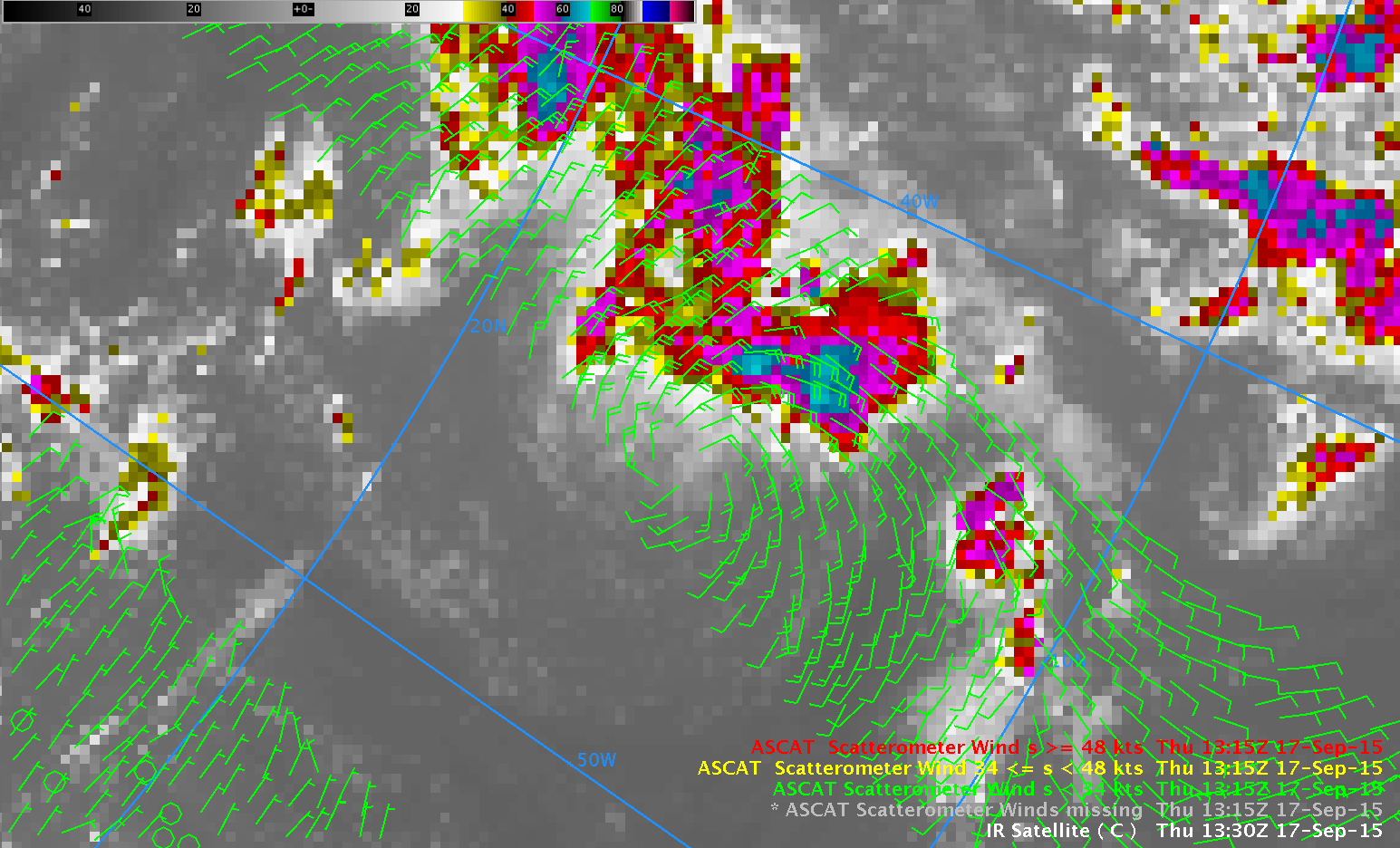
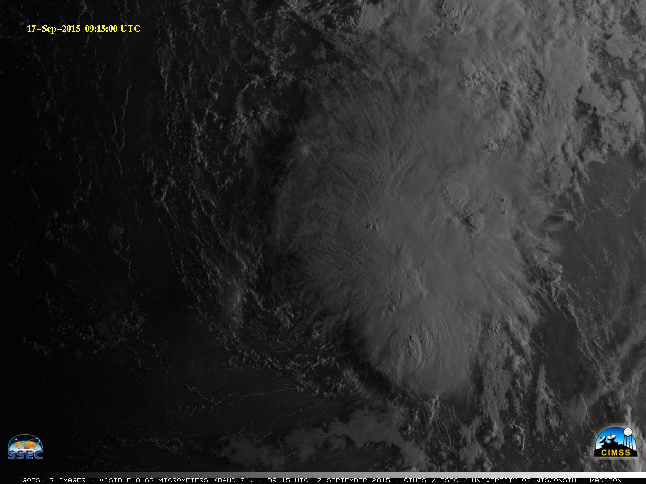
Tropical Depression Nine in the Atlantic Ocean, above, shows characteristics of a heavily sheared storm (longer sunrise-to-sunset animations: gif | mp4). The low-level circulation is displaced south and west of the strongest convection (which is vigorous enough to produce occasional overshooting tops, below, as shown on this page).
Metop-B overflew Tropical Depression Nine’s circulation just after 1300 UTC on 17 September (Orbital tracks for Metop-B are here). The image below shows a circulation with 20-30 knot winds displaced to the south and west of cold 10.7 µm brightness temperatures indicating high cloud tops detected by the GOES-13 Imager.
![]() MIMIC Total Precipitable Water for the 72 hours ending 1400 UTC 17 September 2015 [click to enlarge] |
|