With the arrival of daylight the following morning, 1-minute interval GOES-14 SRSO-R visible (0.63 µm) images (below) revealed the presence of numerous short-lived overshooting tops which were penetrating the cirrus canopy of the persisting MCS. The formation of a well-defined outflow boundary was also seen, which continued to move southward during the late morning hours. The MP4 movie file is also available as a very large (73 Mbyte) animated GIF. A GOES-14 1-minute-image IR (10.7 µm) animation which shows the initial development and subsequent motion of the MCS can be seen here.
GOES-14 1-minute visible images (below) also showed the development of multi-cellular thunderstorms over parts of the Mid-Atlantic states, focused along trough axes ahead of an approaching cold frontal boundary — many of these thunderstorms produced damaging winds (SPC Storm Reports). The MP4 movie file is also available as a very large (102 Mbyte) animated GIF.GOES-14 SRSO-R: Thunderstorms over the ArkLaMiss and Mid-Atlantic regions
August 11th, 2015 | Scott Bachmeier
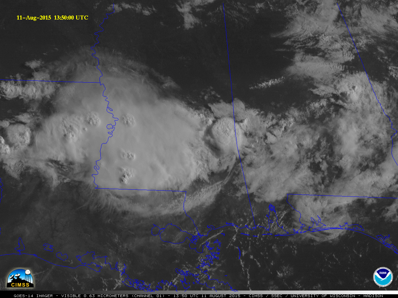
A nighttime mesoscale convective system (MCS) developed near the Arkansas/Louisiana/Mississippi border region after about 0700 UTC (2:00 AM local time) on 11 August 2015, and began to move southeastward. A comparison of 4-km resolution GOES-13 Infrared (10.7 µm) and 375-meter resolution Suomi NPP VIIRS Infrared (11.45 µm) images (above) showed the MCS around 0845 UTC, and highlighted the two advantages of polar-orbiter vs geostationary satellite imagery: (1) higher spatial resolution, for a more accurate assessment of the cloud-top IR Brightness Temperatures (the coldest GOES-13 IR BT was -73º C, while the coldest VIIRS IR BT was -83º C), and (2) minimal parallax error, for a more accurate geo-location of features such as thunderstorm overshooting tops (note how the storm appeared to be located farther to the northwest on the GOES image, centered over far southeastern Arkansas).