Mesoscale Convective Systems over the Upper Midwest, and a Mesoscale Convective Vortex over Wisconsin
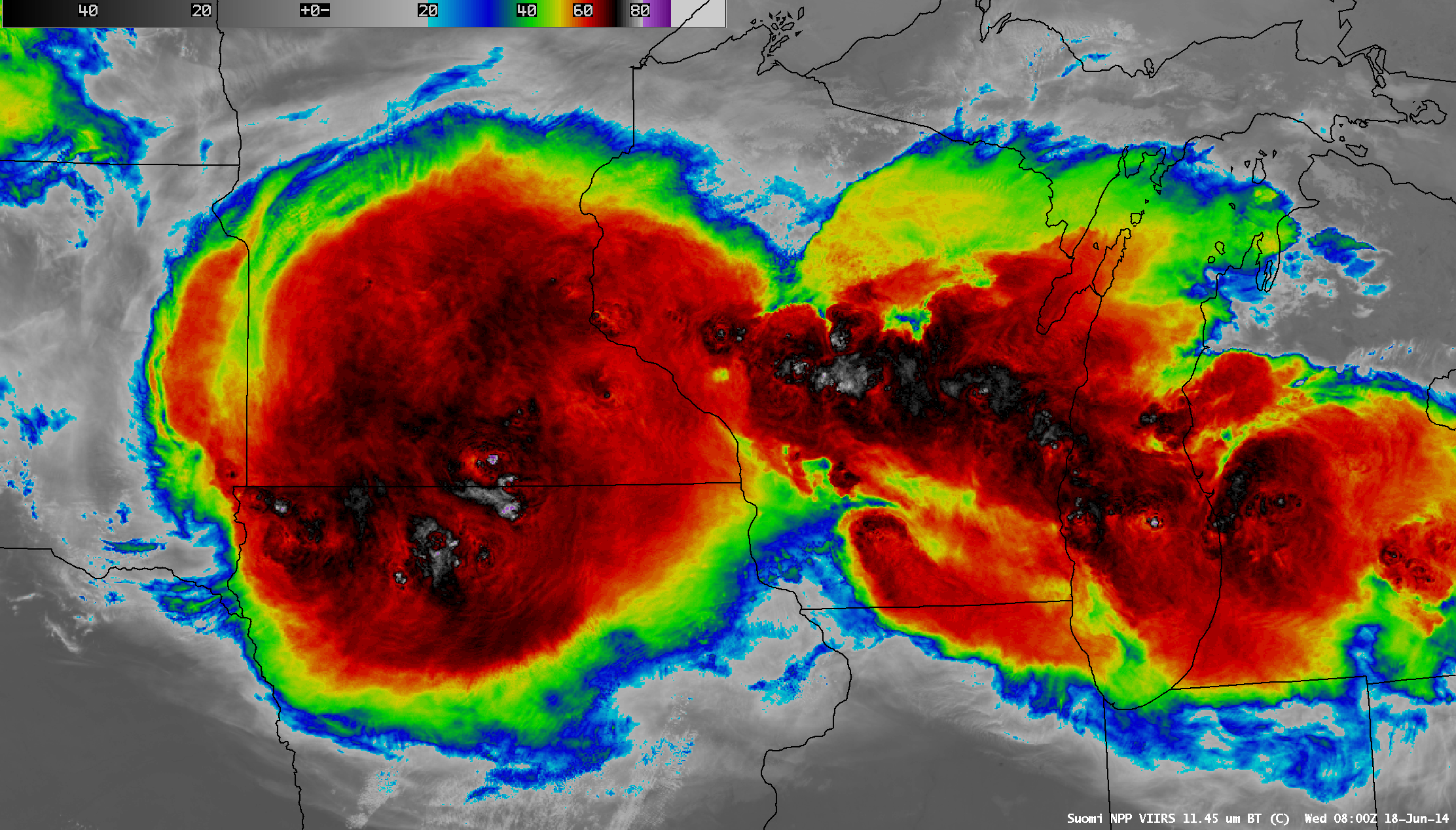
A comparison of AWIPS images of Suomi NPP VIIRS 11.45 µm IR channel and 0.7 µm Day/Night Band data (above) showed very large areas of cold cloud-top IR brightness temperatures associated with Mesoscale Convective Systems (MCSs) over the Upper Midwest region of the US at 08:00 UTC (3:00 AM Central... Read More
