This website works best with a newer web browser such as Chrome, Firefox, Safari or Microsoft Edge. Internet Explorer is not supported by this website.

Category: Tropical cyclones

NUCAPS diagnoses of stable air near Tropical Storm Marco

Tropical Storm Marco over the northwest Caribbean Sea, shown above in a toggle of GOES-16 ABI Clean window imagery (10.3 µm) and a NUCAPS diagnosis of 850-500mb lapse rates, is over very warm waters and in a region of favorably low diagnosed vertical wind shear. (Wind shear is from this website, (direct link to shear); the product is described here)  An inhibiting feature in strengthening, as noted in the National Hurricane Center discussion, is stable... Read More

Potential Tropical Cyclone 9 intensifies to become Tropical Storm Isaias

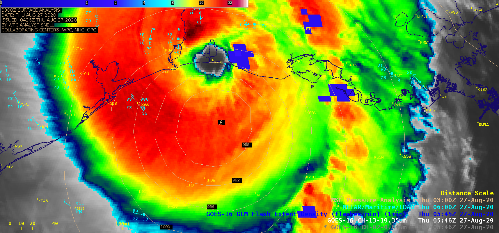
1-minute Mesoscale Domain Sector GOES-16 (GOES-East) “Red” Visible (0.64 µm) and “Clean” Infrared Window (10.35 µm) images (above) showed Potential Tropical Cyclone Nine as it moved northwestward across the Caribbean Sea on 29 July 2020. In Puerto Rico, Luis Muñoz Marin Airport in San Juan (TJSJ) had a wind gust to 44 knots (51 mph) around 19 UTC. Numerous pulsing... Read More