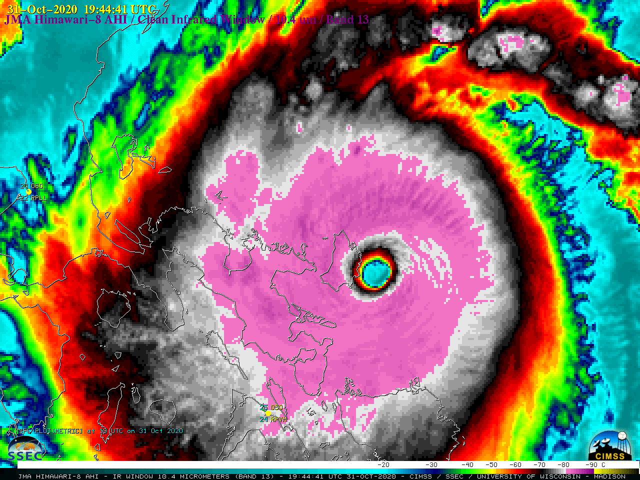
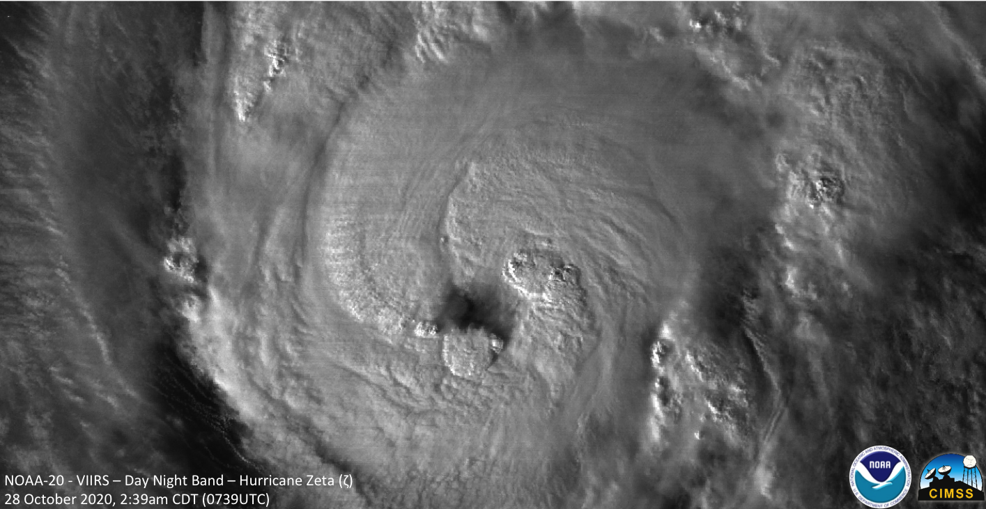
This website works best with a newer web browser such as Chrome, Firefox, Safari or Microsoft Edge. Internet Explorer is not supported by this website.

Category: Tropical cyclones

Potential Tropical Cyclone 9 intensifies to become Tropical Storm Isaias

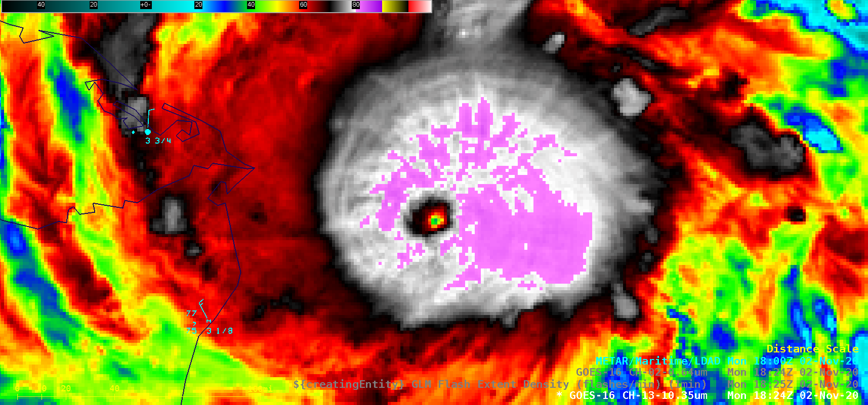
1-minute Mesoscale Domain Sector GOES-16 (GOES-East) “Red” Visible (0.64 µm) and “Clean” Infrared Window (10.35 µm) images (above) showed Potential Tropical Cyclone Nine as it moved northwestward across the Caribbean Sea on 29 July 2020. In Puerto Rico, Luis Muñoz Marin Airport in San Juan (TJSJ) had a wind gust to 44 knots (51 mph) around 19 UTC. Numerous pulsing... Read More

Microwave Estimates of Total Precipitable Water

https://cimss.ssec.wisc.edu/satellite-blog/wp-content/uploads/sites/5/2020/07/MIMICTPW_LastTenDaysEPAC_end27July2020.rockanim.mp4 MIMIC TPW rocking animations from 17-27 July 2020 (and back) [click to play mp4 animation] Morphed Microwave Imagery at CIMSS (MIMIC) estimates of Total Precipitable Water are derived from microwave sensors such as AMSU and ATMS on different polar-orbiting platforms. MIRS retrievals are used to estimate Total Precipitable Water from each polar swath, and those swaths are then advected... Read More