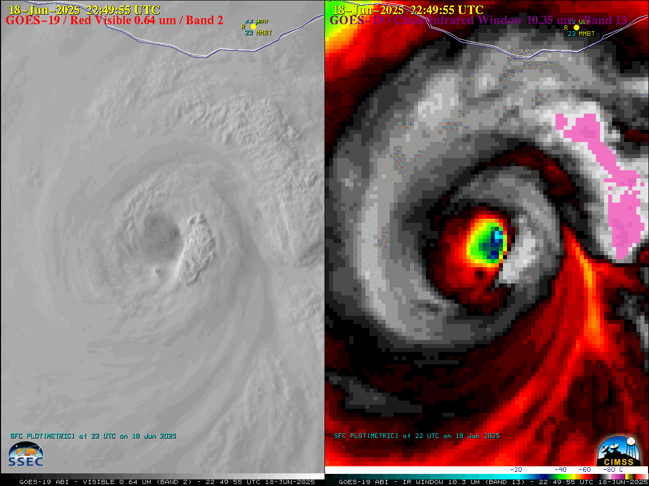
Andrea is named in the Atlantic
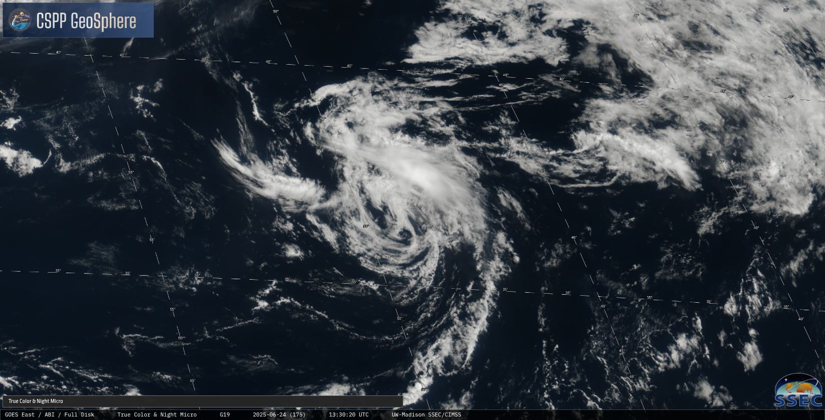
GOES-19 True Color imagery (from CSPP Geosphere) over the mid-Atlantic between 35o and 40oN Latitude, above, shows the circulation of Tropical Storm Andrea, a system that has been tracked for several days now. Overnight, convection developed over the storm, but that convection appears to have dissipated by mid-day on 24 June 2025.... Read More