Tracking dry air around Rafael in the Gulf

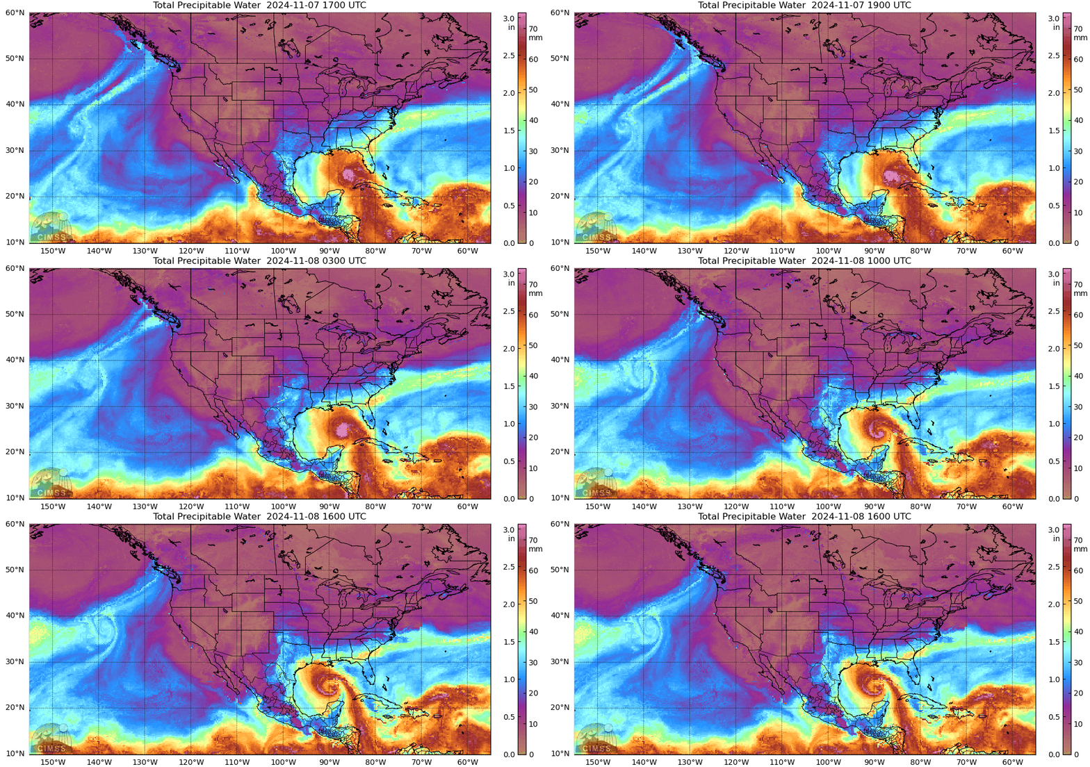
Hurricane Rafael is in the Gulf of Mexico, drifting to the west. The MIMIC Total Precipitable Water (TPW) animation, above, shows a notable thinning in the band of moisture connecting Rafael to deep tropical moisture located over the southern Caribbean Ocean. Dry air from the Yucatan is also wrapping into the circulation, and dry air is east of Rafael (over Florida), north of Rafael (along the southern Gulf Coast) and west of Rafael.
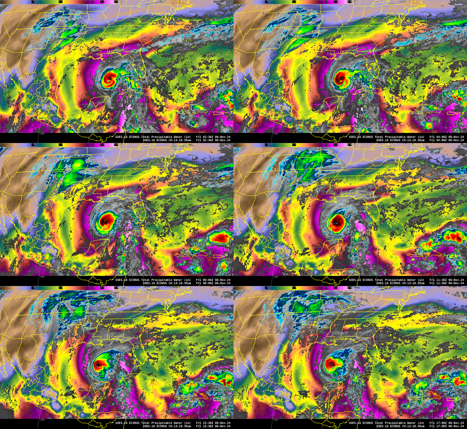
The animation below shows clear-sky Level 2 Total Precipitable Water (TPW) fields from GOES-16, with Band 13 imagery in regions where clouds are present. There is warming of the cold cloud tops during the 14 hours of the animation; one might also infer a decrease in TPW in the feed of moisture linking Rafael in the Gulf to the moisture in the southern/western Caribbean Sea — that is, an agreement with the MIMIC TPW fields above.

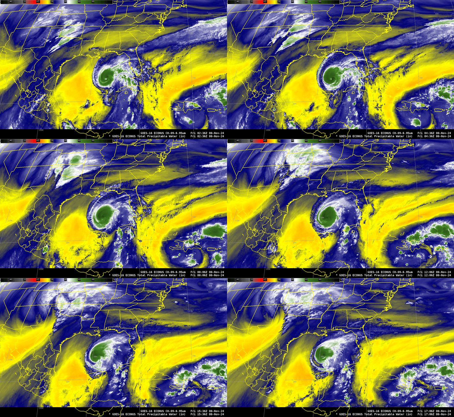
GOES-16 Water Vapor infrared imagery (Band 9, “Mid-level” water vapor, 6.95 µm), below, also shows dry mid-level air surrounding Rafael. The eye of the Hurricane is apparent early in the animation below, but then fills.

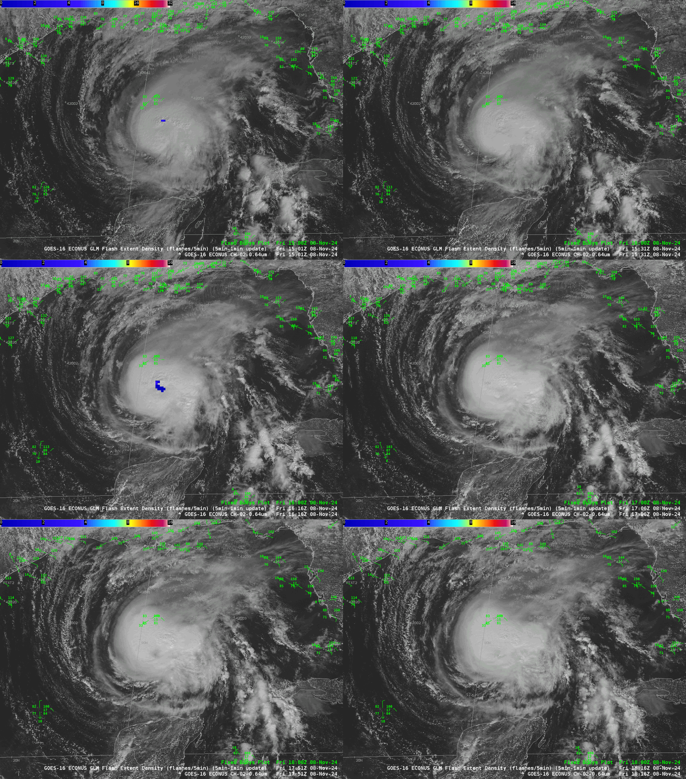
Visible Imagery, below, plotted with GLM observations of Flash Extent Density (scaled from 0-16) show a compact storm with lightning occasionally occurring near the center. A distinct eye is not present. The storm will pass very near mid-Gulf Buoy 42001 during the day today.

For more information on Rafael, refer to the National Hurricane Center website here.

