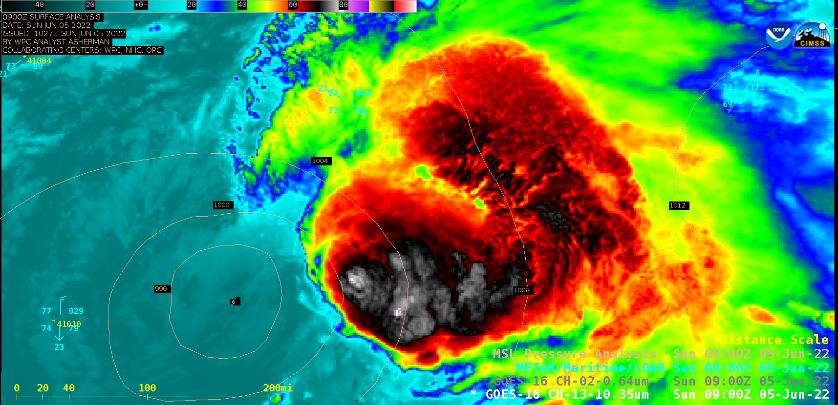
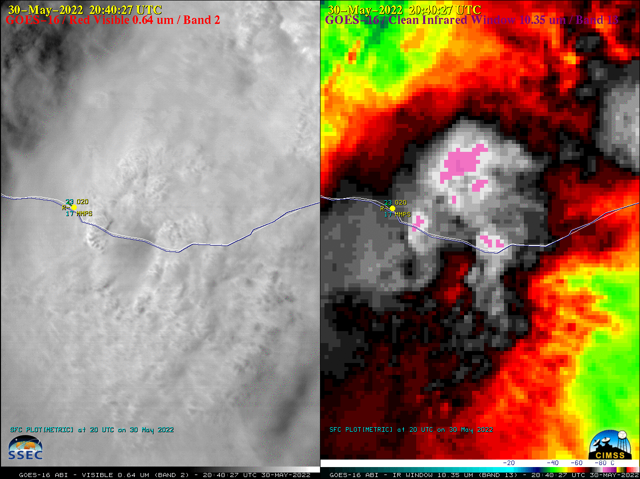
This website works best with a newer web browser such as Chrome, Firefox, Safari or Microsoft Edge. Internet Explorer is not supported by this website.

Category: Tropical cyclones

Tropical Storm Kate loses convection

The animation above, of GOES-16 Visible (0.64 µm) imagery, shows Tropical Storm Kate at sunrise with convection near the storm center and to its east. (An overnight image from Suomi NPP’s Day Night Band, below, taken from NASA Worldview, also shows convection near the storm center.) As the day progresses, however,... Read More

Hurricane Ida develops an eye over the Gulf of Mexico, as intensification continues until landfall

1-–minute Mesoscale Domain Sector GOES-16 (GOES-East) “Red” Visible (0.64 µm) and “Clean” Infrared Window (10.35 µm) images (above)  showed that Hurricane Ida gradually developed an eye, as the Category 1 storm intensified to Category 2 by 1800 UTC on 28 August 2021.Microwave (85 GHz) images from DMSP-17 (above) and DMSP-16 (below) — from the CIMSS Tropical Cyclones site — provided 2 views of the eye... Read More