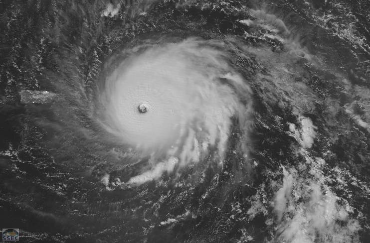
Hurricane Irma north of Hispaniola
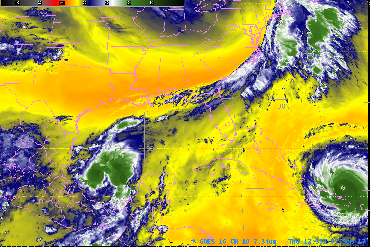
GOES-16 data posted on this page are preliminary, non-operational and are undergoing testingGOES-16 Captured very strong Hurricane Irma, north of Hispaniola, early on the day on 7 September. The 7.34 µm channel shown is sensitive to water vapor, that is, water vapor in the atmosphere absorbs energy at 7.34 µm.... Read More
