Category 5 Hurricane Irma over the Lesser Antilles
Suomi NPP’s Day Night Band Image, below, from Real Earth, shows Hurricane Irma as it is over the island of Barbuda — note that the island is entirely within the eye! (Click here for an image with no underlying maps).
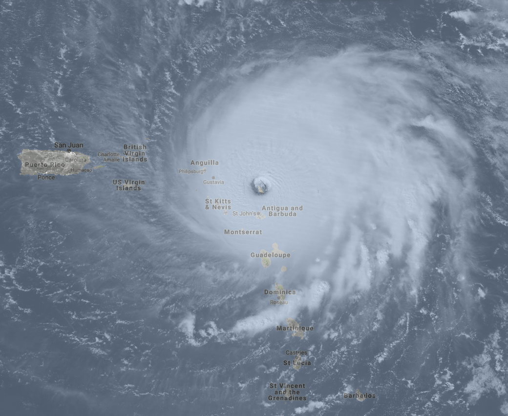
Suomi NPP Day Night Band Visible (0.7 µm) image, 0529 UTC on 6 September 2017, with underlying map (Click to enlarge)
GOES-16 data posted on this page are preliminary, non-operational and are undergoing testing

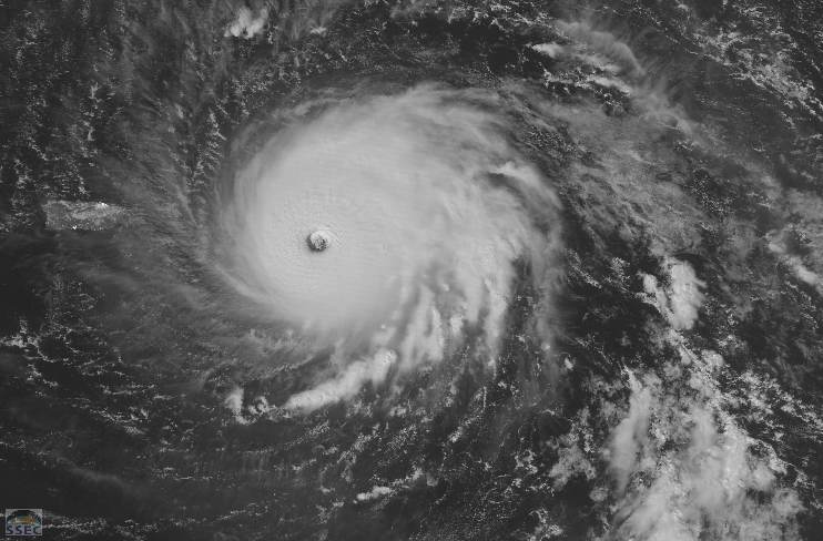
GOES-16 Clean Window (10.3 µm) imagery at 30-second intervals, 0957 – 1202 UTC on 6 September 2017 (Click to animate)
GOES-16 Clean Window (10.3 µm) imagery, above, for two hours near sunrise on 6 September 2017 show a well-developed Irma moving through the islands to the east of Puerto Rico. The storm maintains its excellent satellite presentation with a distinct eye. Geostationary Lightning Mapper Data overlain on the 10.3 µm imagery (with a greyscale enhancement), below, shows that lightning continues to be active within the eyewall of this strong storm.
GOES-16 10.3 µm imagery at 15-minute intervals, with Geostationary Lightning Mapper (GLM) data overlain at 3-minute intervals, yellow oldest, red newest (Click to animate)
For the latest on this powerful storm, consult the National Hurricane Center website, or the CIMSS Tropical Weather Website.