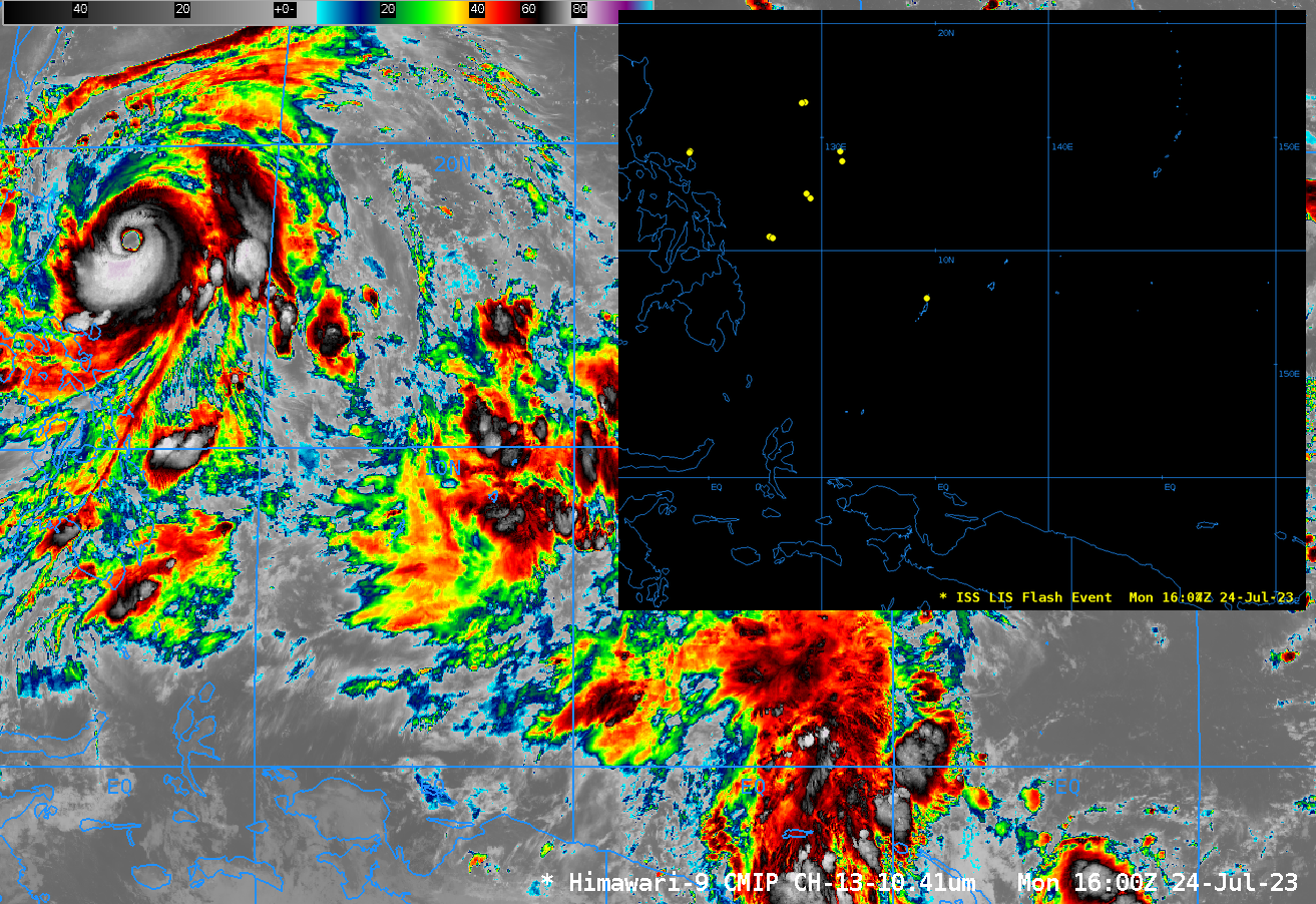
This website works best with a newer web browser such as Chrome, Firefox, Safari or Microsoft Edge. Internet Explorer is not supported by this website.

Category: Tropical cyclones

Cyclone Freddy intensifies to a Category 5 storm

US Space Force EWS-G1 — formerly GOES-13 — Infrared Window (10.7 µm) images (above) showed Cyclone Freddy in the South Indian Ocean, after it re-intensified to a Category 4 storm at 0000 UTC on 15 February 2023. Freddy then briefly peaked at 145 knots at 0000 UTC on 16 February... Read More

SAR data over Tropical Cyclone Freddy in the Indian Ocean

RADARSAT Constellation Mission Satellite 1 (RCM-1) overflew tropical cyclone Freddy in the eastern Indian Ocean on 9 February, and Synthetic Aperture Radar (SAR) winds from the satellite captured a well-developed eye with (instantaneous) surface winds that peaked around 25 m/s. More information on SAR winds with Freddy is available here. The toggle above shows the storm center displaced significantly to the east... Read More

Tropical Cyclone Gabrielle in the Coral Sea

Himawari-9 Upper Level Water Vapor infrared (6.25 µm) imagery for the 8 hours ending 1300 UTC on 8 February 2023 show the nighttime blossoming of convection near the center of developing tropical cyclone Gabrielle to the east of Australia in the tropical southwest Pacific. The environment of the storm is... Read More