NUCAPS fields across an upper tropospheric front
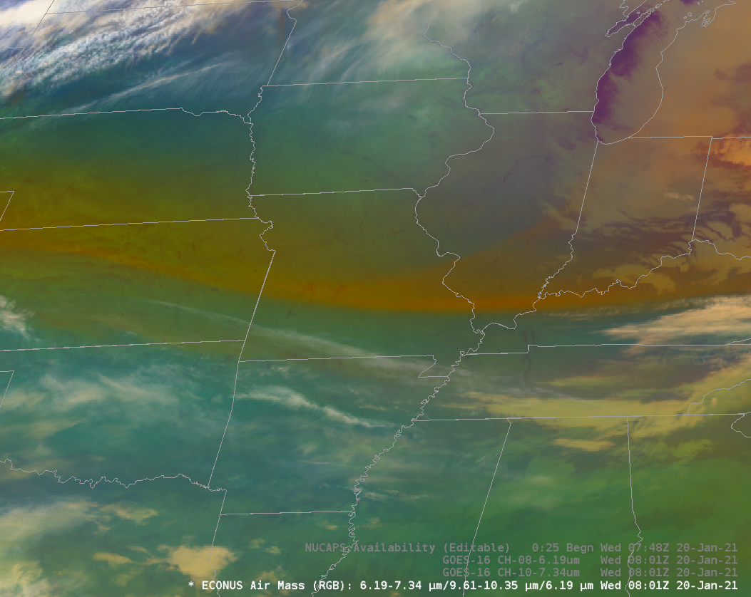
The AirMass RGB from GOES-16 at 0800 UTC on 20 January 2021 showed a distinct color change across central Missouri, from red to green. The enhanced red coloring suggests a large difference in water vapor brightness temperatures. The toggle above (including an image with NUCAPS* sounding points), shows structures in... Read More
