How fast can you create JPSS imagery from data on the Amazon Cloud using Polar2Grid?
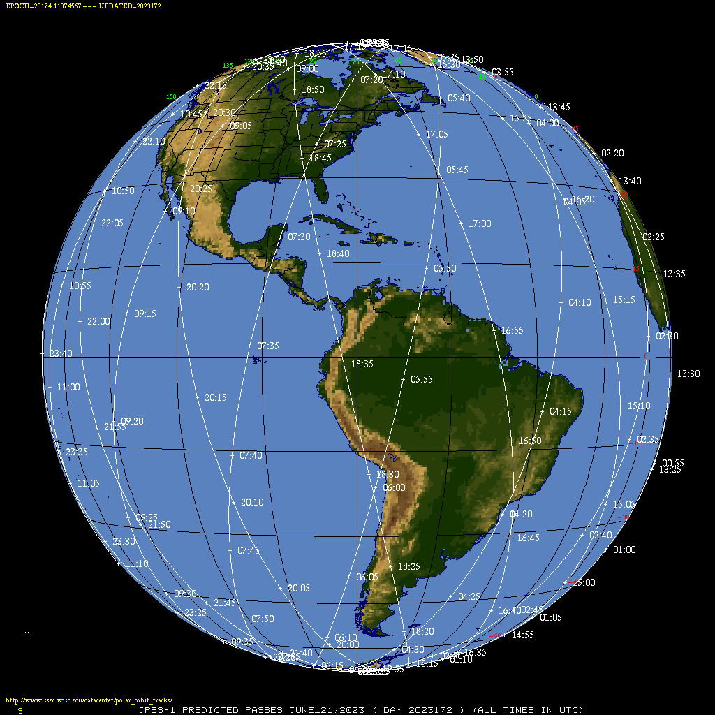
Orbits from NOAA-20 (link, from this site) show a NOAA-20 overpass over Tropical Storm Bret at around 1700 UTC on 21 June 2023. Data from NOAA-20 were available at this site by 1730 UTC, and downloading files from the VIIRS-I1-SDR and VIIRS-IMG-GEO directories (as discussed in this blog post), and running a simple Polar2Grid (software... Read More
