This website works best with a newer web browser such as Chrome, Firefox, Safari or Microsoft Edge. Internet Explorer is not supported by this website.

Category: Severe convection

GOES-16 GLM Lightning detection over Minnesota

Wednesday, 05-11-2022, brought storm damage and copious amounts of lightning over Minnesota and parts of South Dakota, Iowa, and Wisconsin. The GOES-16 Geostationary Lightning Mapper (GLM) detected the flash extent density over these areas. A NEXRAD radar composite shows a large bow echo signature around 05-12-2022 01:25Z that spanned the... Read More

Severe thunderstorms across the Upper Midwest

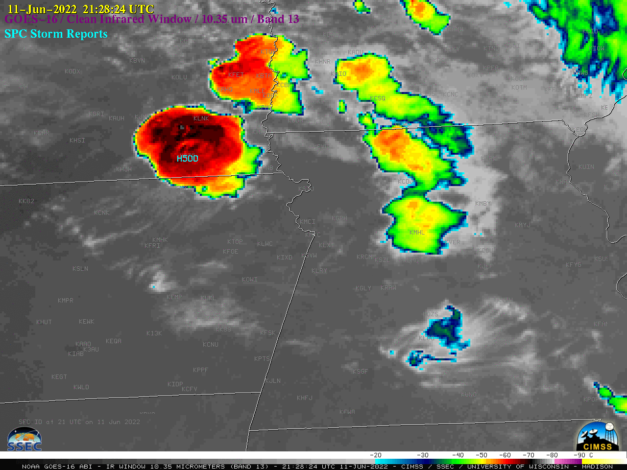
1-minute Mesoscale Domain Sector GOES-16 (GOES-East) “Red” Visible (0.64 µm) images (above) include time-matched SPC Storm Reports — and showed some of the widespread severe weather that occurred across the Upper Midwest during the afternoon and early evening hours on 11 May 2022. Numerous pulsing overshooting tops were apparent in the vicinity of most storm reportsThe corresponding 1-minute GOES-16 “Clean”... Read More

Persistent fog/stratus across eastern Virginia

1-minute Mesoscale Domain Sector GOES-16 (GOES-East) “Red” Visible (0.64 µm) images (above) showed abroad arc of fog/stratus that persisted for much of the day across parts of eastern Virginia, Chesapeake Bay and the Delmarva Peninsula on 03 May 2022. Since this fog/stratus deck — which was on the cold side... Read More