50th Anniversary of the 1974 Super Outbreak
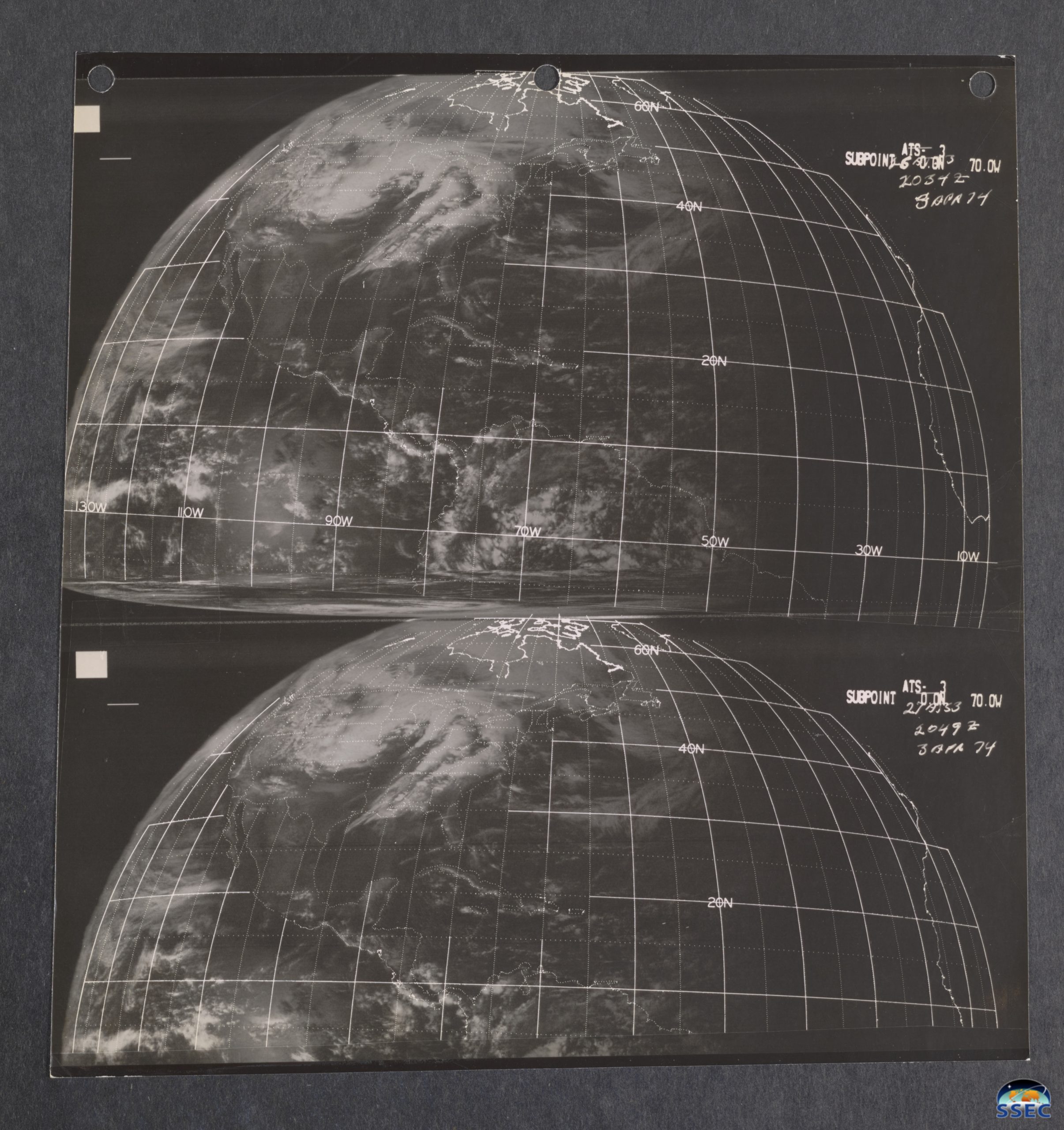
The 3-4 April 1974 Super Outbreak (NWS Wilmington OH | Wikipedia | StoryMap | Interacive WebMap | Monthly Weather Review) was one of the largest and most deadly tornado outbreaks on record in the United States. The University of Wisconsin-Madison Space Science and Engineering Center (UW/SSEC) recently digitized over 66,000 Applications Technology Satellite (ATS)-1 and... Read More