PHS Model Output and severe weather in Kentucky
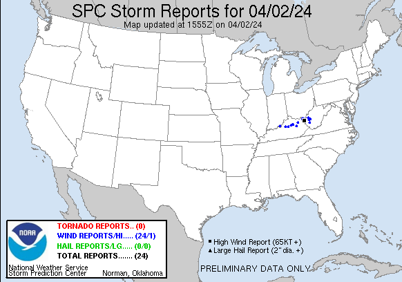
Morning convection on 2 April caused a swath of wind damage across (mostly northern) Kentucky, as shown in the Storm Reports below (from the SPC Website). The animation above shows the GOES-16 Clean Window Infrared (Band 13, 10.3 µm) imagery from to 1421. The strong convection shows includes cold cloud tops that last for a few minutes before collapsing; collapsing updrafts such as those are consistent with the occasional reports of strong winds at the surface. (Click here to see the same animation with warning polygons). The GOES-16 Derived Stability Index (Lifted Index in this case, scaled from -5 to 5) is also shown with the Clean Window infrared imagery, and a corridor of instability can be inferred, but because GOES-R Stabiity Indices are clear-sky only, a lot of information is missing.
The toggle below shows the 3- and 4-h forecasts of SBCAPE from the 1000 UTC PHS model in addition to the warning polygons. The instability as measured by the SBCAPE is moving east-northeastward into southern Ohio, and the warning polygons are near the leading edge of the instability. The sounder data in the Polar Hyperspectral Soundings model (PHS) is adding information that helps define the region of hazardous weather.
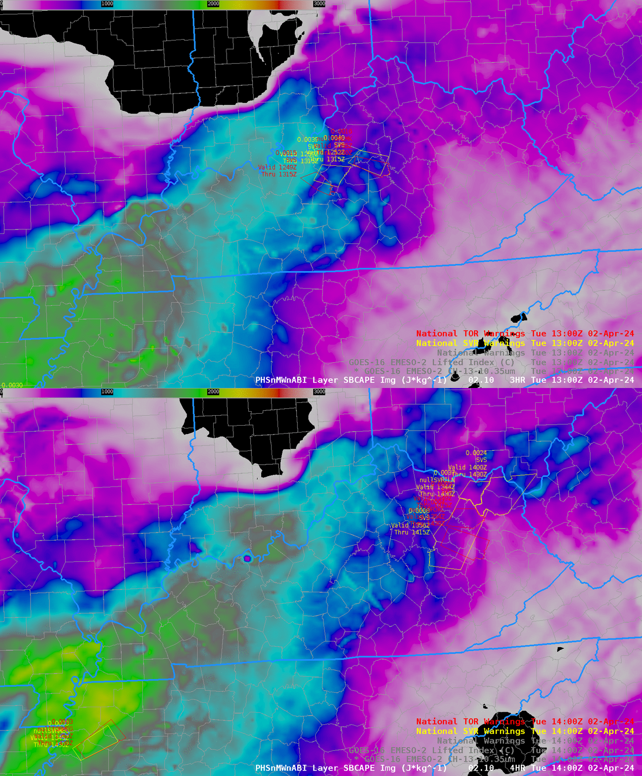
The sliders below compare the 1300 UTC and 1400 UTC Band 13/Lifted Index imagery and the 3-h (and 4-h) forecast of Surface-based CAPE derived from PHS Model output (available at this website). Note how the nose of the SBCAPE is well-aligned with the deep convection in the ABI imagery.
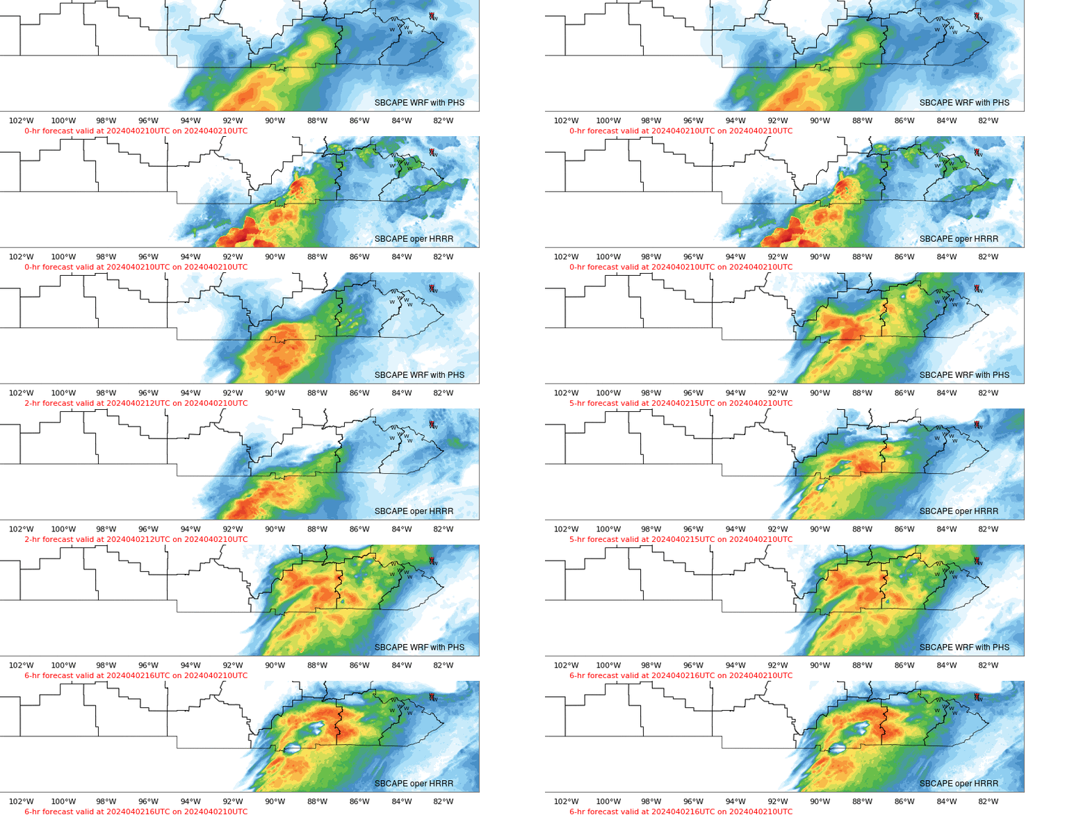
The PHS model output is giving more information about instability than the GOES-R Level 2 products in this cloudy scene! The toggle below compares the 3-km HRRR with the 4-km WRF that includes PHS information. The PHS model has instability farther north into Kentucky, closer to where the severe weather was observed. SPC storm reports were mostly just north of 38oN latitude.
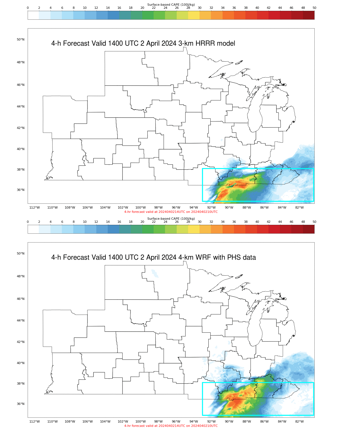
SBCAPE fields from the model that includes PHS data (top), shown in the animation below, depict greater instability at 1400 UTC when the plotted severe weather was occurring.
