Category: SAR

Hurricane Kiko rapidly intensifies to a Category 4 storm in the East Pacific Ocean
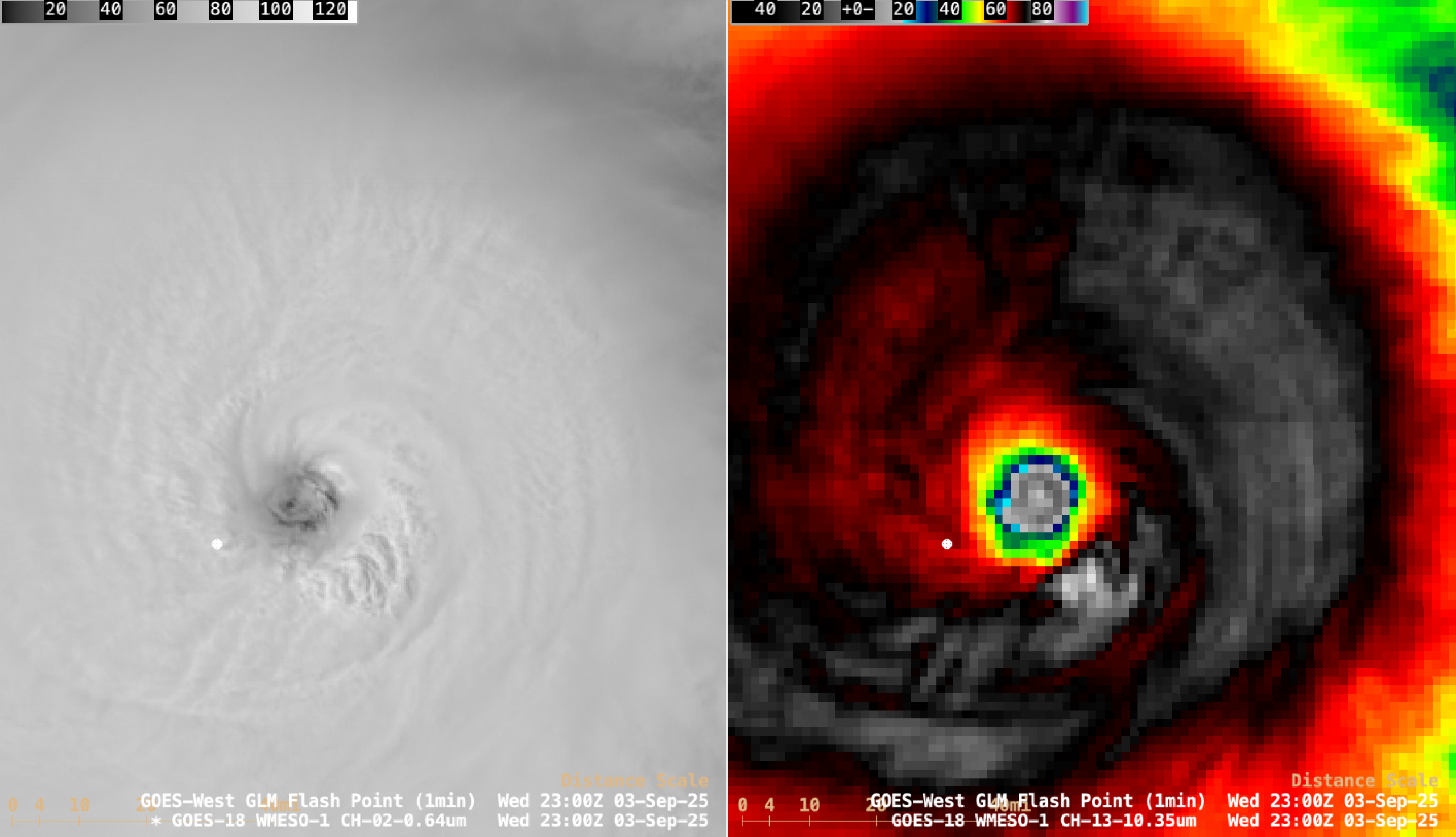
1-minute Mesoscale Domain Sector GOES-18 (GOES-West) Visible and Infrared images (above) showed the westward motion of of Hurricane Kiko during an 8.5-hour period as the tropical cyclone was rapidly intensifying (SATCON) from a Category 2 storm at 1500 UTC on 03 September 2025 to a Category 3 storm at 1800 UTC and... Read More
Hurricane Erin reaches Category 5 intensity north of the Leeward Islands

1-minute Mesoscale Domain Sector GOES-19 (GOES-East) Visible and Infrared images (above) showed the WNW motion of the eye of Hurricane Erin during a 7-hour period as the tropical cyclone rapidly intensified from a Category 4 storm at 0950 UTC to a Category 5 storm at 1520 UTC, north of the Leeward Islands on... Read More
Cyclone Errol rapidly intensifies to Category 5 intensity off the coast of Western Australia

Target Sector (2.5-minute interval) JMA Himawari-9 AHI Red Visible (0.64 µm) and Clean Infrared Window (10.4 µm) images (above) showed Cyclone Errol as it was rapidly intensifying off the northern coast of Western Australia on 15-16 April 2025. About 2 hours after the end of the above animation, Errol peaked... Read More
