Gale Warnings over Hawai’i
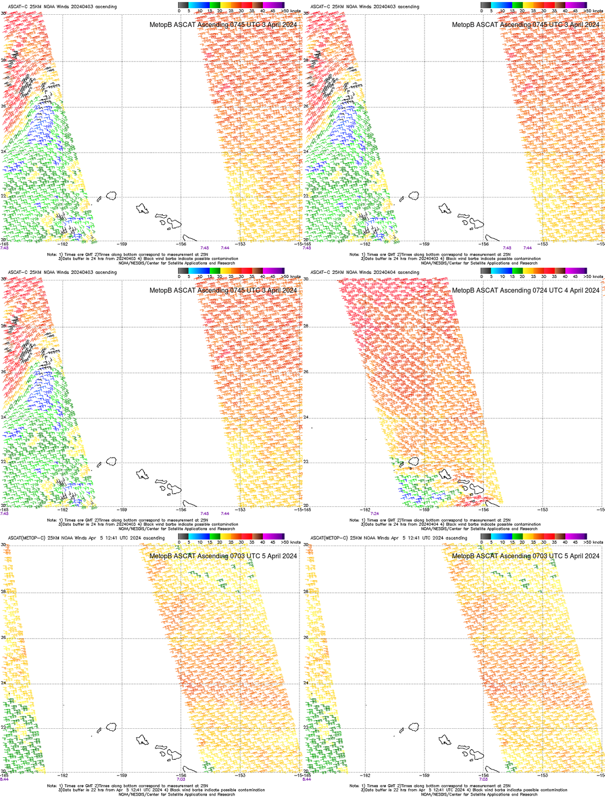
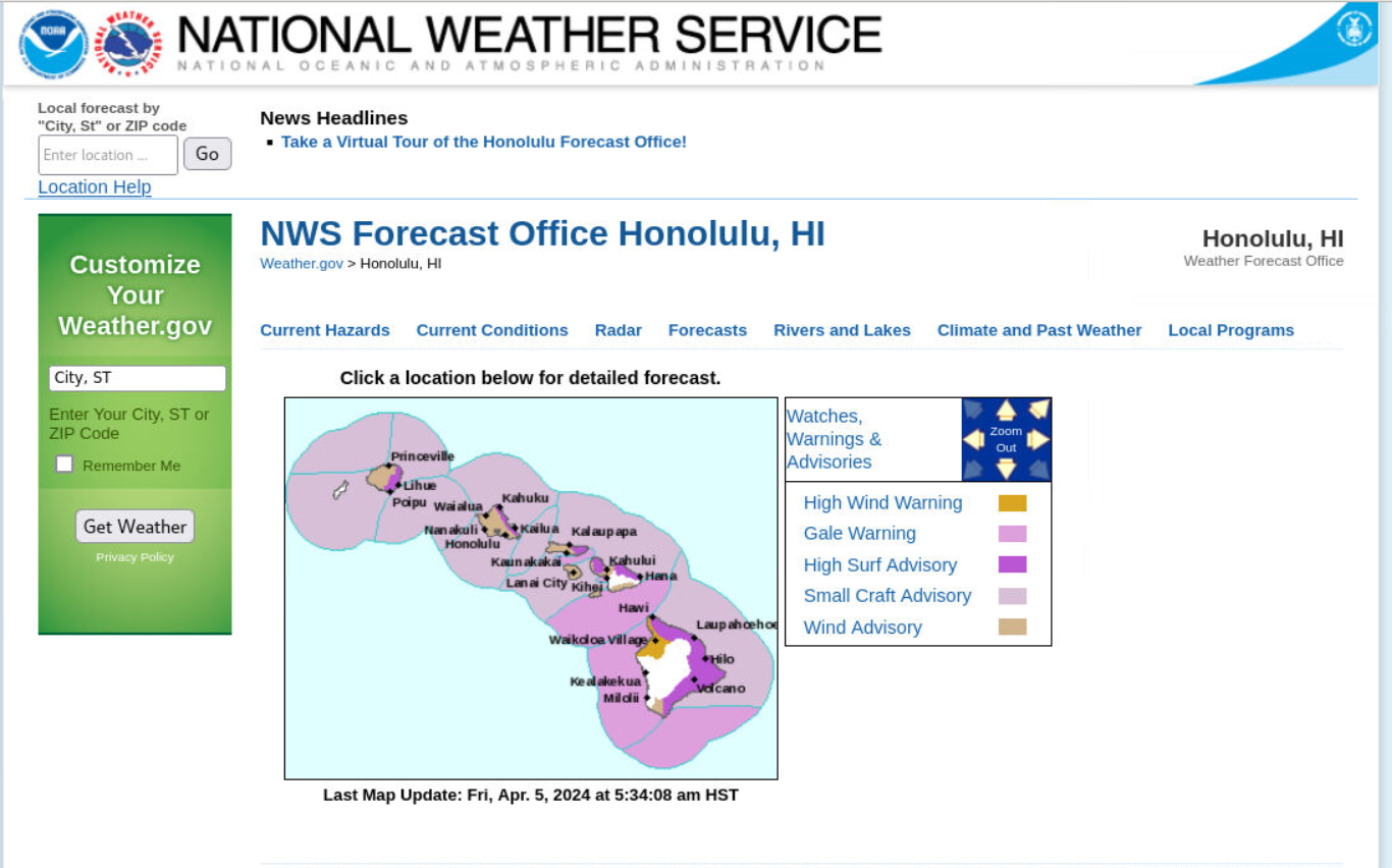
A series of Advanced Scatterometer (ASCAT) images (ascending passes) from Metop-B, above, show a large region of gale force winds surrounding the Hawai’ian Islands between 3 April and 5 April 2024. The entire island chain is under Wind Advisories or Gale Warnings; additionally, High Surf Advisories are in effect on the eastern sides of most islands as shown in the screen capture of the website of the Honolulu NWS Forecast Office below. Small Craft Advisories are also widespread around the islands.
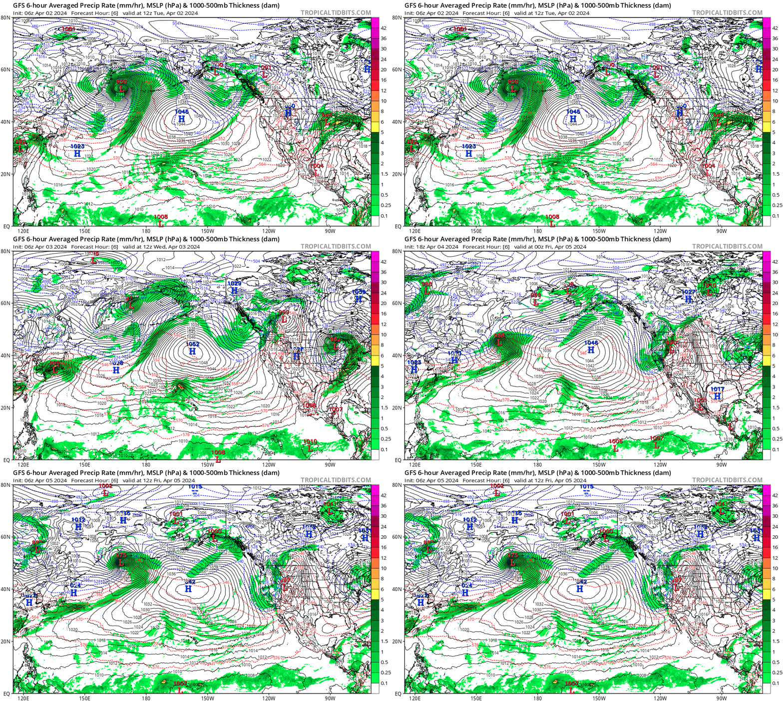
The strong winds are Equatorward of an unusually strong Anticyclone (> 1050 mb!) that has been moving through the north-central Pacific Ocean as depicted in the GFS model output shown below (taken from this website).
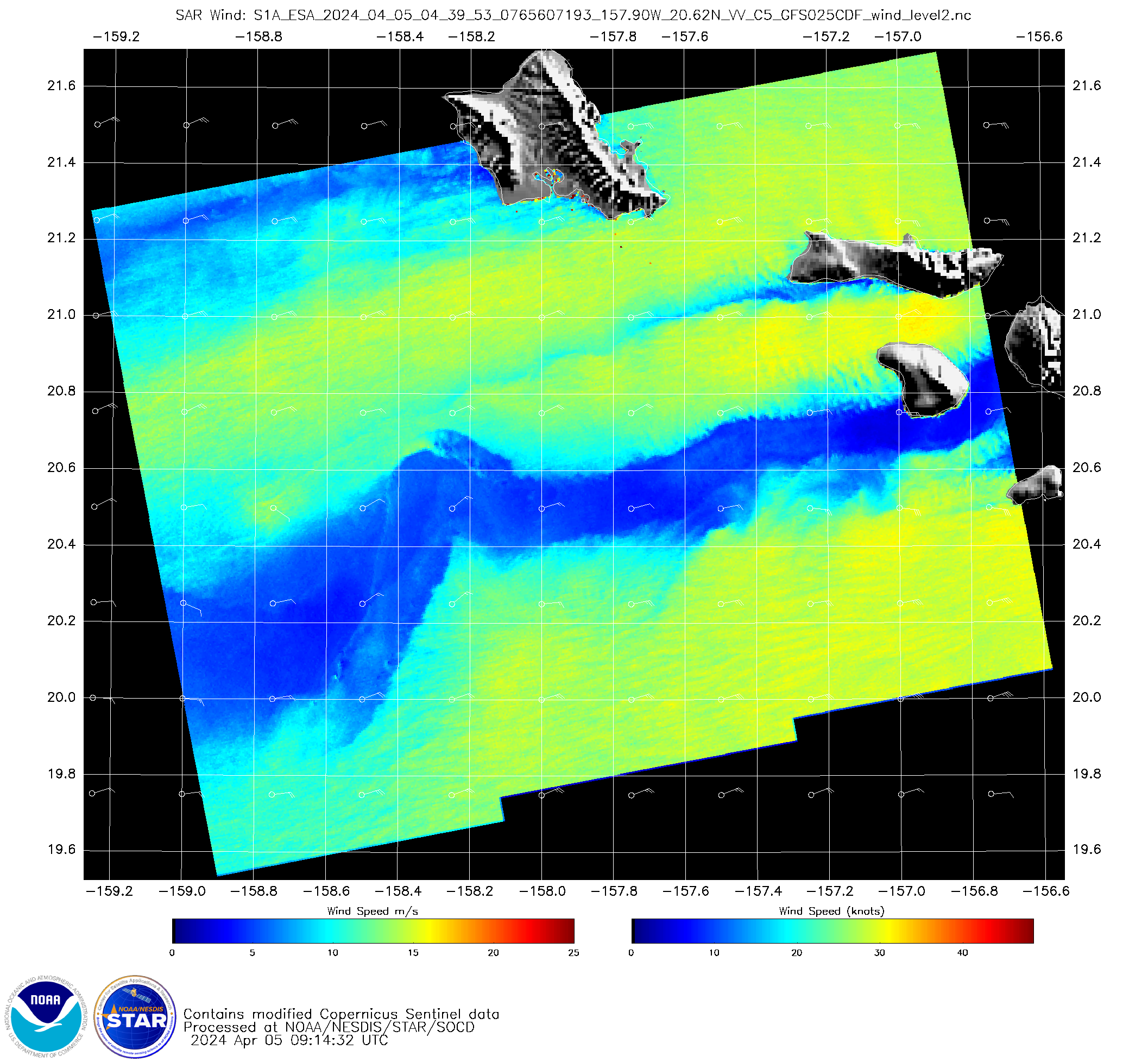
Synthetic Aperture Radar (SAR) winds (source), below, also show gale-force winds in/around Hawai’ian islands, but the islands are blocking winds such that relatively calm regions extend for some distance downwind of the islands. (The lighter winds in the lee of the islands show up in the scatterometry fields shown above as well, most especially in the imagery from 4 April).
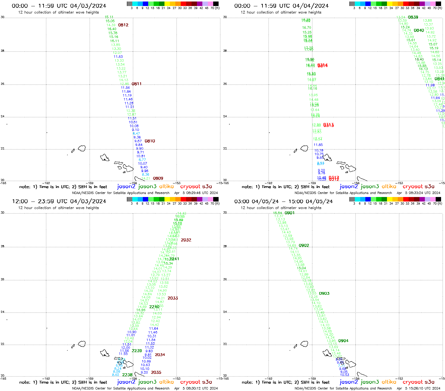
What do the waves look like? Altimetry data, below, shows slowly building Significant Wave Heights (defined as the average of the highest 1/3rd of the wave heights) between 3 and 5 April 2024. (Imagery from here)
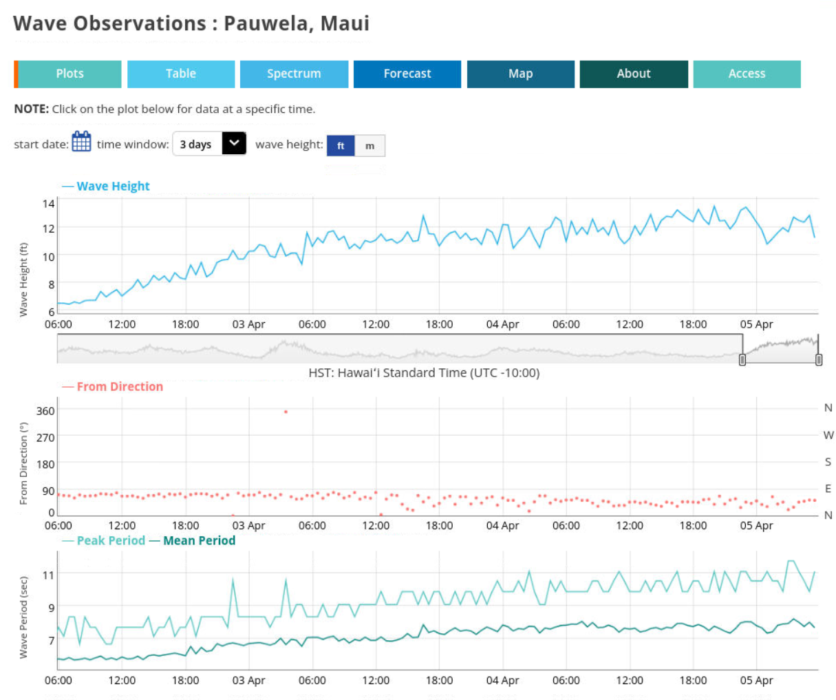
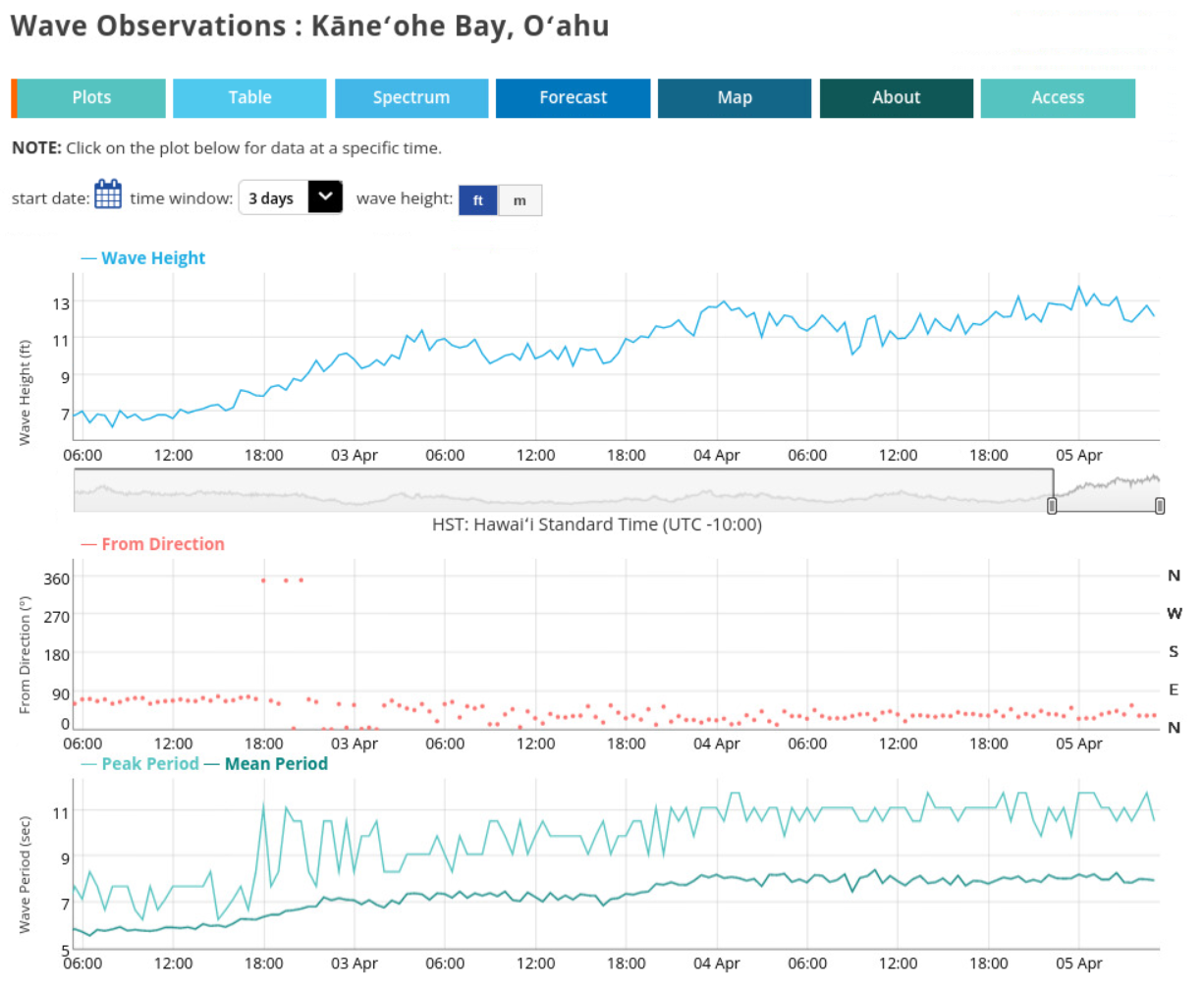
Observed waves (from this website) north of Maui, below, and east of Kaneohe Bay, Oahu (bottom) also show building wave heights from 3-5 April.
