ASCAT winds versus SAR winds
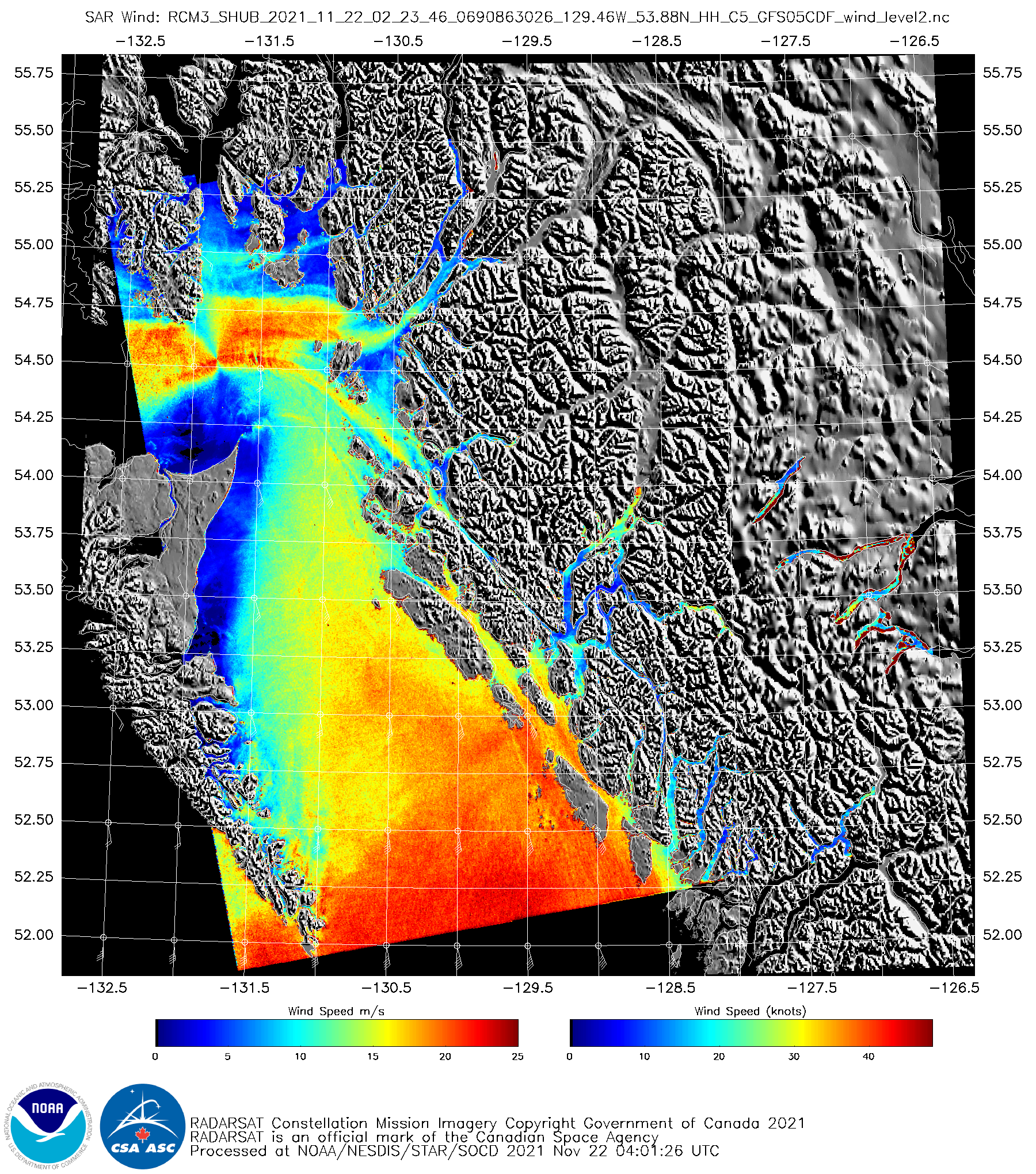
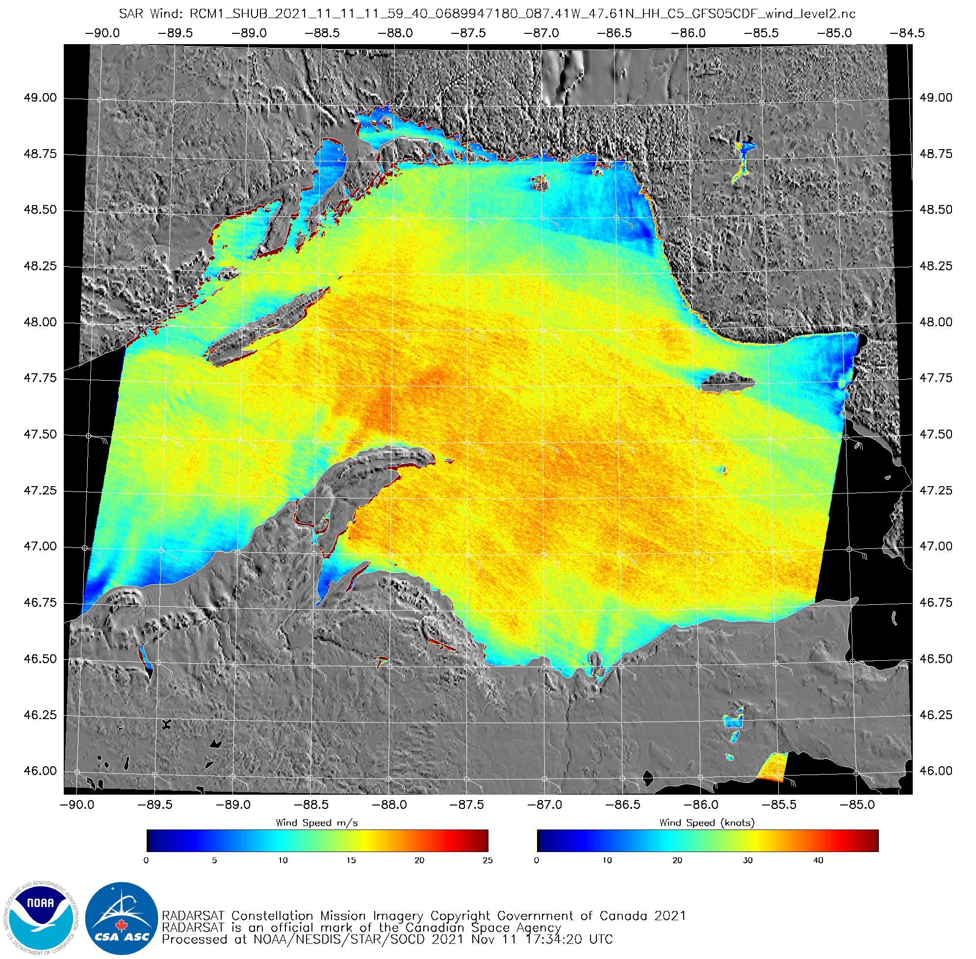
From an email came this question: RADARSAT vs ASCAT winds, what are the differences between the two methods?This comparison is not easy to make directly, as the orbits of Metop-B and Metop-C, the two satellites that carry the ASCAT instrument (now that Metop-A, which satellite also carried ASCAT, has been decomissioned), don’t... Read More

