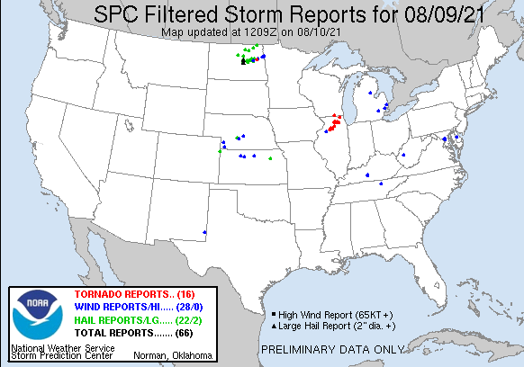
Severe weather over northeast Illinois
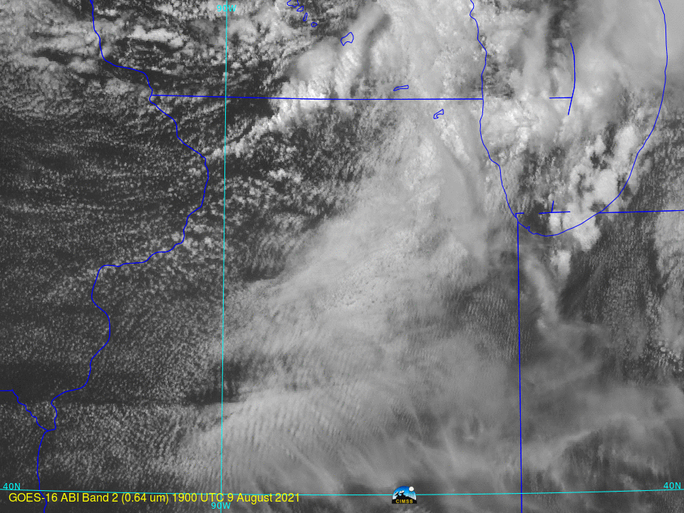
Severe thunderstorms developed over northeast Illinois late in the afternoon on 9 August, and a series of tornadoes resulted. Storm Reports (from the Storm Prediction Center) are shown below. The mp4 animation above (click here for a large animated gif) shows 1-minute GOES-16 Mesoscale Sector 2 visible imagery (0.64 µm) from 1900 UTC on 9 August through 0040 UTC on 10 August. The active convection is apparent.
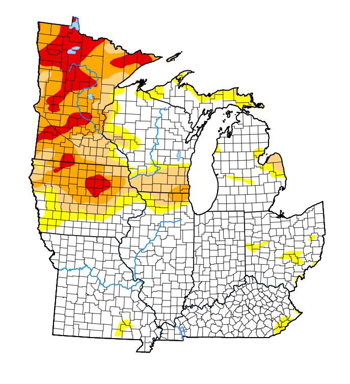
Part of the region hit by severe weather is in a persistent drought, as shown below (an image from this website). Rains that accompanied the severe weather provided some drought relief. (Click here for hourly CMORPH2 precipitation estimates from RealEarth)
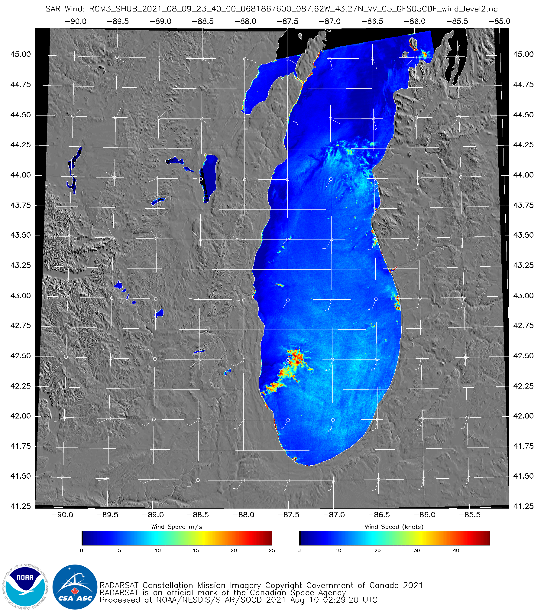
RCM3 (RADARSAT Constellation Mission 3) Synthetic Aperture Radar (SAR) winds from a 2340 UTC overpass on 9 August (from this site) show a wind feature over Lake Michigan associated with the convection. These wind estimates might be affected by ice within the glaciated clouds