This website works best with a newer web browser such as Chrome, Firefox, Safari or Microsoft Edge. Internet Explorer is not supported by this website.

Category: Red-Green-Blue (RGB) images

Tehuano gap wind event

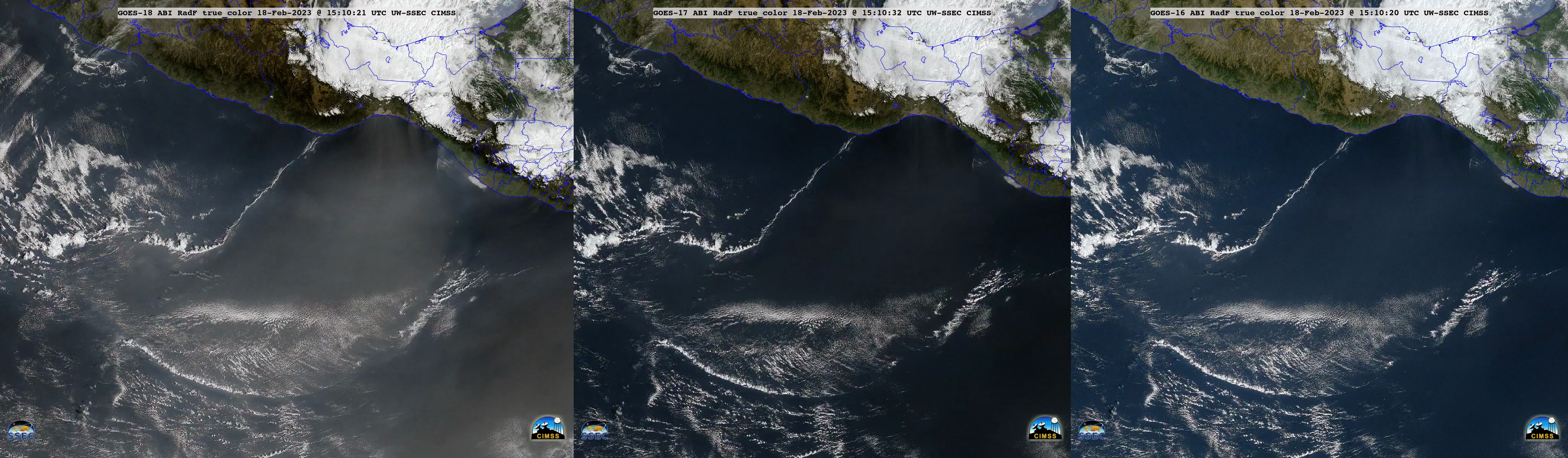
True Color RGB mages — created using Geo2Grid — from GOES-18 (GOES-West), GOES-17 and GOES-16 (GOES-East) (above) displayed the hazy signature of blowing dust associated with a Tehuano wind event, which was spreading south-southwestward from the Gulf of Tehuantepec across the Pacific Ocean on 18 February 2023. A narrow rope cloud... Read More

Mesoscale convective bands enhancing snowfall rates across the Upper Midwest

GOES-16 (GOES-East) “Red” Visible (0.64 µm) and Day Cloud Phase Distinction RGB images (above) showed widespread elevated convective banding that was helping to enhance snowfall rates — with some locations reporting 1.5 to 2.0 inches per hour — across parts of Minnesota, Wisconsin, Lower Michigan, Iowa and Illinois on 16 February 2023. There was no GLM indication... Read More