Tropical Cyclone Harold makes landfall on Vanuatu
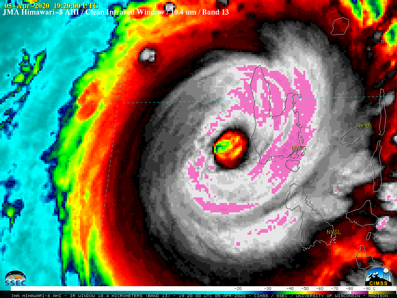
Tropical Cyclone Harold made landfall on Vanuatu’s largest island of Espiritu Santo as a Category 4 storm (ADT | SATCON) on 05 April 2020. JMA Himawari-8 Infrared Window (10.4 µm) images (above) showed the emergence of a well defined eye — which exhibited some trochoidal motion. Cloud-top infrared brightness temperatures... Read More
